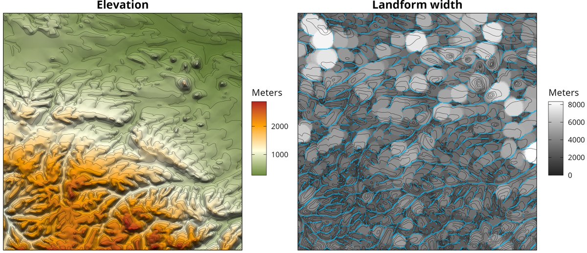
New paper in @RemoteSens_MDPI : Granularity of Digital Elevation Model and Optimal Level of Detail in Small-Scale Cartographic Relief Presentation🏔
💡Landform selection follows radical law
💡Optimal relative granularity is ~5-6 mm
https://t.co/8if80p6PFx
https://t.co/W4ZTqCA0Jt
‼️New #rayshader release (v0.32.5)! This version brings 3rd person views to your maps, generated directly from a spatial path: turn your GPS bike rides/runs/hikes into cool 3D animations, directly in #RStats! You can even steady the camera or add rotation for a cinematic effect.
We have some wonderful news: RStudio is now Posit! 🎉
While many things will stay the same, our rebrand will result in changes beyond a new name. To start, our new website https://t.co/vI56Gz7Yqf is now live. Please check out our new home and let us know what you think!
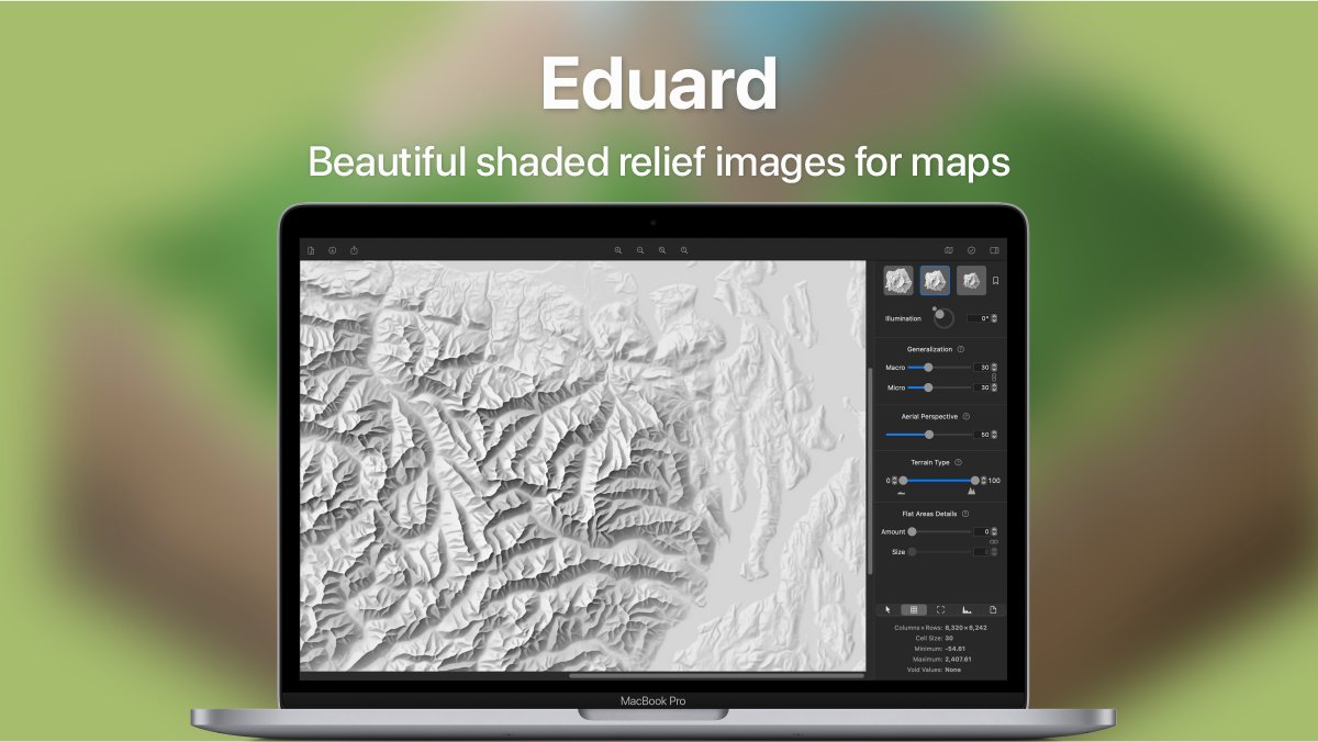
Eduard is now available on the Mac App Store. https://t.co/4eQYeGo0xc
The introductory price ends with the NACIS conference on October 23. The regular price will be $99.99.
https://t.co/JZuWPG34BX
New Journal Urban Informatics ed John Shi (HKPolyU); first issue all articles open acc. Papers by myself, Mike Goodchild, Charlie Catlett, Shaowen Wang, Qing‐Quan Li, Yang Yue, Qi‐Li Gao, Chen Zhong, Joana Barros, Qingquan Li, Xintao Liu, Anshu Zhang,
https://t.co/3ERceSaFZi
I've been promising people a #threejs editor with animation support for more than a year. This is it! 🎉 We are releasing this week. Has all the features my old react-three-editable library had, and much, much more. I'm incredibly excited. #animation#webdev
The call for participation is now open for the 12th ICA Mtn Cartography Workshop. The theme of the workshop is People, Maps, and Mountains, although any topic relating to maps and rugged places is welcome, as are all types of presentations!
https://t.co/jKxQ1Gs1cY
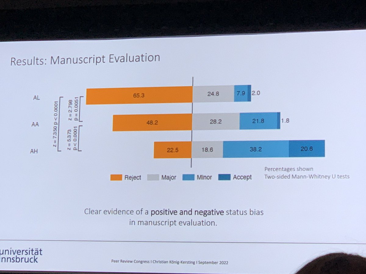
Massive status bias in peer review.
534 reviewers randomized to review the same paper revealing the low status, high status, or neither author. 65% reject low status, 23% reject high status.
Amazing work by Juergen Huber and colleagues. #prc9
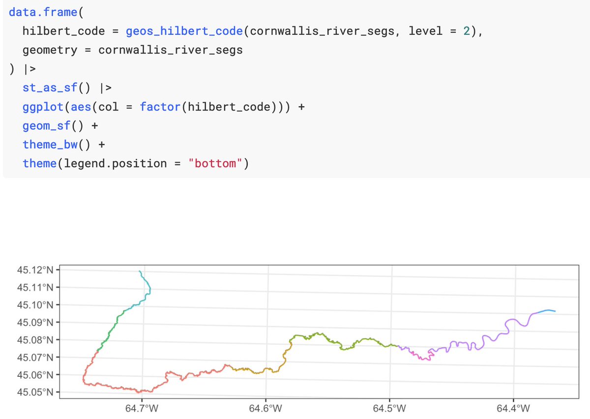
A new version of the 'geos' package for #rstats is live 📐! Faster conversions from sf, new features from GEOS 3.11.0, and more! https://t.co/IQy2bSrrSj #rspatial
This is fantastic! Finally after ~2years of comms the #rspatial community is part of the @OSGeo family 😻
Shiny new page: https://t.co/aWG0Yrt3w6
Details+discussion+how2 get involved: https://t.co/018CcB5wuv
Tagging ppl, spread the word! #RStats#gischat
A global map of #LocalClimateZones is now published in the OA data journal Earth System Science Data of
@copernicus_org: https://t.co/oBD1idcWi9
I am really excited about this, as this manuscript embodies 7 years of work. 1/n