Unlocking a new layer of infrastructure above Earth. Building the platform for resilient sensing, communications, and intelligence from the stratosphere.
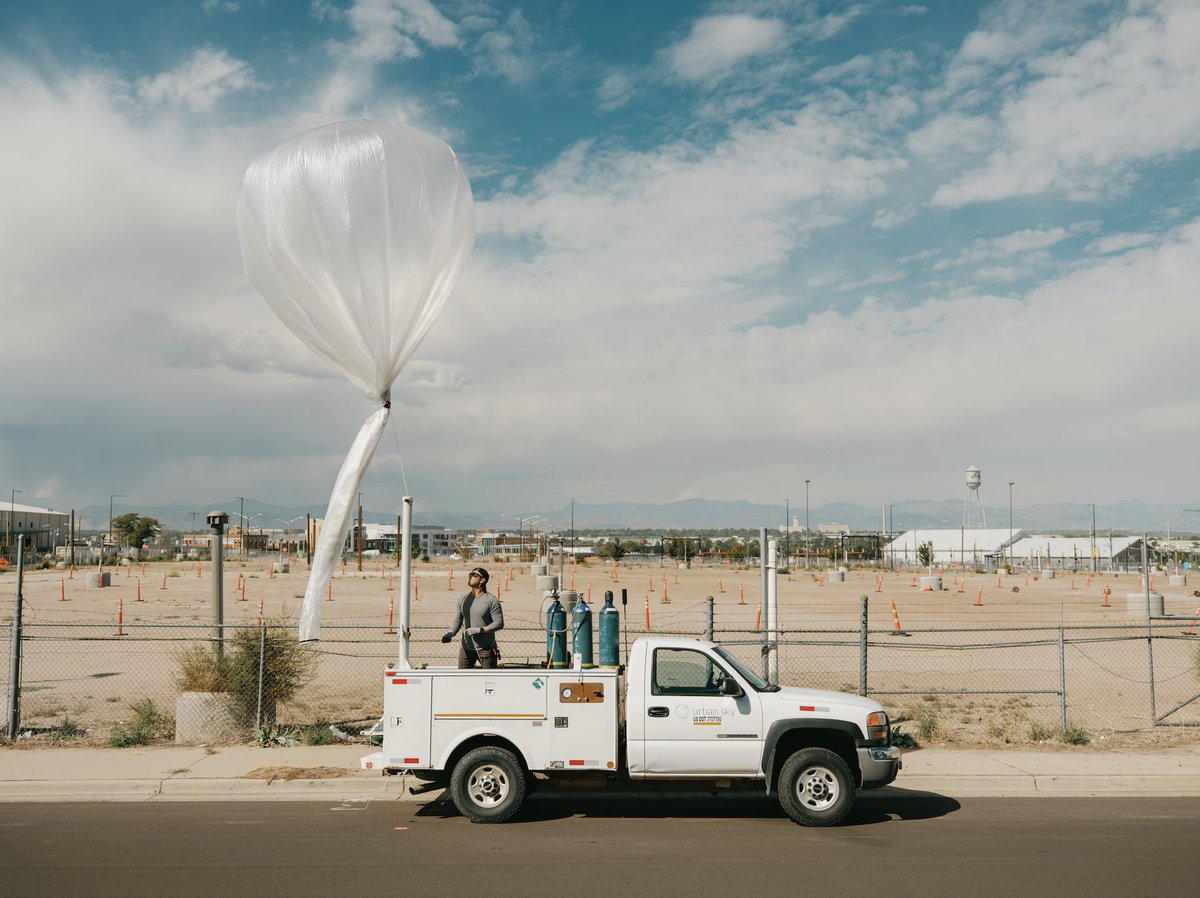
The stratosphere is emerging as a critical layer of infrastructure for defense and national security. We’re proud to play a part in support of U.S. Army strategic goals to demonstrate how deployable stratospheric platforms can enable persistent sensing, comms, and intel at scale.
U.S. SPACE COMMAND HOLDS ADVANCED TRAINING EXERCISE AT UTAH'S DUGWAY PROVING GROUND
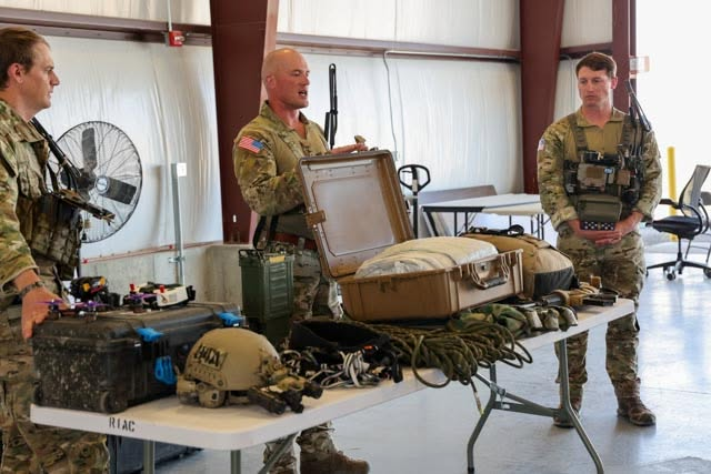
U.S. Space Command says it hosted military leaders and other distinguished visitors at Utah's Dugway Proving Ground for a live-fire demonstration as part of APOLLO NEXUS 26.
The exercise brought together U.S. Space Command, U.S. Special Operations Command, U.S. Cyber Command and U.S. Strategic Command to showcase what officials called the future of joint military operations across multiple domains.
According to Space Command, the event included high-altitude precision drops and testing designed to advance cross-domain electronic warfare capabilities.
Military officials said the demonstration highlighted how U.S. forces, allied partners and industry assets can work together to coordinate operations across land, air, space and cyber domains. The exercise was intended to test emerging technologies and concepts aimed at strengthening integrated deterrence and strategic military capabilities.
Photos: U.S. Space Command
Dugway Proving Ground, U.S. Army testing facility
West Desert, Utah
U.S. SPACE COMMAND HOLDS ADVANCED TRAINING EXERCISE AT UTAH'S DUGWAY PROVING GROUND
U.S. Space Command says it hosted military leaders and other distinguished visitors at Utah's Dugway Proving Ground for a live-fire demonstration as part of APOLLO NEXUS 26.
The exercise brought together U.S. Space Command, U.S. Special Operations Command, U.S. Cyber Command and U.S. Strategic Command to showcase what officials called the future of joint military operations across multiple domains.
According to Space Command, the event included high-altitude precision drops and testing designed to advance cross-domain electronic warfare capabilities.
Military officials said the demonstration highlighted how U.S. forces, allied partners and industry assets can work together to coordinate operations across land, air, space and cyber domains. The exercise was intended to test emerging technologies and concepts aimed at strengthening integrated deterrence and strategic military capabilities.
Photos: U.S. Space Command
Dugway Proving Ground, U.S. Army testing facility
West Desert, Utah
Because Somtimes a Chicken Sandwich Needs to Get to Space - new Core Memory pod on the tech and business of the Stratosphere
KFC. Humans. Chinese spy balloons. US balloon dominance. We've got it all with Andrew Antonio from @urbanskyimaging
Timestamps
(00:00) Launching chicken sandwich to space
(00:45) Balloons and wonders take flight
(02:40) Stratex shatters altitude records
(04:44) Red Bull stunt meets engineering
(07:20) Young leap into space industry
(10:00) World View’s vision takes off
(12:08) Massive balloons yield nimble tech
(15:46) Mastering station-keeping maneuvers
(18:22) KFC sends sandwich skyward
(24:14) Urban Sky pioneers tactical balloons
(27:31) Navigating winds with smart controls
(30:05) Precision descent: science meets art
(35:14) Global arms race in balloon tech
(38:07) China spy balloon mystery still lingers
(44:59) Stratosphere becomes routine frontier
(50:56) Quirky recoveries and payload adventures
(57:08) Stratospheric beer and final banter
Today @urbanskyimaging announced a milestone $30M Series B. LH Partner @AndreaHippeau got a chance to talk with CEO @andrew_antonio about the raise, the state of the company, and what’s in store.
https://t.co/ZlKkjEiW6y
This capital will fuel the development of a suite of connected hardware, software, and AI-centric stratospheric products that will soon unlock the full value of the stratosphere for our customers.
A few days ago we posted about our LWIR imaging mission above the Palisades Fire. During that mission (Sun, Jan 19,) we also deployed a 10cm high-res aerial imagery sensor. That data is now processed and freely available within the link below:
https://t.co/F4TnI4TLOc
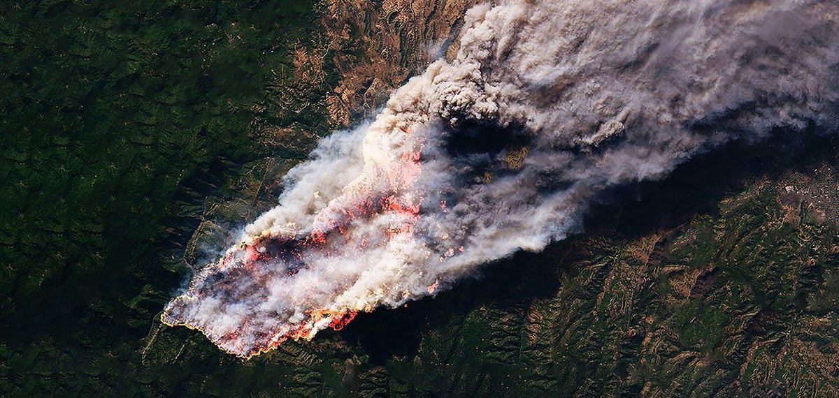
We conducted a stratospheric infrared imaging mission above the Palisades Fire on Sunday. An overview map of the 3m LWIR data is pictured below. Please help us get this into the hands of those that can use it. Free access to the data can be found here: https://t.co/F4TnI4TLOc
How @urbanskyimaging’s stratospheric Microballoon solution is revolutionizing the nature of fire management and disaster response. https://t.co/nSmzj32dog
This is huge! Urban Sky (Techstars 2023) on being awarded a $99M IDIQ contract by the Air Force Research Laboratory! This is a "Phase III" contract that allows for sole source acquisition of Urban Sky products by any & all government customers. 🚀
https://t.co/KUT1BnEMiL
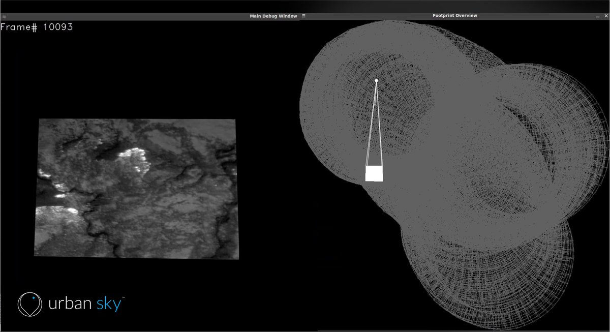
The small white dot shows the locale of our Microballoon. The white “rectangle” shows one image frame projected onto the Earth. And the remaining “circles” show the thousands of image frames captured while hovering above the fire.
This photo illustrates the power of the stratosphere for persistent, continuous, real-time monitoring. It shows our Microballoon hovering above a wildfire for hours and continuously scanning (i.e. the thousands of visible image frames shown) above our target area.
Practical #DeepTech, 🙌! Love seeing our @UnionLabs portcos doing the work. @urbanskyimaging Microballoon & Hotspot system 👇 over Alexander Mountain fire in Colorado (map in high-resolution / infrared). @andrew_antonio
We now have the highest res, most recent map of the Alexander MTN fire in Colorado. We flew our stratospheric system above this ~9,000 acre fire yesterday and processed the data in <8 hours.
Please share to help us get it into the hands of the firefighting agencies and communities affected. And email [email protected] to request the actual GEOTIFF files with critical geolocation information
Great article by @NASAspinoff!
“Ballooning Business for Shrinking Cameras: NASA-funded miniaturized technology offers better imagery than a satellite”
https://t.co/L4RfEX2GPv