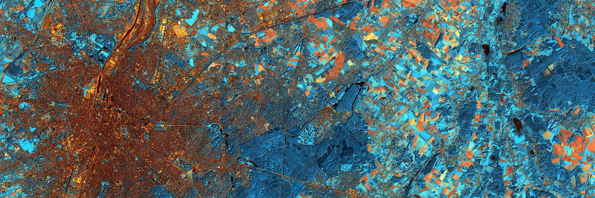
New paper: “We suggest that using cost-distance accessibility maps over Euclidean distance is not always relevant, especially when based on low resolution and/or non-exhaustive geographical datasets, which is often the case in LMICs.” https://t.co/hnv30vi3tW
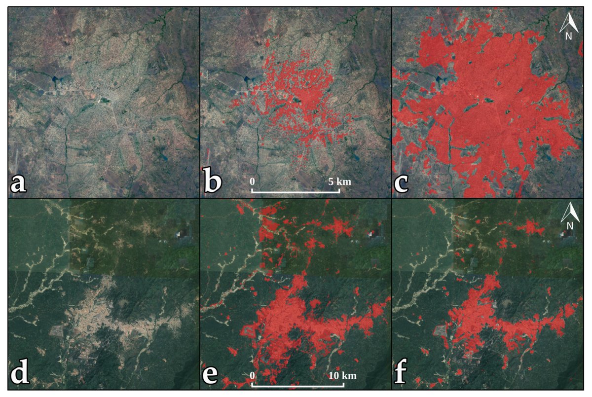
#Mapping 20 Years of Urban Expansion in 45 Urban Areas of Sub-Saharan Africa
Across the case studies, built-up areas averaged a compound annual growth rate of 5.5% between 1995 and 2015
https://t.co/Jks0IzWtVh
Nous vivons deux épidémies. La première est celle liée à la transmission qui se déroule dans la communauté et est globalement sous contrôle grâce au confinement. La deuxième se déroule actuellement dans les maisons de repos, avec des incertitudes sur les causes de décès. (1/7)
Fmask 4.0 paper is finally online! You can download it for free here: https://t.co/4APqjRwr6t
The software and code are available here: https://t.co/Y5HbSgGmnP
Huge improvements for Sentinel-2 data and good improvements for Landsat data. Nice work from @Shi60604194
Mamba just got updated to 0.0.7! We removed the alpha label, added support for deleting packages, selection with version specifications such as xtensor=*=openblas, more mature error handling!
conda install mamba -c conda-forge
And soon ... the first minimamba?
The free & open data policy of #Landsat program has been so beneficial to the science community. This is the Landsat Science Team's voice regarding the importance of keeping the current free & open data policy. Please help us to spread the news by retweet! https://t.co/4jq4TxPexG
This guide helped me today get otb into my processing toolbox on QGIS 3.6 https://t.co/JZOzSt0TnH by the sounds of it will be part of the standard toolbox in 3.8 - that is great news for open source remote sensing!
My new book (Satellite Remote Sensing & the Management of Natural Resources) is coming out on Monday! After years putting it together, I'm really excited to see it published on time (more or less) for #LPS19@ZSLScience@JAppliedEcology@RSECJournal https://t.co/dQcBaRCLFW
When used well, #data can be a driver of equity: “Putting people and healthcare infrastructure on the map ensures that no one is left behind” - @AndyTatem@WorldPopProject@RSTMH#UHC https://t.co/Znl8B74ynF
New blog post: why you should cite open source tools.
https://t.co/VrkyteLGzA
Please read and share widely: there is not enough awareness that scientists are behind these tools and their careers (sadly) depend on citations to them.
#MAJA_L2A v3.2 was just released. It provides surf. reflectance for #Sentinel2 w. a high quality cloud mask. It is already available :
🔹as a free executable for linux
🔹as an on demand processor on PEPS : https://t.co/F3TonBleSj
Details on improvements : https://t.co/lcZKPuP71c
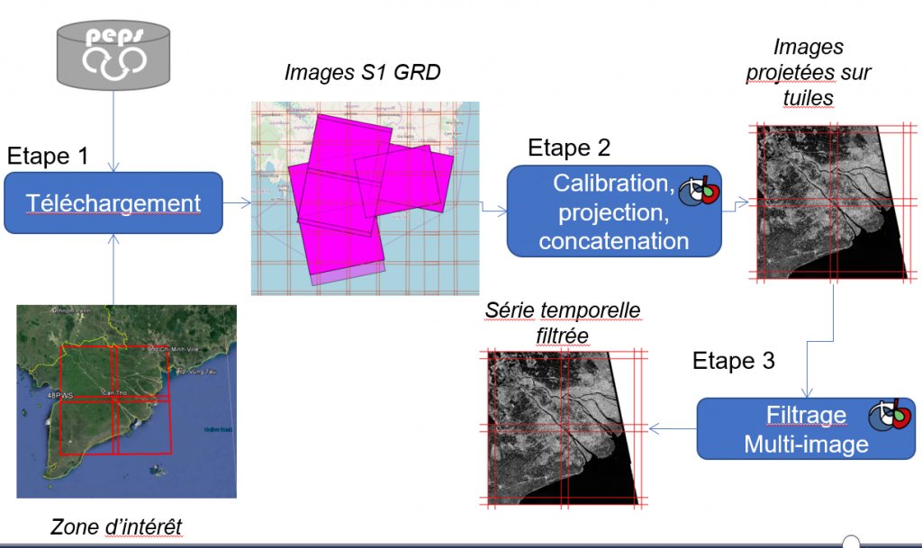
Our SAR specialists from @CNES & @CesbioLab have developed a nice tool named #S1Tiling, to calibrate, ortho-rectify #Sentinel1 data onto #Sentinel2 grid, and filter speckle with a spatio-temporal filter.
https://t.co/SZuUNQTAml
You can now take out for a spin the all-new, best-yet, next-generation version of #PySAL, released yesterday. Completely new organisation, lots more of functionality and a new architecture to support at least the next 10 years. This is a biggie. https://t.co/YKR033InJt