Remote Sensing Savanna Ecologist, Open Science Enthusiast, Termite Mound Mapper, Dog Lover, New Yorker, Italian American Fig Obsessed, Artist, Gardener, PhD
In a new podcast, NASA's ASTER Science Team Lead Dr. Michael Abrams reflects on 23 years of Terra #ASTER observations and the instrument's pivotal role in shaping the field of thermal remote sensing.
Check it out at: https://t.co/0PVHknx9h7
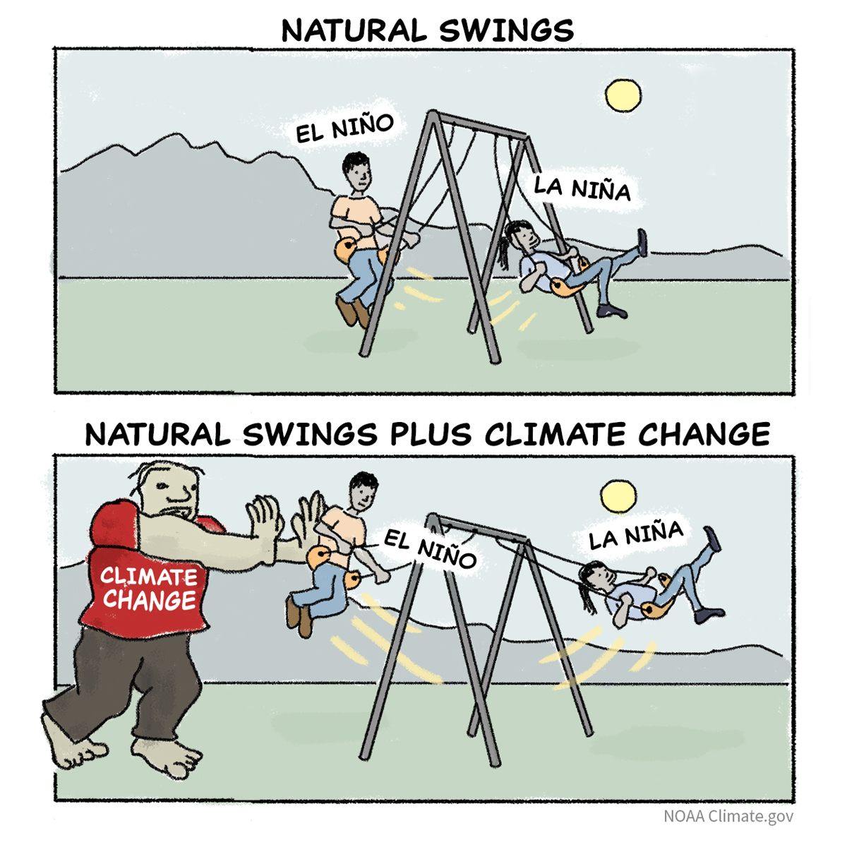
The swings between El Niño and La Niña have been bigger in recent decades than earlier ones. Our guest blogger at the ENSO Blog covers new research pointing the finger at human-caused climate change.
https://t.co/KwZnsoRsFS
Are you using NASA's Application for Extracting and Exploring Analysis Ready Samples (AρρEEARS)?
A new Changelog has been added! Look at the Changelog for new features, adjustments, bug fixes, and release notes. #OpenScience#AppEEARS
https://t.co/L47H3MGiwA
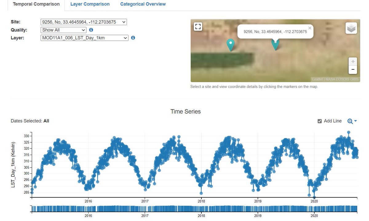
Who uses @NASAEarth data? Dr. Helen Poulos, Adjunct Assistant Professor of Environmental Studies in Wesleyan University's College of the Environment, to better understand climate-induced change in the forests of the southwestern U.S.
Learn more: https://t.co/kVDHwbIqsm
How does Dr. Helen Poulos use @NASAEarth science data to understand the impact of climate change on the forests of the Southwestern U.S.?
Find out in our newest Data User Profile: https://t.co/kVDHwbIqsm
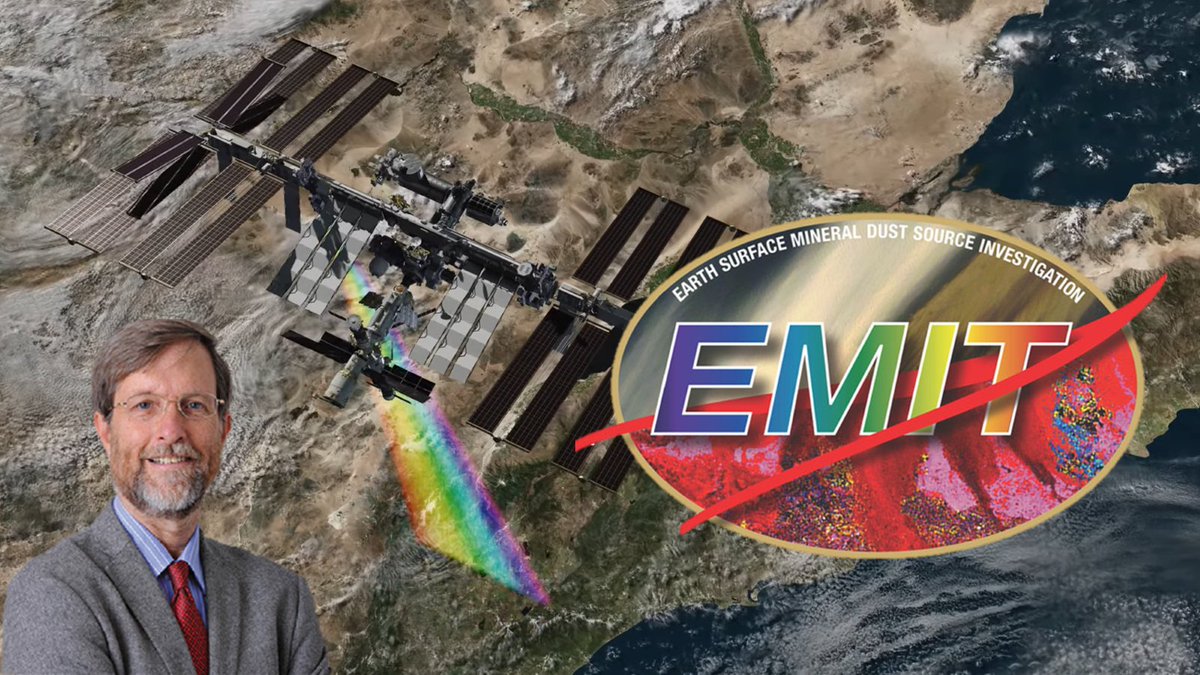
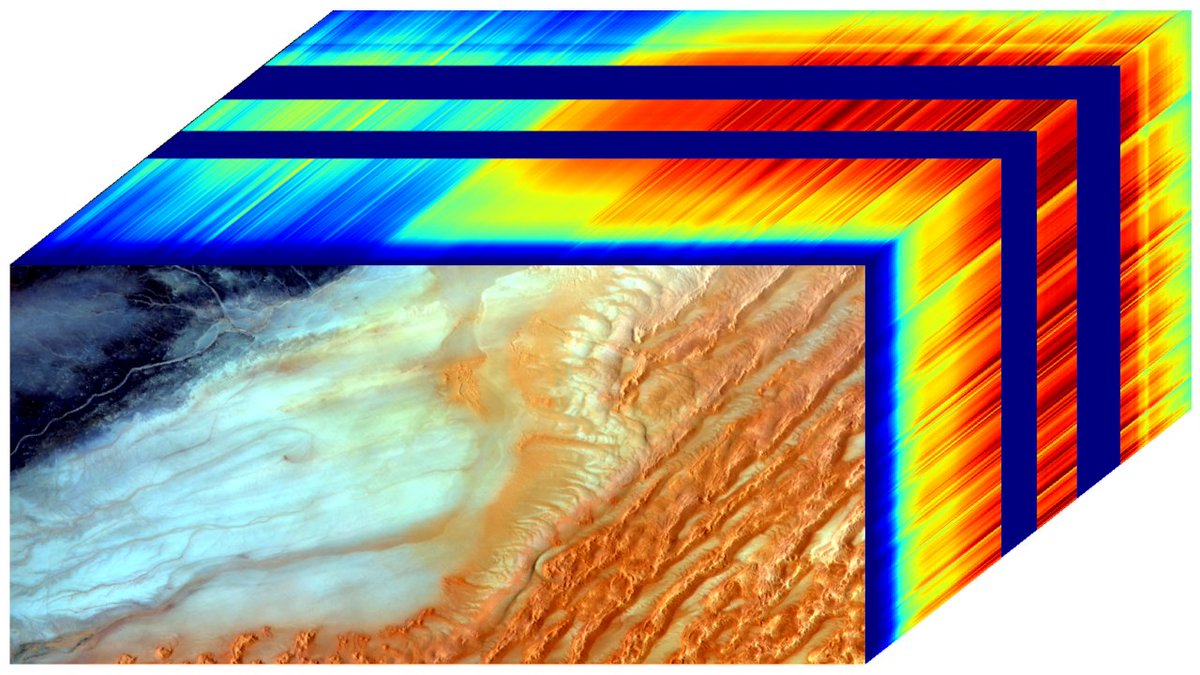
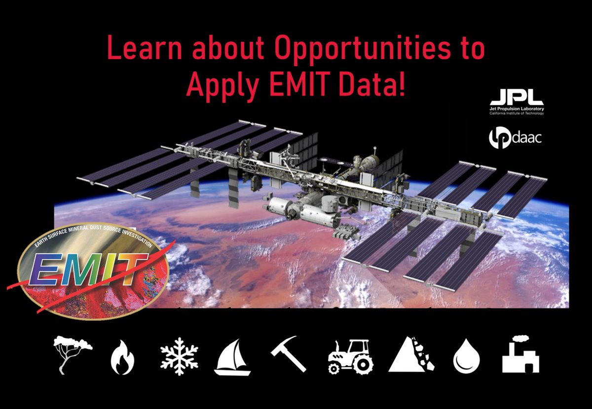
New data from NASA's Earth Surface Mineral Dust Investigation (EMIT) instrument will help scientists better understand the role mineral dust plays in heating and cooling Earth's atmosphere.
Learn about the first EMIT datasets and resources: https://t.co/hqt35O91Nh
#LPDAAC
If you're around #JupyterCon2023 I'm giving a talk at 2:00PM (CET) on how NASA's ITS_LIVE project leveraged the Jupyter and @pangeo_data ecosystems to simplify big data analytics for key climate change variables. https://t.co/W2mTX59Kiu #openscience
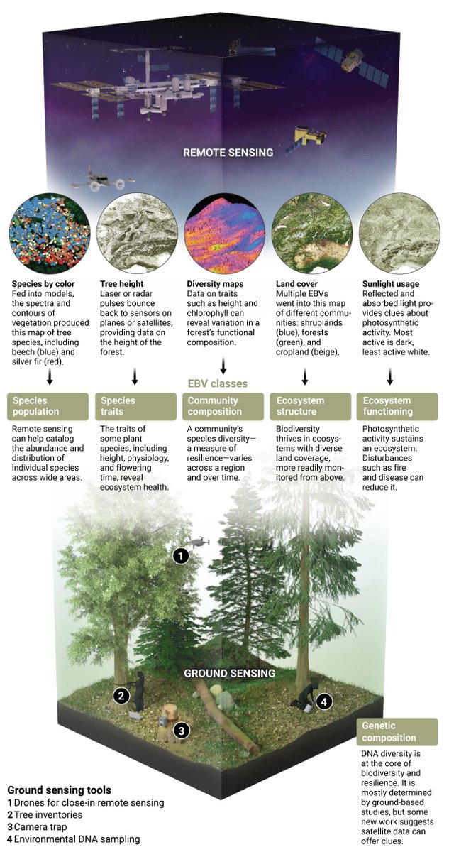
Satellites and other remote sensing tools are not only revolutionizing how scientists study ecosystems, they’re also poised to become powerful tools in the fight to protect them.
🌎 Learn more on #EarthDay: https://t.co/yfeRBZWvIr
Join us for #EarthDay at Union Station in Washington, DC on 4/20 or 4/21 - or online, to learn how data from NASA's fleet of Earth-observing satellites help us understand Earth's atmospheric, oceanic, and terrestrial systems.
#OpenScience
Learn more: https://t.co/UyCoFMlZYr
📢Are you ready to study #mineral composition and #GHGs using #spectroscopy from space? A new NASA #ROSES solicitation for the EMIT mission is out! #LPDAAC#OpenScience#ISS
🗓️Notice of Intent due 6/1/23
➡️Full proposals due 7/19/23
Learn more at: https://t.co/nQ81qqLf6Y
Join us on 🗓️4/20 at 7pm PT for @NASAJPL’s public lecture about the Earth Surface Mineral Dust Source Investigation (EMIT) spectroscopy mission. Learn how EMIT detects #GHGs and looks at mineral composition in arid lands and deserts.
➡️Live stream: https://t.co/ElwbDSz1nc
📢New paper! 🌳
Savanna structure on a budget: #LiDAR vegetation mapping and monitoring made more accessible. We show the utility of entry level hardware and reduced model complexity to encourage a wider adoption in land management.
https://t.co/dfyLYUFqZI
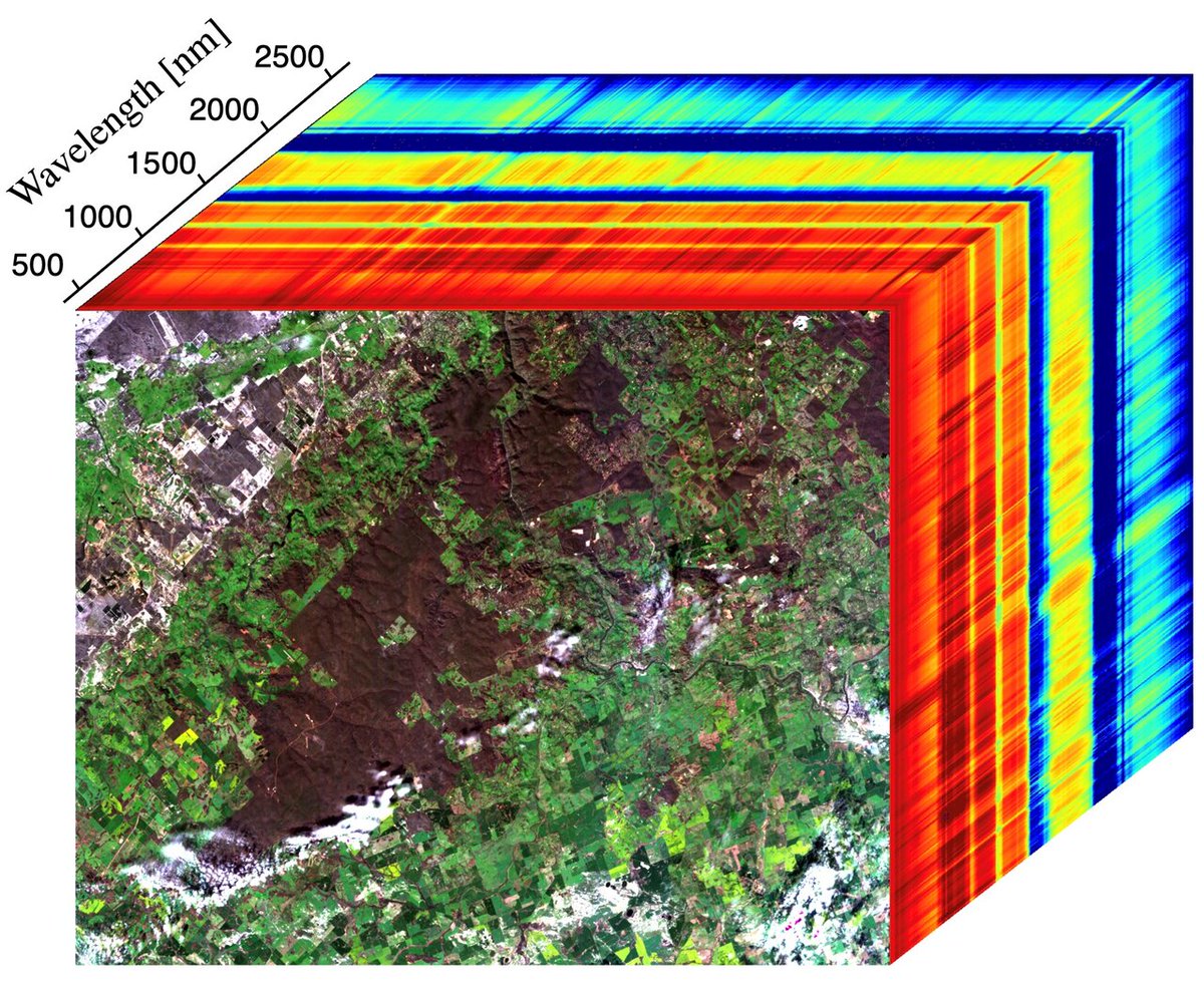
New! Data Tool in Focus: NASA's Application for Extracting and Exploring Analysis Ready Samples (AρρEEARS)
AppEEARS lets users subset data spatially, temporally, and by layer, significantly reducing the amount of data and time needed for analysis.
https://t.co/LX3V7vgacz
New! Data Tool in Focus: NASA's Application for Extracting and Exploring Analysis Ready Samples (AρρEEARS)
AppEEARS lets users subset data spatially, temporally, and by layer, significantly reducing the amount of data and time needed for analysis.
https://t.co/LX3V7vgacz
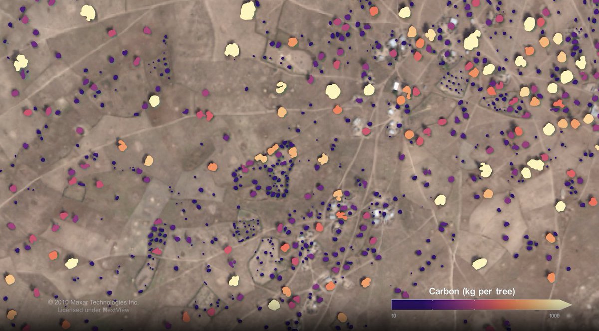
@NASA-funded scientists mapped nearly 10 billion individual trees in Africa’s drylands, specifically the Saharan, Sahel, and Sudanian zones of Africa. Their research will assess the amount of carbon stored outside of major forests. Check out the story, at https://t.co/EDaLKyXONV!
Equity, inclusion and accessibility in participatory sciences with Faculty Fellow Caren Cooper (@CoopSciScoop) at the next #Geospatial Forum this Friday | Join us live, or watch the recording later on our YouTube channel: https://t.co/XMPLDWoO4D