Are you working on crisis maps?
Using emerging technologies to improve humanitarian action? Concerned about the many risks? Training digital humanitarians? Studying humanitarian technology? Interested in Codes of Conduct?
If so, please let us know! We’ll retweet if you @ us.
Time to pull out an old friend of a tshirt to celebrate this network of humanitarians, civic tech, research, and business. It was the spark of so many ideas and friendships. Do you have your tshirt or a story to share? @CrisisMappers
33 million have now been affected by #FloodsInPakistan and the number of fatalities has risen to 1,400.
New maps from CrisisReady present updated data on population density changes & mobility patterns as the floods continue to devastate the country:
https://t.co/2g7rpHgAGc
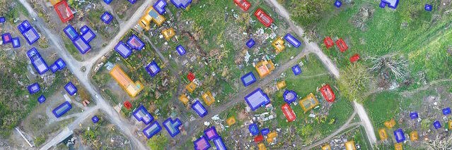
The Russia-Ukraine Monitor Map is a crowdsourced effort by @Cen4infoRes and the wider open source community to map, document and verify significant incidents during the conflict in Ukraine.
@BenDoBrown explains how it works https://t.co/qtlI8lBz9i
Seeing a sad turn of events as the situation in Ukraine has escalated. The mapping done by our team at @Cen4infoRes and the wider community is now verifying and logging more events inside Ukraine of shelling, bombings and other events. Here is the link: https://t.co/QwQrTWsmBF
In the aftermath of #HurricaneIda2021, Direct Relief & @HarvardChanSPH are analyzing population movement data in coordination with @Facebook to understand where people might go, post-storm, & where aid is most needed now @crisisreadiness https://t.co/a6pilaMLuX
On crisis mapping - why are maps of crises in the 'global south' more widespread? Who gets to define crises? Where are the maps of white supremist uprisings in the US @mapmakerdavid#DecolonizeTheMap#decolonize#osm
Very pleased to share this fully revised and updated Code of Conduct on the use of UAVs in humanitarian action! The full review and update was kindly spearheaded by @HHI_Signal at @HHI_Signal 🙏
To read the new Code and to share your feedback: https://t.co/b64HiyVEPi
Humanitarian organizations are increasingly turning to drones to support disaster response efforts. Yet many fail to use this technology effectively. Check out this peer-reviewed online course to learn why, and how to avoid these failures https://t.co/PydiyLEDga
1/2 - To all my humanitarian, academic, and technology friends. I am working on my #master thesis which focuses on the effects #technology has had on the #humanitarian sector over the past decade and how people envision it changing it in the future. #research
@PatrickMeier For sure - we talked with FEMA about doing error analysis of video collected after an earthquake to previous survey data like aerial LiDAR or oblique ortho to detect and quantify structural damage. This was for the recent Puerto Rico earthquake. We weren’t far enough along then.
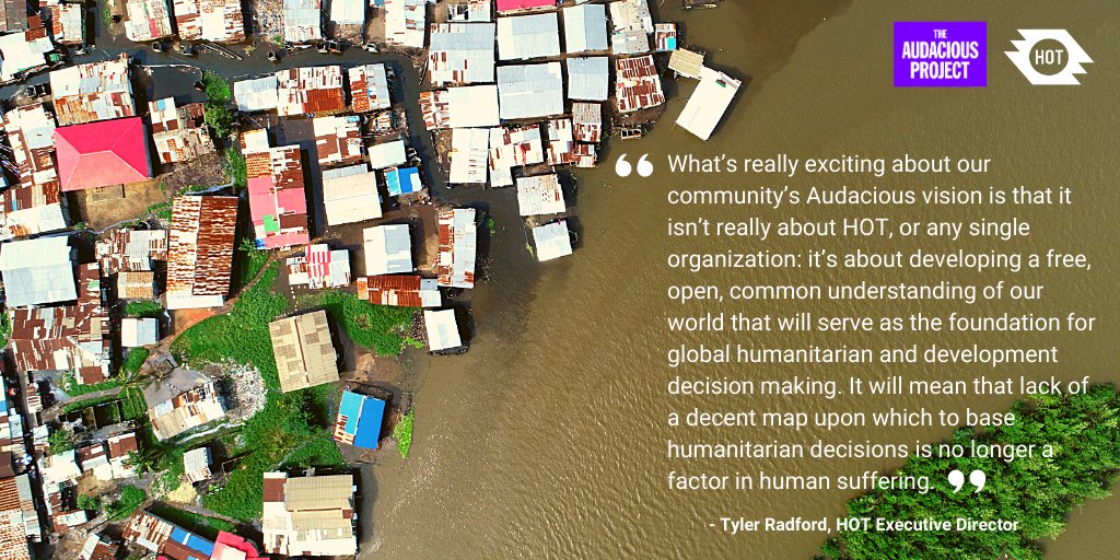
HOT is honored & humbled to announce that our community has been selected by @TheAudaciousPrj & will receive support to map an area home to 1 billion people at risk of disaster who are not currently on the map. #Audacious2020#TED2020 https://t.co/KLa5LEULnn