Every artist should watch this video! Charles is an excellent teacher, and you'll be learning a lot compared to 10-30 minutes of videos. #artㅤㅤ
https://t.co/AOiPqr9VRW
NOAA-HWT has officially published their 2026 SFE study findings!
StormNet scored 1st place at all lead-days on mid-range severe wx prediction.
They noted that "StormNet and WxNext2 Mean represent a major leap in capability" over SPC's currently used tools, like GEFS-MLP.
@thatoneguy7560 I think it does its job for a Shonen story. The story isn't bad, but it's nothing that really captivates me. I keep up with it because the composition looks cool.
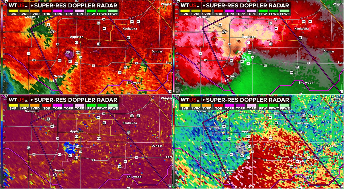
Intense tornado/waterspout is now over the northern side of Lake Winnebago, south of Appleton, WI heading for Stockbridge.
TAKE COVER NOW! This is an extremely dangerous tornado, with a history of producing major damage in Appleton!
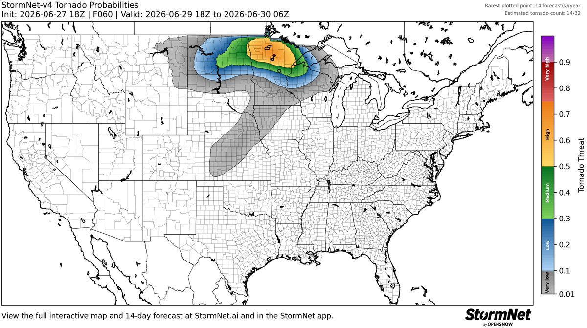
Elevated threat of tornadoes detected for Monday, June 29th, 2026.
See attached map for details.
This forecast initialized on Saturday afternoon. Follow for future forecast updates.
Elevated threat of tornadoes detected for Monday, June 29th, 2026.
See attached map for details.
This forecast initialized on Saturday morning. Follow for future forecast updates.
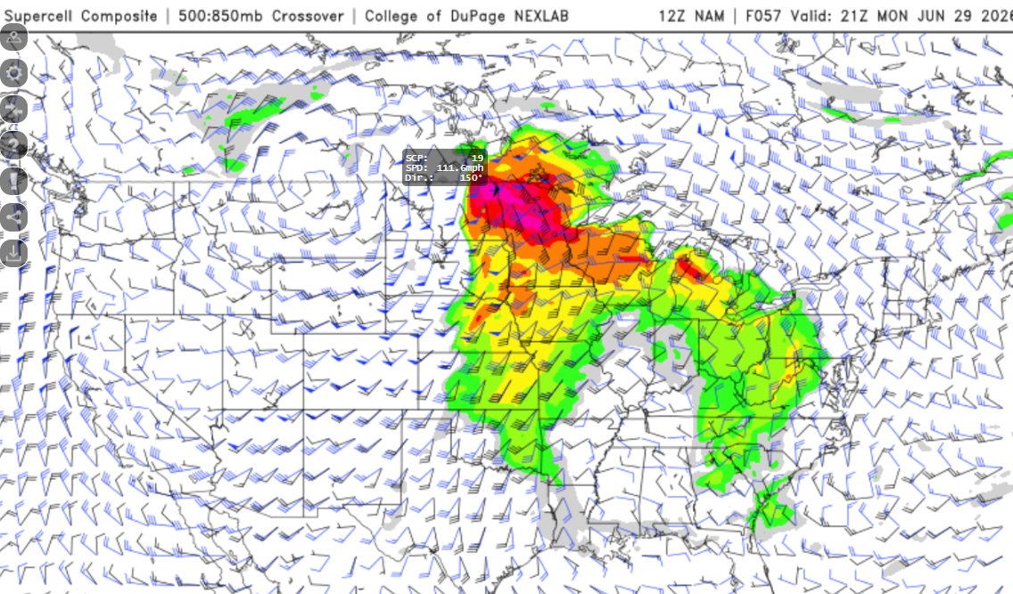
And of course, the best model ever has just up trended significantly. Of course storm mode is a question, but I see no reason why the SPC would hold off on a Day 3 ENH risk. A few EF-2+ tornadoes appear likely Monday...
Monday has my eye WAY more than it did last night. I wouldn't be shocked if we see a few long-tracked EF-2+ tornadoes being possible. Could be a dangerous day if this trend continues. I expect the SPC to upgrade to a day 3 ENH risk level 3 out of 5 at the next update...
Well, find me interested in whatever is about to happen on the Minnesota/Canada border on Monday. No matter what, looks like a pretty rare volatile environment for this area that we don't see often...
Incredible radar data coming from KVWX NEXRAD as a tornado is in progress just miles from the radar - and it's at once disjointed from the parent supercell, but apparently carrying a glob of rain along with it with it sitting happily in the middle
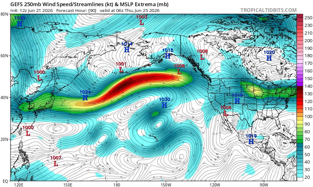
A Jet Extension this week cam lead to an uptick in severe weather by months end as shortwave trough eject into the Plains, particularly the northern Plains. I would not be surprised if there is a more substantial severe weather threat sometime before June ends.
LINK: https://t.co/lPAzyLUetT
My footage of the strong, damaging, photogenic tornado that occurred near Effingham, IL, on Wednesday. This tornado had an audible roar and lofted ample debris as it crossed the road a few hundred yards to our south.