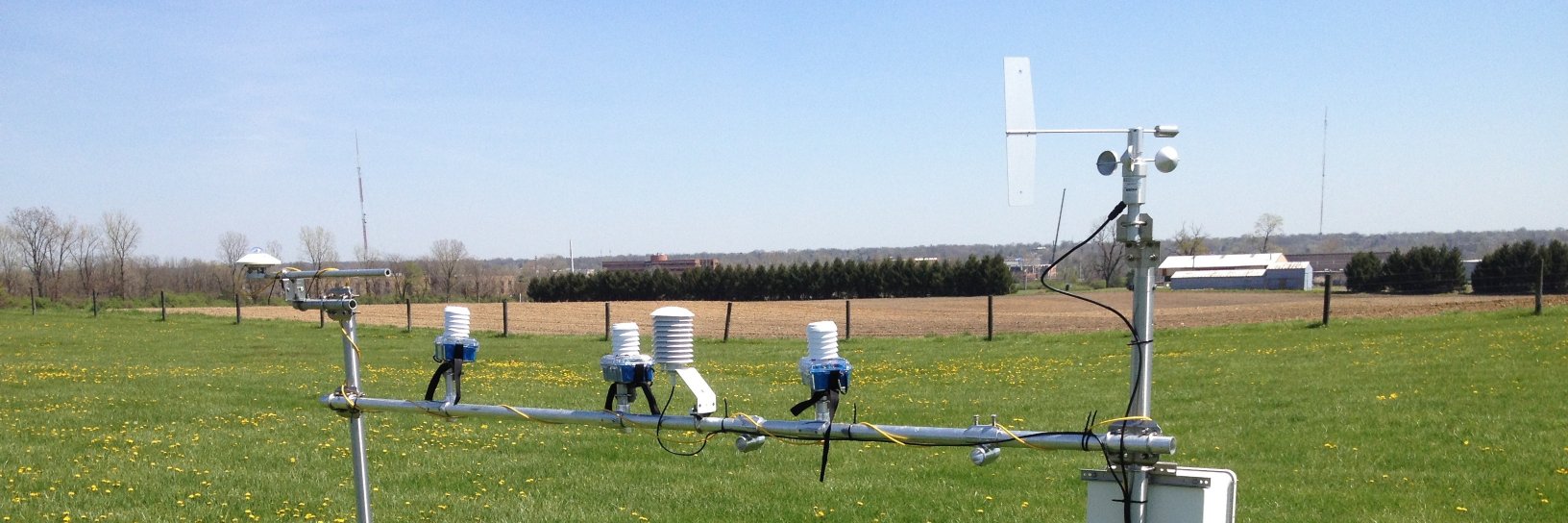
State Climate Office of Ohio (SCOO) actively accesses local and state science-based climate information, delivering climate services through education and inter
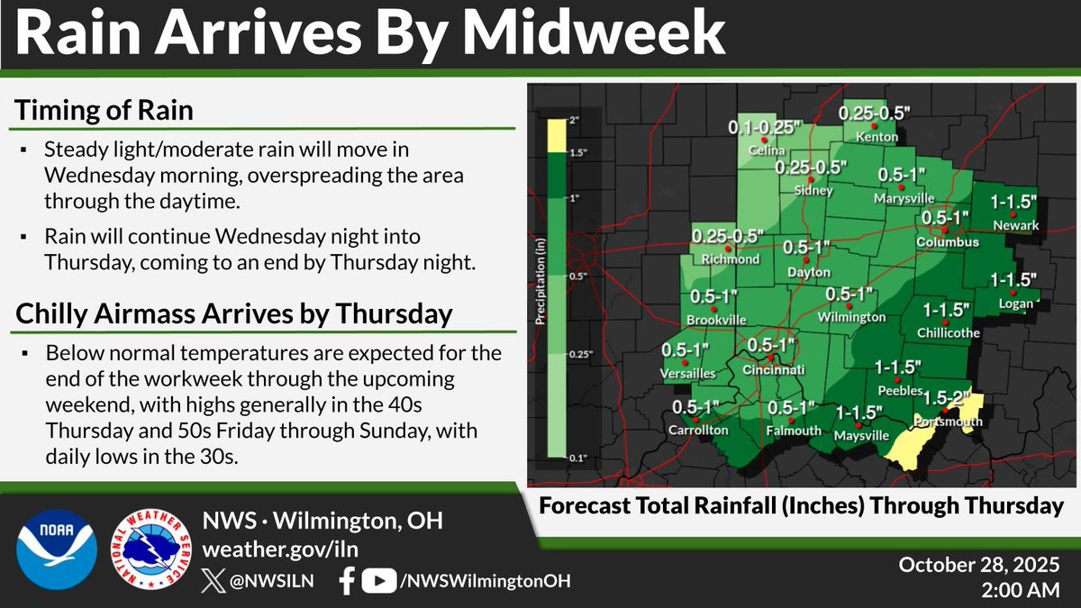
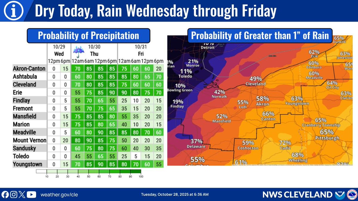
Widespread rain is expected for many spots in the local area Wednesday through Thursday, with the steadiest and heaviest rain expected for locales near and south of the Ohio River as well as near and east of the I-71 corridor.
Today is your last sunny day for a bit!
Rain arrives late Wednesday and continues through Friday. Some areas could see over 1 inch of rain by Halloween…time for rain-friendly costumes 🎃☔
We’ll keep you posted on any impacts to weekend plans!
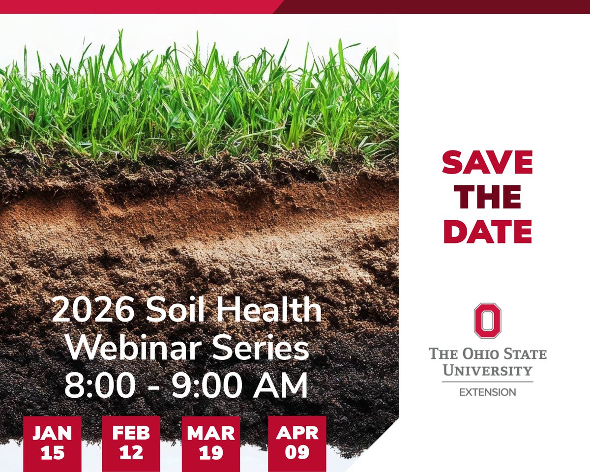
Save the Date for our 2026 Soil Health Webinar Series kicking off on January 15th! Stay tuned for registration and speaker details.
#soilhealth#Extension@manbirrakkar
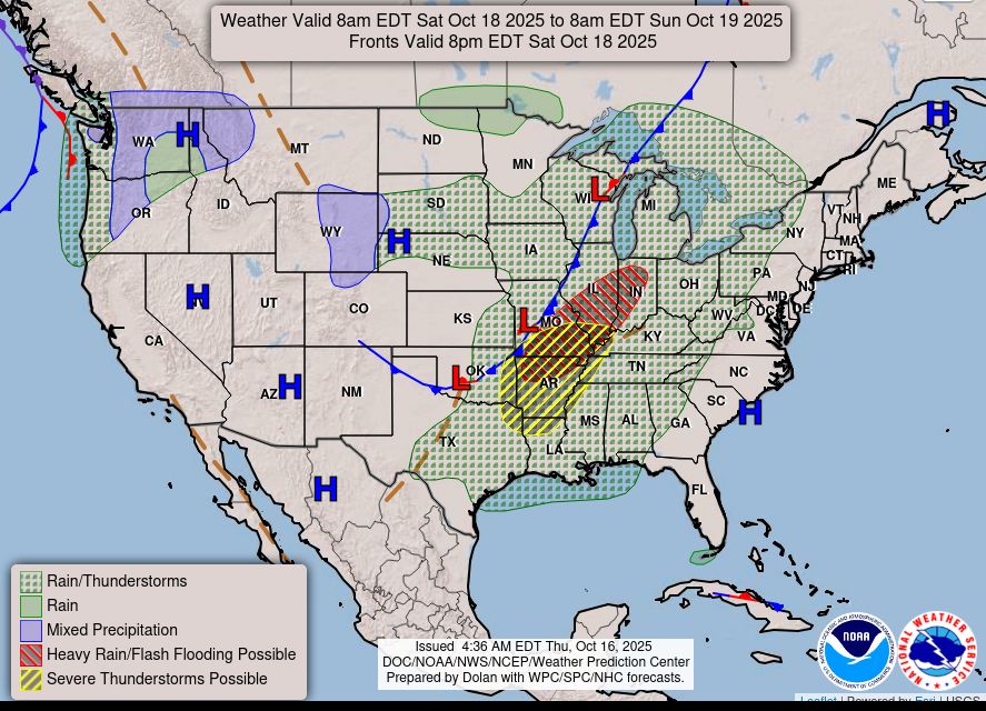
A storm system will slowly continue to press across the central U.S. Friday and Saturday with widespread showers and thunderstorms. Slight risks for severe thunderstorms and excessive rainfall have been issued Saturday from the Ozarks into the mid-Mississippi River Valley with potential for damaging winds, large hail, tornadoes, and flash flooding. https://t.co/qk3BcVP5M8
NOAA’s National Weather Service Winter Outlook has been released.
This outlook shows the likely temperature and precipitation the U.S. could experience during meteorological winter (December 1, 2025 through February 28, 2026) and drought conditions through January 31, 2026.
Here are the highlights:
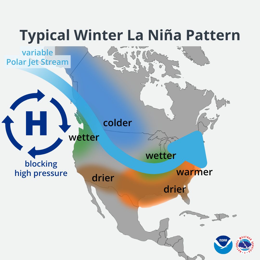
🌎La Niña conditions are expected to develop later this fall and will be a factor in the winter outlook.
🌡️A milder-than-average winter is favored across the southern tier of the country and along the Eastern Seaboard.
💧Wetter-than-average conditions for the Ohio Valley and southern Great Lakes region, along with most of Alaska, are also favored. Drier-than-average conditions are forecast in the desert Southwest, along the Gulf Coast, and from Florida to the Carolinas.
🌤️Drought conditions are expected to persist and worsen from southern Texas to California.
NOAA’s seasonal outlooks provide the likelihood that average temperature and total precipitation for the three-month period will be above-, near- or below-average and how drought conditions are anticipated to change in the months ahead.
Keep In Mind: The outlook does not project seasonal snowfall accumulations as snow forecasts are generally not predictable more than a week in advance, and cold weather can still be experienced in areas that are warmer-than-normal over the course of the season.
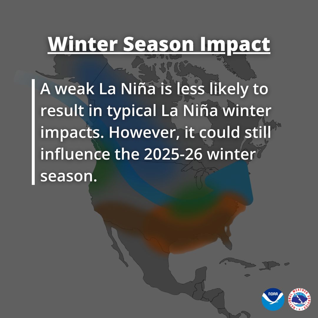
While La Niña is currently expected to remain weak, it could still influence the 2025-26 winter season. See what a typical winter La Niña pattern looks like across the U.S.
For more information visit https://t.co/EQ7rAgwMgE.
(2/2)
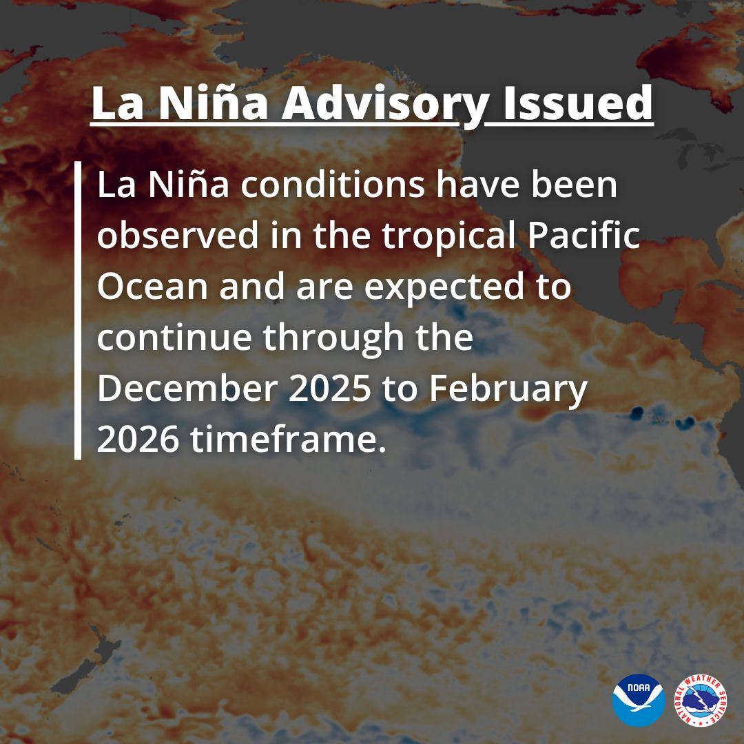
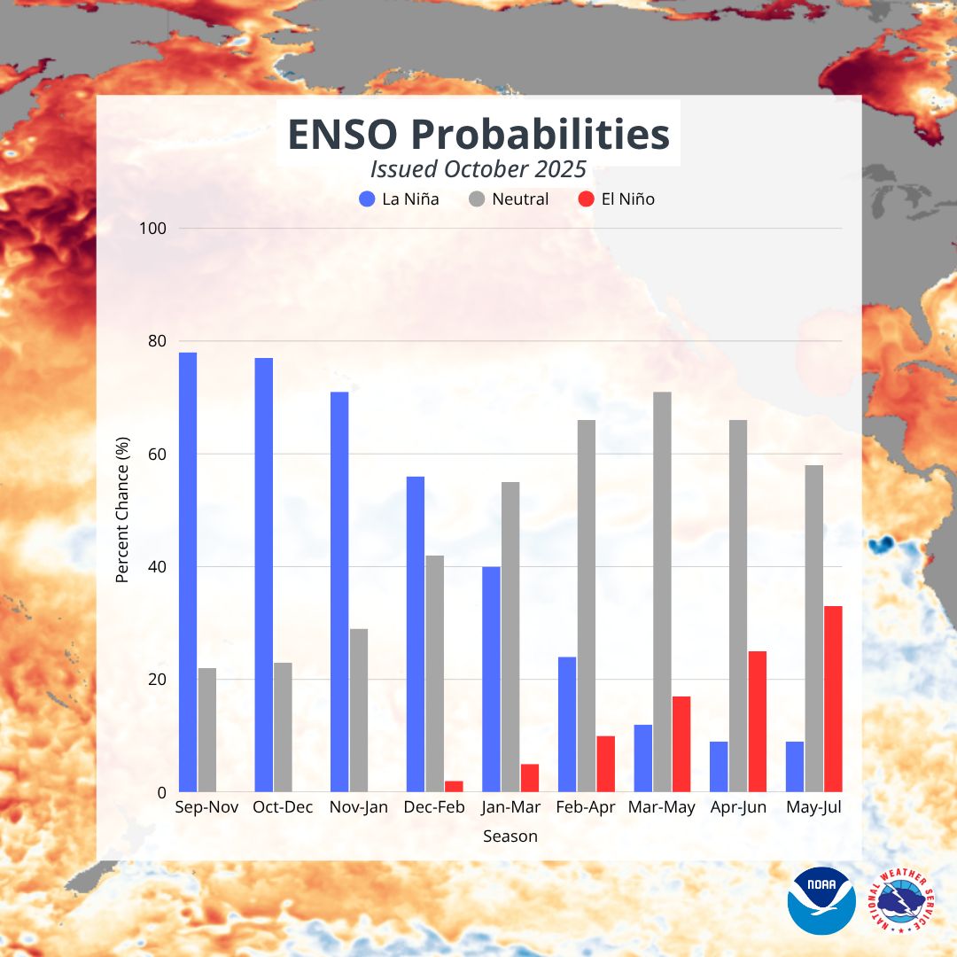
A La Niña Advisory has been issued, meaning that La Niña conditions have been observed in the tropical Pacific Ocean and are expected to continue through the December 2025 to February 2026 timeframe.
A transition to ENSO-neutral conditions, meaning neither El Niño nor La Niña conditions, is most likely in the January to March 2026 timeframe.
(1/2)
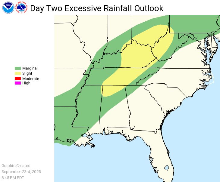
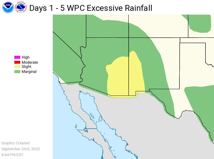
Heavy to excessive rainfall Wednesday may bring areas of flash and urban flooding over portions of the Ohio and Tennessee Valleys. In Arizona and New Mexico, heavy to excessive rainfall from monsoon thunderstorms may bring isolated flash and urban flooding Thursday into Saturday. https://t.co/qk3BcVP5M8
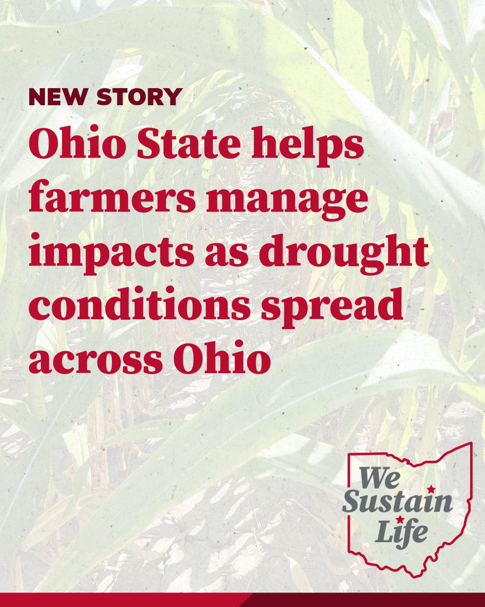
An ag weather and climate specialist says @Ohio_Climate is expanding its efforts to provide #drought resources for #farmers across the state.
Full story below @brownfield
https://t.co/9X92OrqQQk
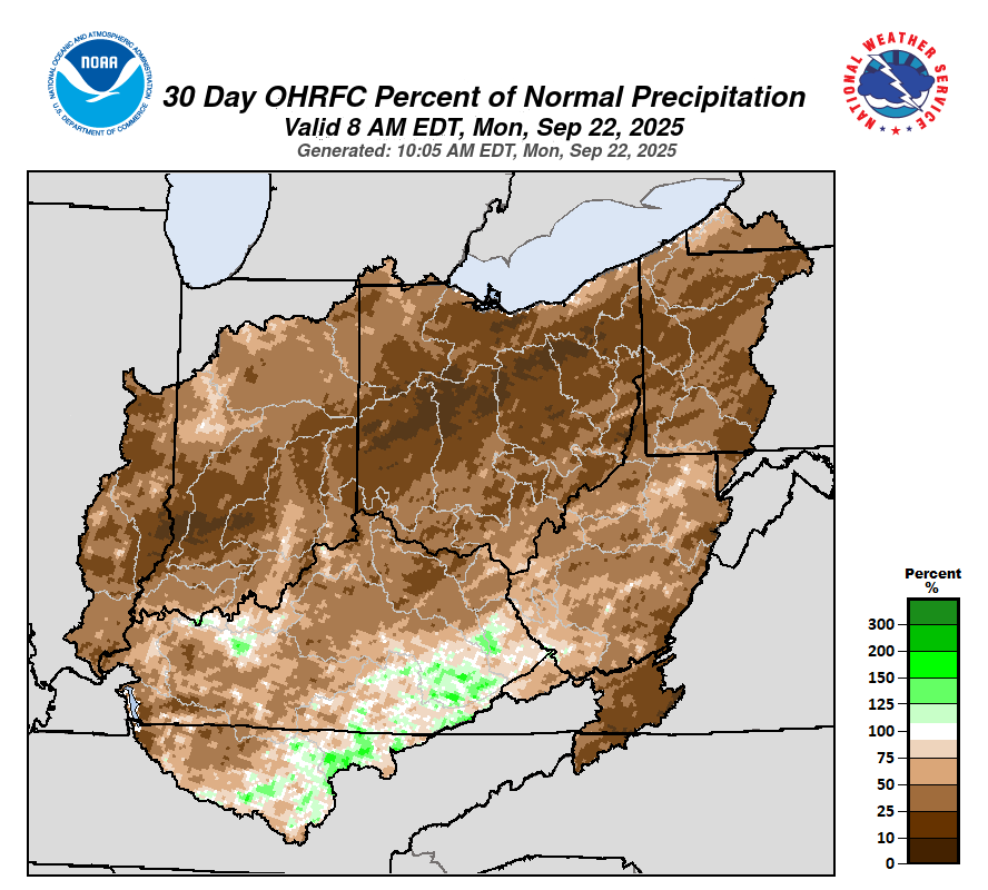
After the driest August on record for Ohio, some relief has arrived 🌧 Drier weather will resume by the weekend through the first half of next week though. Read the full climate summary and weather forecast at https://t.co/UiZzU9UFm4
#climate#harvest25#weather
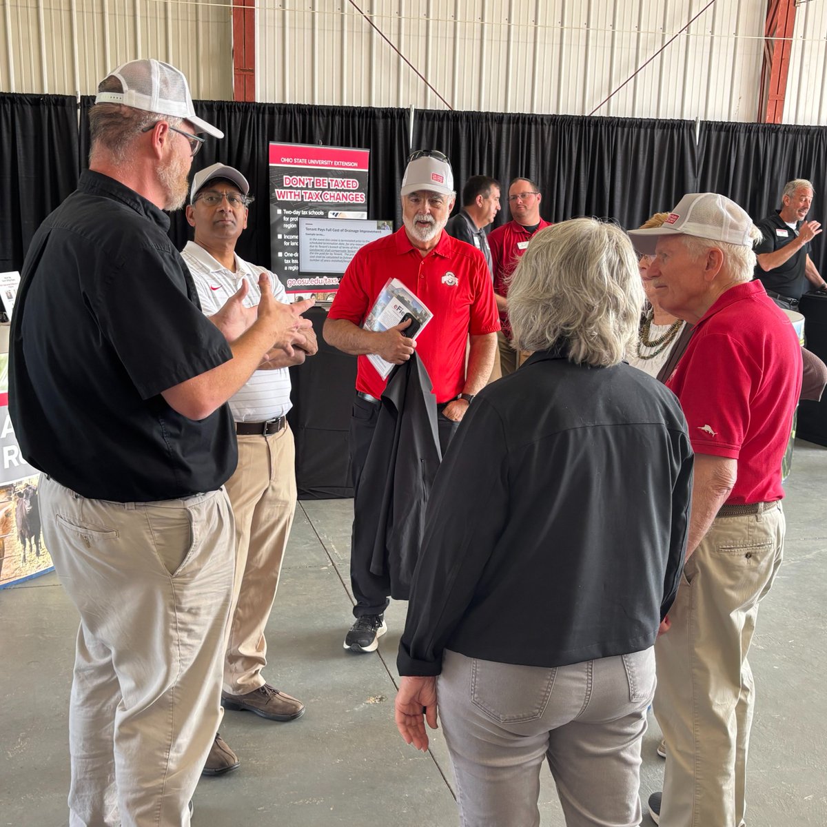
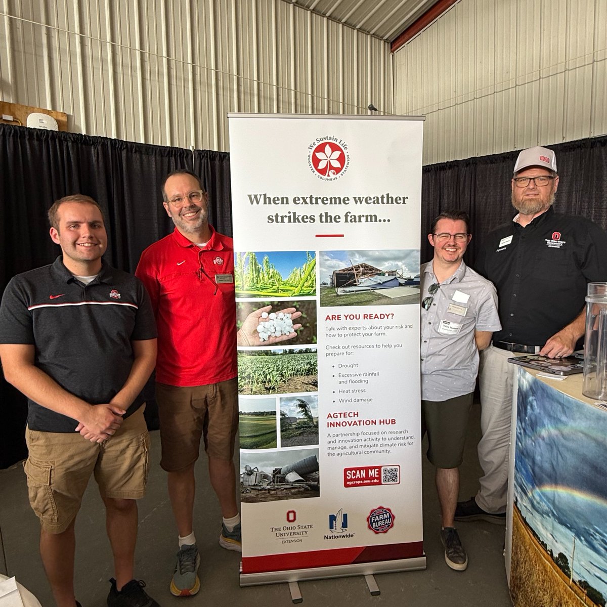
The State Climate Office of Ohio, including members of the Byrd Center, OSU Extension, and Weather USA participated in this year's Farm Science Review this past week.
#ICYMI at #FSR25: As an Ag Weather and Climate Field Specialist with Ohio State University Extension, Aaron Wilson's work revolves around helping producers implement weather resilient agricultural practices. Learn more in this video.
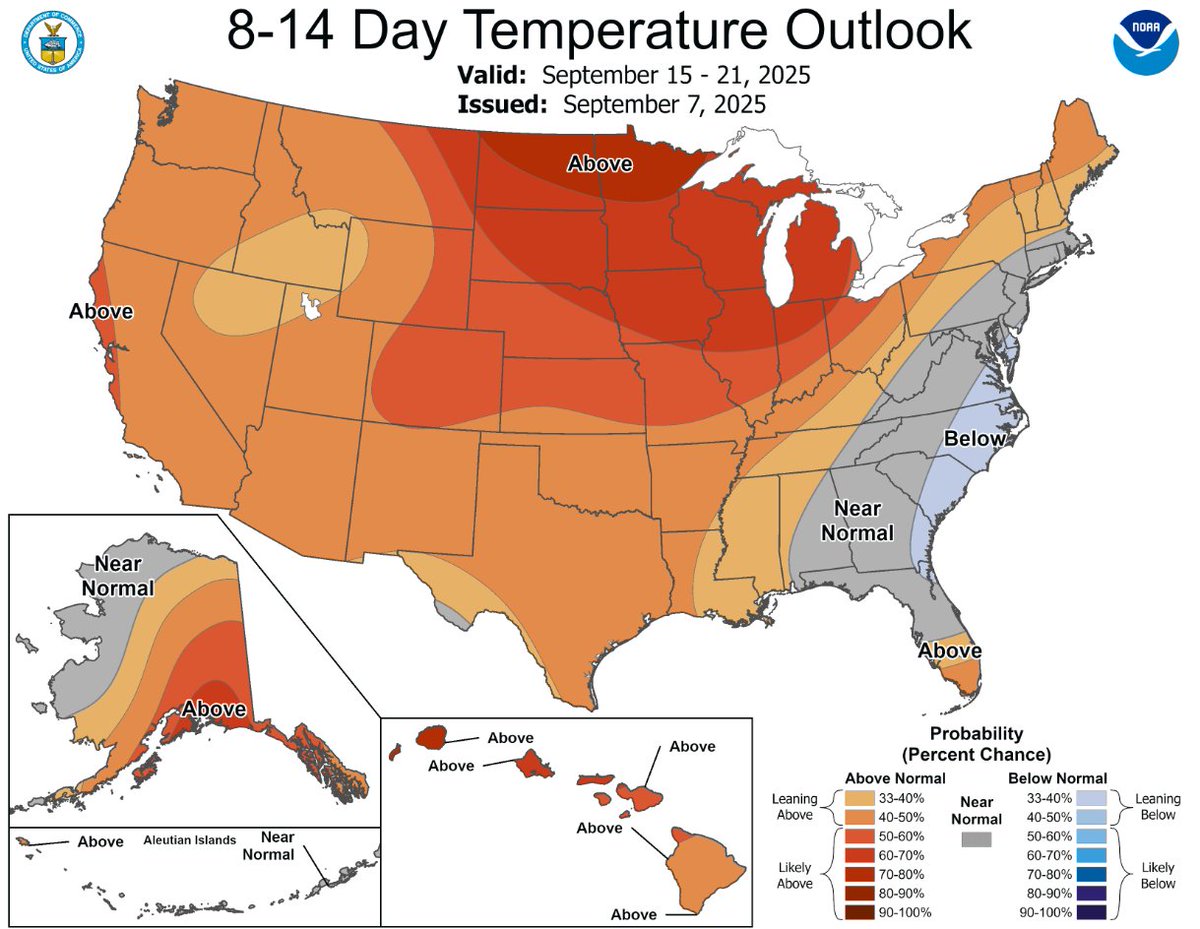
Mid-September heat wave persisting up the Mississippi Valley into the Midwest, with warmer than normal weather from the Great Lakes to the Northeast https://t.co/A3RX3bwD5b
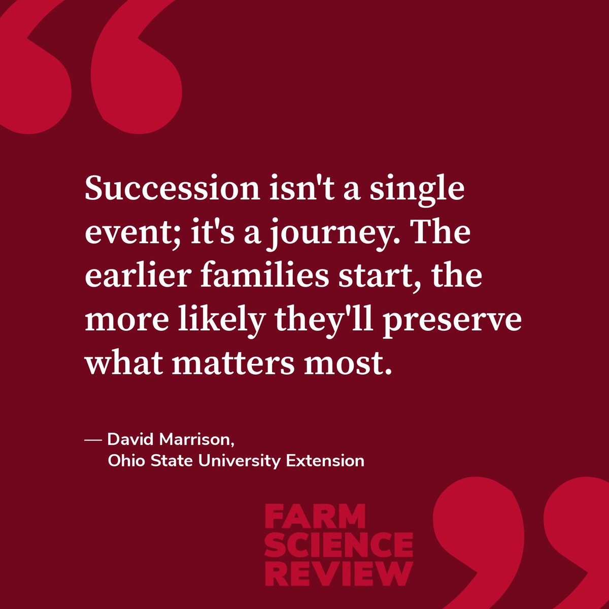
Farm succession planning can feel like a daunting task, but it is never too early to start the conversation.
At #FSR25, @CFAES_OSU is providing families with strategies to navigate every aspect of passing the torch to the next generation. Learn more: https://t.co/mHF1Ev2XEf
📰 More than half of Ohio is now experiencing abnormally dry conditions as the forecast shows continued below- or near-normal precipitation.
The good news? Our experts are expanding efforts to assist producers across the state.
Read the full story here: https://t.co/q3yPCd9yh9
After a relatively cool stretch of weather for portions of the U.S., temperatures will be on the rise this week and that trend will continue into mid September. The exception being eastern portions of the country with a near to below normal signal. Here's the 8-14 day temperature outlook (September 15-21).👇
We're officially ONE month away from #FSR25!
We can't wait for three jam-packed days of educational sessions, demonstrations, and conversations with folks from across Ohio.
Get your tickets today: https://t.co/mZNW1aMkrI