Below is the link to the September Issue Of The REACTer.
https://t.co/kZ9jtLx4kD
To enroll in one of our online training courses, send an e-mail with your name and membership number to [email protected]
REMEMBER!!
Send In That REACT News!
Send to [email protected]
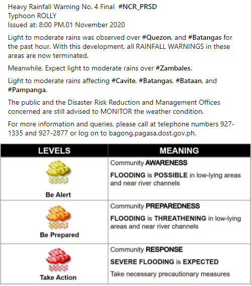
Heavy Rainfall Warning No. 4 Final #NCR_PRSD
Typhoon ROLLY
Issued at: 8:00 PM,01 November 2020
Light to moderate rains was observed over #Quezon, and #Batangas for the past hour. With this development, all RAINFALL WARNINGS in these areas are now terminated.
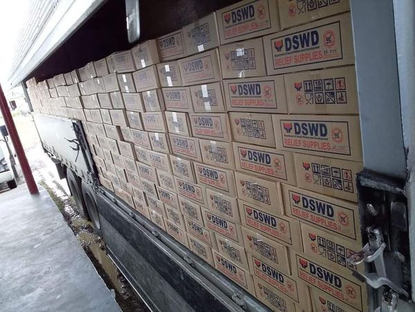
DSWD has prepositioned 260,164 food packs (FFPs) in strategic areas across the country for families affected by Typhoon Rolly.
Read more:
https://t.co/NHxKq5gHdo
#InformInformInform#LagingHanda#Rollyph
🌪 And here is a new discussion from @NWSSPC concerning the potential for tornadoes this afternoon and evening. Tornado threat is not high but can not be ruled out. #LAwx#MSwx https://t.co/NVnQCRRqxo
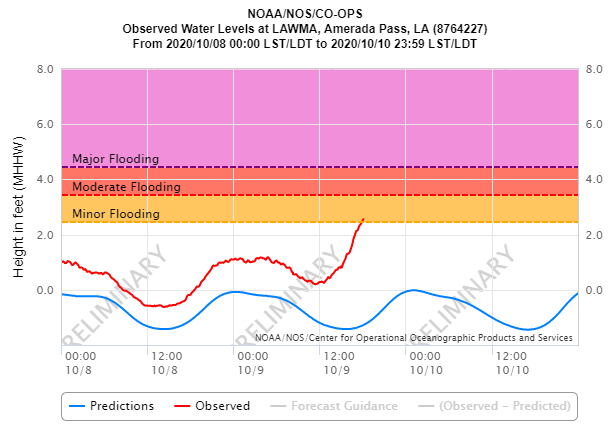
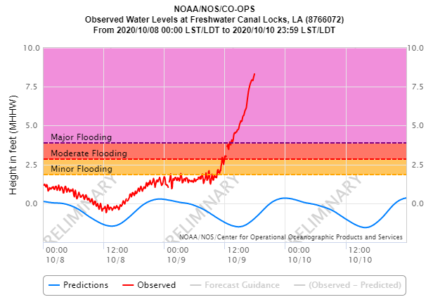
🌊6p CDT: We continue to watch tides across coastal LA. Freshwater Canal Locks in southwest LA now with a surge of 9.4 ft (8.32 MHHW). Amerada Pass with 3.8 ft surge, & Port Fourchon now at 1.2 ft. Port Fourchon should begin to start rising a little faster. 🌀 #Delta#LAwx
7:45PM: Watching a band of heavy rain showers slowly parading east across SE LA and S MS. Rain will continue to work its way into #NOLA and surrounding areas shortly. Good news - no tornado warnings at this time, but will keep a close eye on it. #lawx#mswx
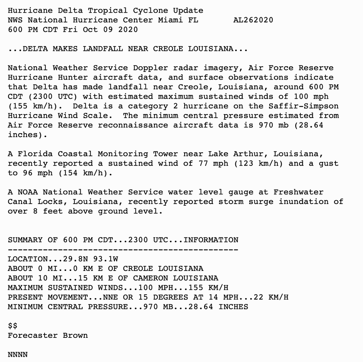
Hurricane #Delta makes landfall near Creole, Louisiana, at 6:00 PM CDT as a category 2 hurricane on the Saffir-Simpson Hurricane Wind Scale. Damaging winds and a life-threatening storm surge continue over portions of southern Louisiana. Latest at: https://t.co/tW4KeGdBFb
Some areas could get two feet...of rain. Here are four flooding graphics to use in highlighting the dangers of coastal and inland flooding. #Sally#WeatherReady
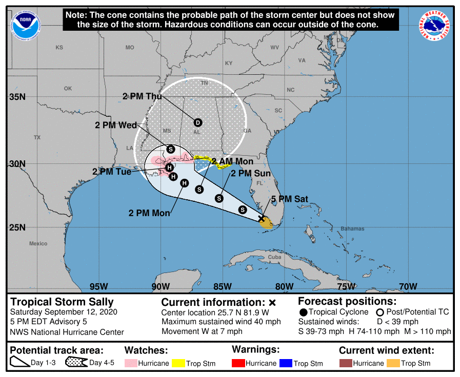
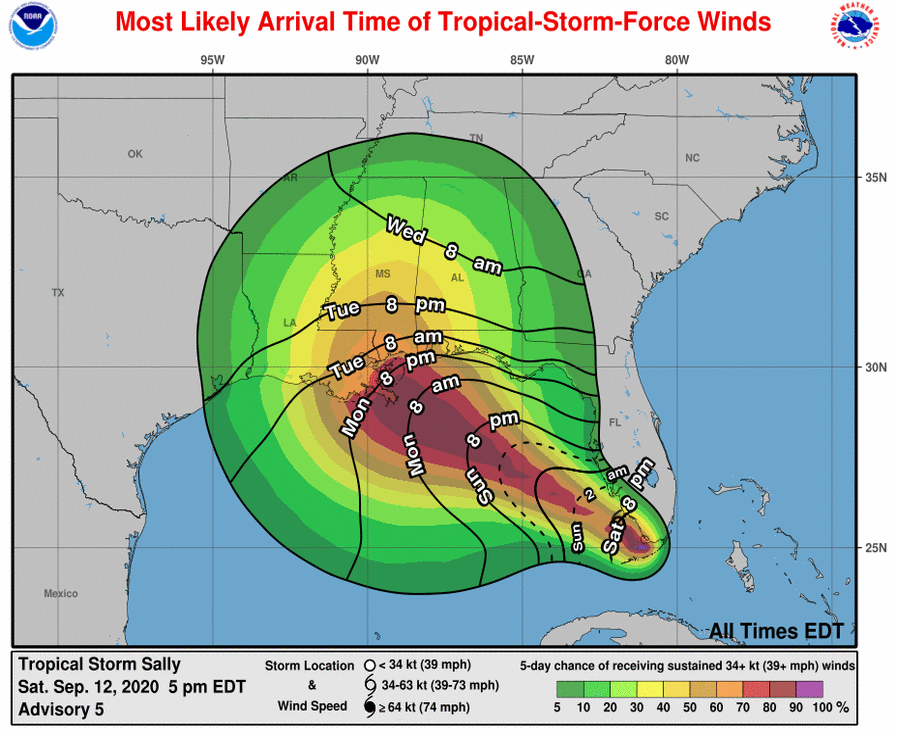
NWS- Tropical Storm #Sally is forecast to make landfall as a category 2 hurricane over southeast Louisiana early Tuesday morning. The storm will slowly move across the area bringing a threat for heavy rainfall and flash flooding.
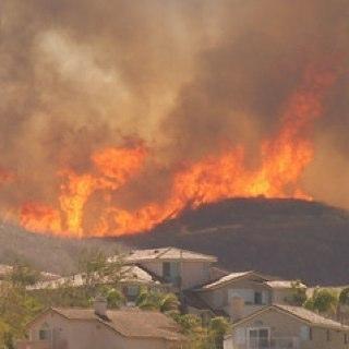
#Wildfire smoke can irritate your eyes, nose, throat, and lungs. It can make you cough or wheeze, and can make it hard to breathe. @Airnow’s Fire and Smoke Map shows current air quality, smoke plumes and fire locations all on one map. https://t.co/JqNDYav4Bj
A Hurricane Watch is in effect from Grand Isle, LA, to the Alabama/Florida border, where hurricane-force winds are possible by early Tuesday, with tropical storm conditions possible on Monday #Sally https://t.co/tW4KeFW0gB