I never publicly comment on political matters because they are usually irrelevant to my work of providing hurricane data and forecasts to people in my personal capacity. Today though, it is highly relevant, and as a member of the meteorological community, I am angry.
Planned or ongoing bulk workforce cuts would irreparably harm the National Weather Service, NOAA, and their scientists who save innumerable lives by warning people in advance of tornadoes, hurricanes, wildfires, tsunamis, blizzards, and other life-threatening hazards. Many of you reading this may knowingly or unknowingly be alive today because of their work, or know someone who is. As a direct consequence of wounding the NWS and NOAA, the public would be less safe.
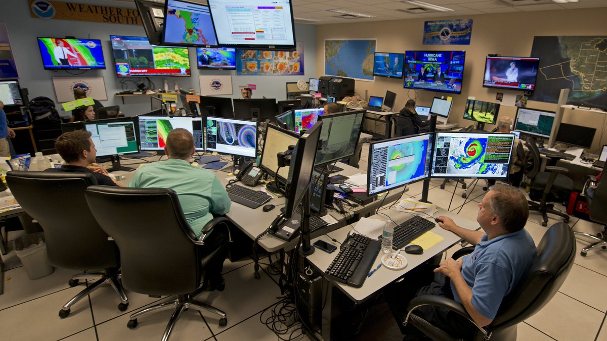
My personal mission to bring hurricane science, data, and forecasts to the public would not be possible without the weather observations, doppler radar stations, computer models, hurricane hunter aircraft, and weather satellites provided by NOAA and the NWS. Your favorite weather apps, TV meteorologists, and private weather companies would also be unable to function without this data or the civil servants who live and breathe it to synthesize it into public safety information.
All of these benefits cost each taxpayer the equivalent of a few cups of coffee per year, and surveys show most would be willing to pay much more. The American weather enterprise saves many, many times more money than it costs to run, making it one of the biggest bangs for your buck in the government. The impact of quality weather forecasts and infrastructure on society is multiplied many-fold by preventing economic disruptions, keeping public transportation efficient, and providing lead time to prepare for and mitigate disasters. Most importantly, it saves priceless lives.
Careful, long-term plans to streamline or reorient the weather enterprise in an evolving world are not bad, but *this plan* is insane. A feverish rush to take a cleaver to this workforce is self-destructive and dangerous to Americans who rely on the services they provide. It also cuts off the legs of young, passionate scientists who represent the future of meteorology in the new age of AI and other emerging technologies -- the very people we need in the field right now.
As a part of this community since the age of 8 when I began analyzing hurricanes with dial-up internet, I am heartbroken and concerned by what appears to be planned or already in motion. It also directly impacts my friends and family. I cannot be silent, despite knowing I do myself no favors by speaking out. I ask you to join me in advocating for @NWS and @NOAA if you value their work or the work that I am able to do because of them. There are many ways to make your voice heard.
That's all for now, thanks for reading.
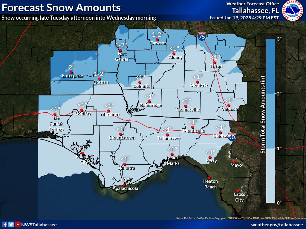
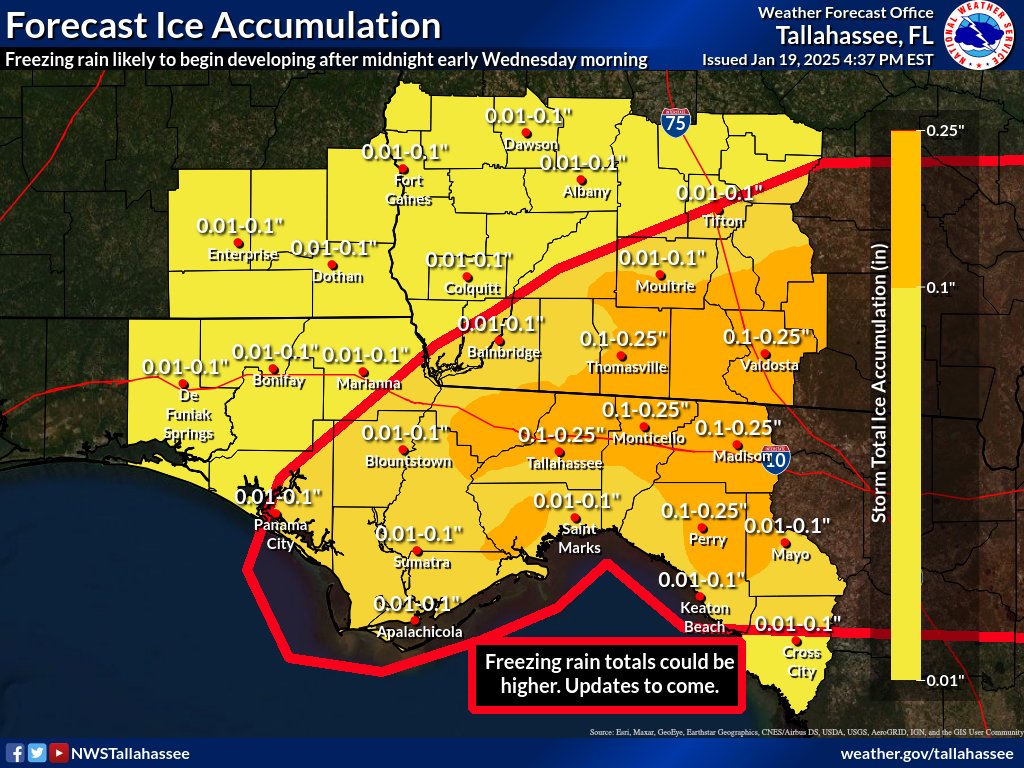
A winter storm watch is now in effect for nearly our entire forecast area as we monitor the upcoming winter storm Tuesday afternoon into Wednesday. Keep in mind, winter weather forecasts are tough, especially in the south. Forecast amounts are likely to change. #FLwx#ALwx#GAwx
8:05 AM CDT Monday Update: Milton rapidly intensifies into a category 4 hurricane. The maximum sustained winds have now increased to 150 mph (240 km/h) and the minimum pressure has fallen to 940 mb.
These are deeply concerning intensity shifts from the GFS for #TD14. While the details of the exact track/intensity of the storm are still TBD, what is clear is that everybody along the western coast of Florida needs to prepare for a life-threatening, intense hurricane. #flwx
So, big rains working our way this week, but look around the peninsula!
I think south Florida has a flooding concern for the amount of tropical moisture moving in... for us? Lots of clouds, and plenty of showers. Big pattern change...
Much more on 'Coffee Talk' in just a few!
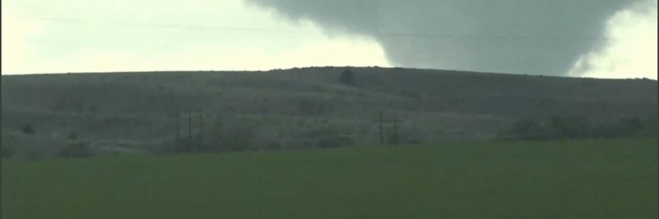
This video shows people parking under a bridge, exiting their vehicles, and then being pelted by debris, all in the name of safety with a tornado that they could have easily driven away from.
WE HAVE TO STOP DOING THIS!!!!
LINK: https://t.co/WHlfnEHFf3
Preliminary survey results: There were 2 EF-2 tornadoes that touched down in eastern Gadsden and western Leon County that tracked across Central Leon County. Additionally, intense 100 mph straight-line winds accompanied the tornadoes. (1/2) #FLwx
Don’t get complacent today. Storms form 2-3pm and LLJ doesn’t really get going until 6pm. If the first 3-4 hours are relatively unproductive, that doesn’t not mean it is a bust. And anyone with a big following saying so could severely undermine the perception of the threat.
I just released my full video showcasing my chase where I captured a career-high 9 tornadoes throughout parts of SE NE and SW IA.
If you have time, please give it a like and a share!
(Video link in the tweet below)
@ReedTimmerUSA@ryanhallyall@CornbeltChasers@IAStormChasing
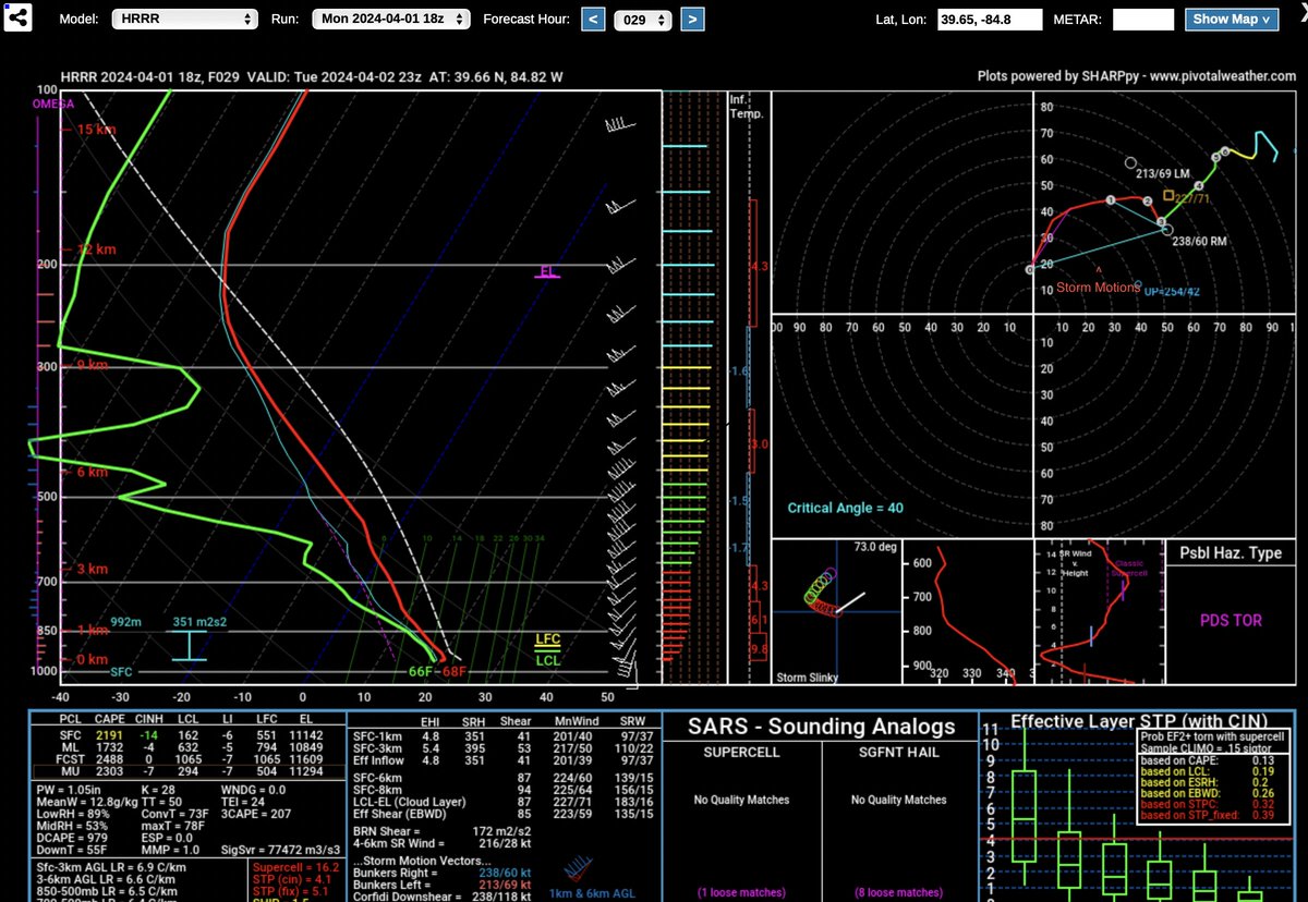
Tuesday has a potent parameter space modeled across all the cams, but there is a difference between the NAM and HRRR that could make or break the setup. The orientation of the boundary is almost parallel to the shear vectors on the NAM (messier mode), while more perpendicular on the HRRR (more isolated mode).
As crazy as it may sound, Global sea surface temperatures have now been at all-time record warm levels for an entire year.
This is perhaps one of the most absurd and alarming graphs I have ever plotted.
Some of the fans who suffered frostbite at the January playoff game between the #Chiefs and #Dolphins might need amputations, per @fox4kc
Temperatures were minus 4 degrees Fahrenheit at kickoff, with a wind chill of minus 27F.
This is probably the most banana’d of a banana low I‘ve seen, while there’s still time for things to change I’d be hard pressed to see anyway to get sig severe next Tues-Wed