The one year difference in sea surface temperatures in the Eastern Pacific is out of this world.
From a developing La Niña in 2025 to a budding Super El Niño in 2026 and all-time record warm ocean temperatures in the Eastern Pacific.
Elevated threat of tornadoes detected for Wednesday, June 17th, 2026.
See attached map for details.
This forecast initialized on Saturday morning. Follow for future forecast updates.
Here is a radar animation of the deep #pyroCu from yesterday's RX burn on Farmington Bay of the Great Salt Lake. You can see both the first deep plume pulse, the lake breeze move the plume inland, then an storm outflow hit the plume at the end (pushing it back west).
Latest sounding from Fort Worth, TX is absolutely wild with a crazy instability profile and decent hodograph shape. All timer for this office for sure.
MiniCOW packs MegaPOWER! Observes birth and ingestion of satellite tornado
and Fujiwara effect deflecting tornado. Tornado transitions 2x between clear eye and debris ball. Prelim data from most powerful mobile radar, 1 MegaWatt C-band storm-penetrating miniCOW in Braman, OK 🌪️
VIDEO: Short Form Video edit for Enid, Oklahoma Tornado has been completed. Close Tornado Intercept Enid Oklahoma - 23 April, 2026 #okwx@NWSNorman
https://t.co/0Iu8wXCl7o
The terrifying view of the tornado near Enid, Oklahoma this evening as it crossed the road. Join our live streams & watch the full chase edit coming up via https://t.co/nieJn2YwxP
Central OK is likely to remain strongly capped through Thursday. Current synoptic forcing appears too weak to erode the inversion, so storms would probably require a stronger or earlier-arriving jet streak than is currently forecast. #okwx@aguacerowx
2/20/26 8:35 am Update:
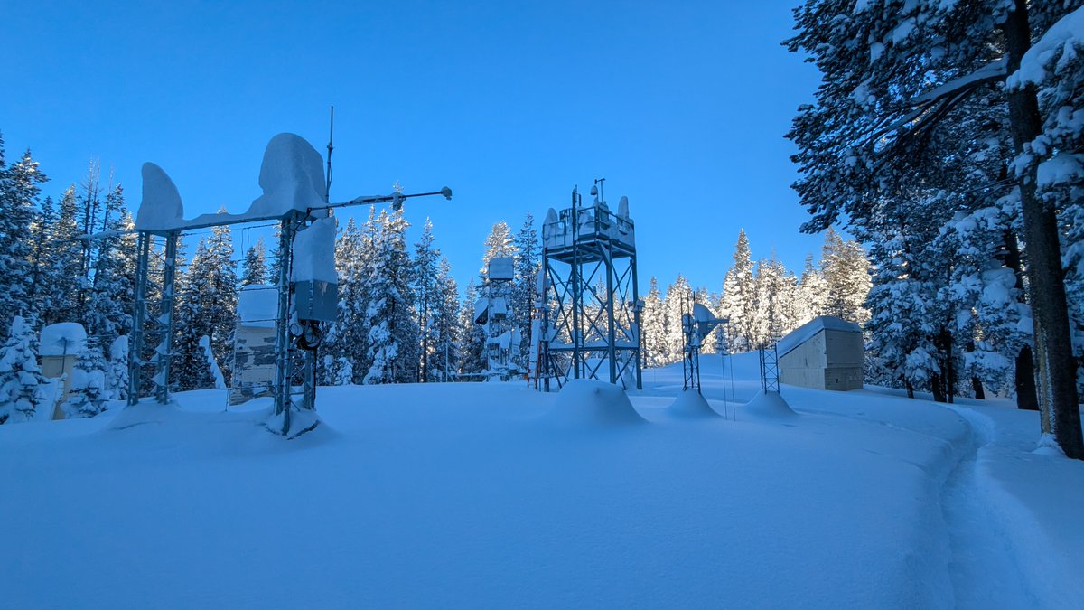
#snow has stopped but not before giving us 18.5" (47 cm) in the last day. That brings our 5-day total to 111" (281.5 cm), third snowiest 5-day period on record at the lab*.
Calm conditions for the next several days but a warmer storm moves in mid-week.
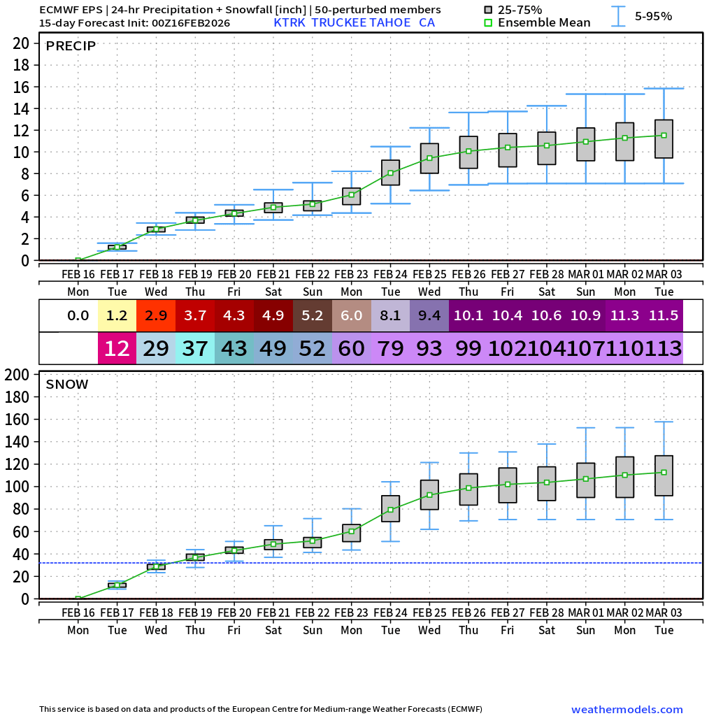
Truckee Tahoe, California 📈🏔️
11.5" of precipitation ... assuming 10:1 ratio of snowfall to liquid, that's 115 inches or about 10-feet of snowfall. ❄️
But temperatures support higher ratios ... so let's say 10 to 15 feet of snowfall in next 10-days
Big changes are coming to Storm Prediction Center Convective Outlooks on or around March 2!
-Introduction of three different types of hatching for significant severe weather, corresponding to increasing intensity of potential hazards
-Addition of 75 and 90% wind contours
Read more about the upcoming changes here: https://t.co/vhDAWf0ZyK
What are your thoughts? Might get to work on a video discussing these changes in detail and how to interpret them.
LINK: https://t.co/ioW4HowuZb
Going LIVE at 8:30pm CST to break down the meteorology behind the upcoming heavy rain/flash flooding event set to peak tomorrow across Southern California. We'll also touch on the low-end severe risk across the state tonight through Thursday.
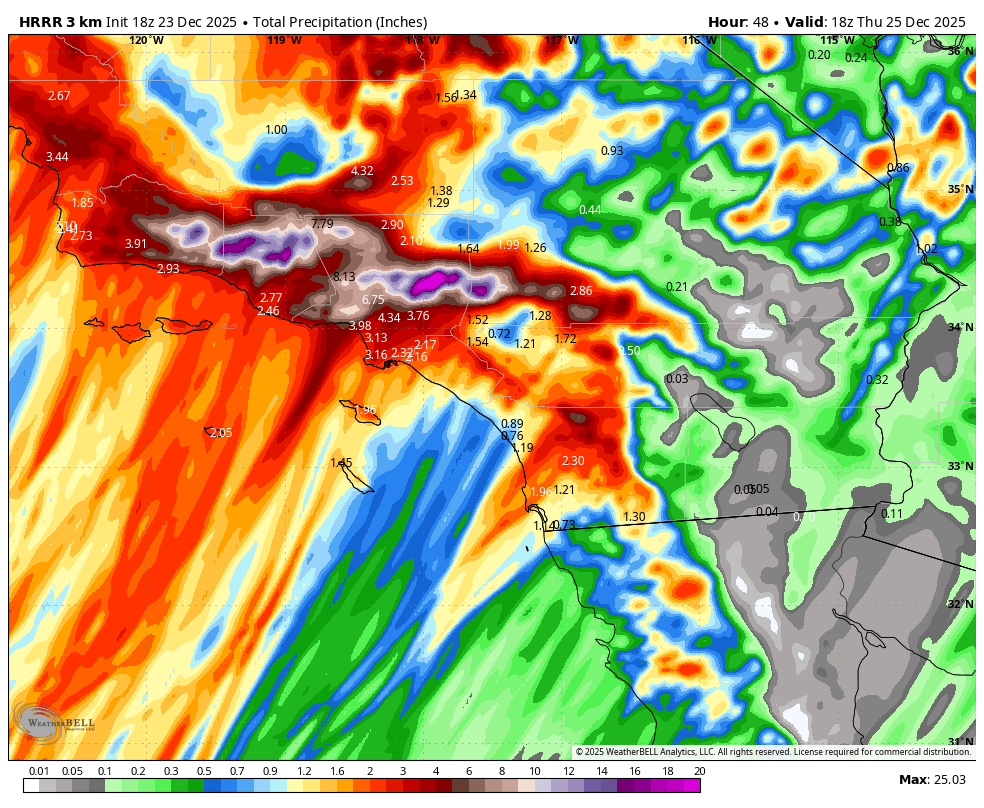
Very concerning high resolution model data coming in showing over 20 inches of rain falling in the mountains of SoCal over the next 48 hours.
This would lead to potential catastrophic flooding and is exactly why a rare High Risk for flash flooding has been issued by the @NWSWPC.