In 2025, Copernicus EMS produced 812 maps from 69 rapid activations and 12 risk & recovery events. These on-demand maps guide response to floods, earthquakes, storms, and more.
Source: https://t.co/vx8K5Zvkf3
#DisasterResponse#Mapping#Copernicus#Emergency#Geoawesome
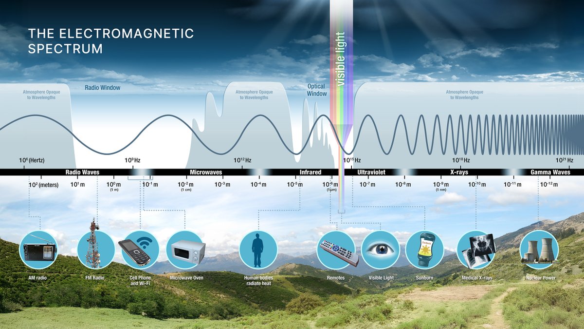
🛰️ Need to explain remote sensing to friends, family, colleagues, students or anyone else? Here's a useful summary of the basics courtesy of @NASAEarth
https://t.co/FMhMvNFnAq
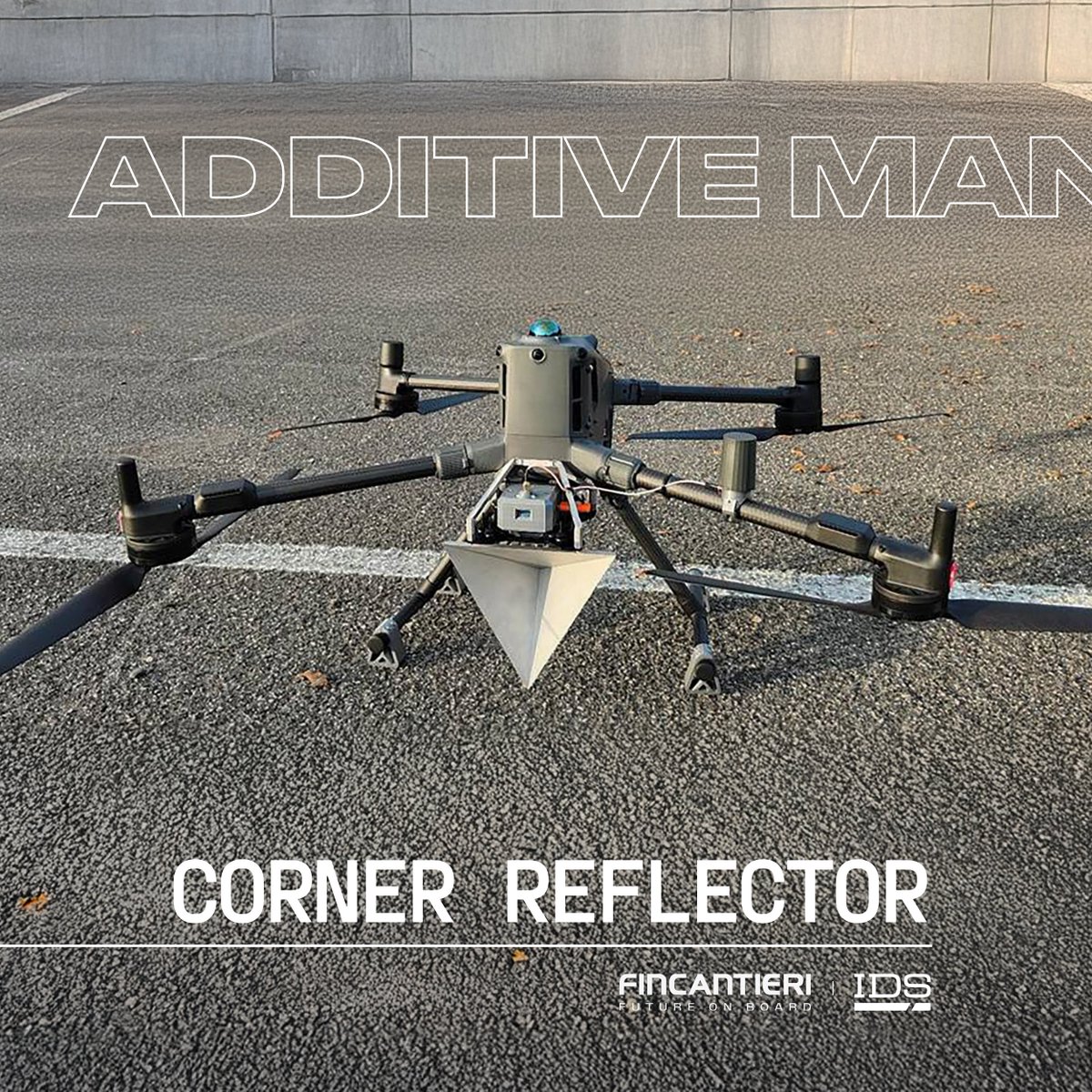
As part of our continuous innovation journey and our commitment to exploiting Additive Manufacturing technologies, we are steadily turning advanced concepts into real, high-impact applications. Following the success case of the injector holder developed with our subsidiary Isotta Fraschini and presented at Formnext (Frankfurt), we are excited to share a new milestone.
We are proud to announce that, together with our subsidiary IDS, we have successfully developed two components using cutting-edge Additive Manufacturing technology.
The first product, the Notch Filter — manufactured through 3D printing and integrated within a Satcom On The Move (SOTM) communications antenna — offers a solution designed to increase the isolation between the antenna’s transmitting and receiving circuits, thereby enhancing system performance and reliability. The second project, the RF Corner Reflector for UAV application, was developed to meet the need for a light and effective device for electromagnetic engineering.
Additive Manufacturing - an innovative approach, also known as 3D printing, that builds components by adding successive layers of material based on a digital model - enabled the production of both components, optimizing their weight, quality, and performance confirming the advantages of this innovative technology and further underscoring our commitment to pioneering development, towards a more innovative future.
More on Additive Manufacturing here 👉 https://t.co/RK8Fo64YVb
Them: "Have you looked at the #hyperspectral data from NASA's #PACE OCI (https://t.co/4jv9uoQGkF)?"
Me: "But it's an Ocean Color Instrument and I'm all about land."
Them: "It also monitors the land."
Me:
Global Fishing Watch is now in @Esri ArcGIS Online 🌍
Explore fishing activity, vessel presence & radar detections alongside your local layers.
🗺️ Overlay data
📈 Track trends
🛰️ Spot hidden vessels
⚙️ Streamline work
🤝 Share insights
https://t.co/j8MFpTb0l3
DJI Mavic 3 Pro flying over Mt Everest (8848.86 m). The drone ascended ~3,500 meters from the base camp to the summit of the highest mountain in the world.
Star color reflects surface temperature through black body radiation, allowing astronomers to estimate a star’s temperature, age, and life cycle from light alone.
📢 Introducing the GlobalGeoTree Dataset!
🌳 A large-scale multimodal dataset for global tree species classification, with 6.26M geolocated samples from 221 countries.
🛰️ Each sample includes Sentinel-2 time series and 27 environmental variables (climate, geography, soil).
🌍 Covers 275 families, 2,734 genera, and 21,001 species across taxonomic levels.
🧠 GlobalGeoTree-6M supports large-scale pretraining, while GlobalGeoTree-10kEval enables zero-shot and few-shot evaluation.
🔎 Ideal for biodiversity mapping, species-level monitoring, and multimodal EO models.
📄 More info: https://t.co/TWb2mVwCMK
#IEEEGRSS #IADF #GlobalGeoTree #RemoteSensing #Biodiversity #TreeSpecies #Sentinel2 #EarthObservation #OpenData 🌱
taking pothole detection to the next level
real-time; takes only 15 minutes to train; no manual annotations
- auto-annotated the dataset with SAM3
- fine-tuned RF-DETR segmentation model
- track and count potholes with ByteTrack
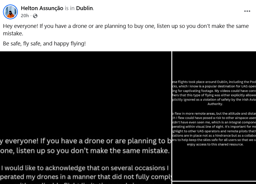
Following a recent drone prosecution by the IAA, the drone operator pled guilty and agreed to share their experience to help educate the drone community.
It’s important to remember that flying a drone makes you a pilot and understand your responsibilities before you take to the skies.
https://t.co/Frblr6yABP
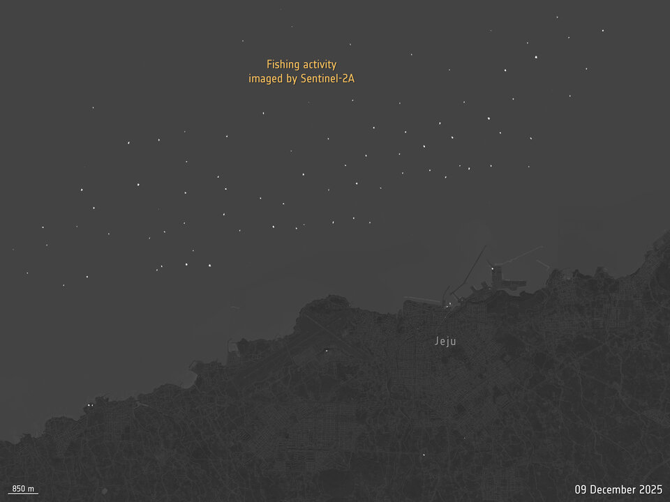
Snapshots of Earth after dark🌙
For the first time, @CopernicusEU Sentinel-2A has captured night‑time images of Earth, spotting gas flares in the Middle East, wildfires in India and even fishing boats in South Korea. The results from these tests are being used to prepare for Sentinel‑2 Next Generation.
https://t.co/GIBM1O2cGp
On December 17, Starlink experienced an anomaly on satellite 35956, resulting in loss of communications with the vehicle at 418 km. The anomaly led to venting of the propulsion tank, a rapid decay in semi-major axis by about 4 km, and the release of a small number of trackable low relative velocity objects. SpaceX is coordinating with the @USSpaceForce and @NASA to monitor the objects.
The satellite is largely intact, tumbling, and will reenter the Earth’s atmosphere and fully demise within weeks. The satellite's current trajectory will place it below the @Space_Station, posing no risk to the orbiting lab or its crew.
As the world’s largest satellite constellation operator, we are deeply committed to space safety. We take these events seriously. Our engineers are rapidly working to root cause and mitigate the source of the anomaly and are already in the process of deploying software to our vehicles that increases protections against this type of event.
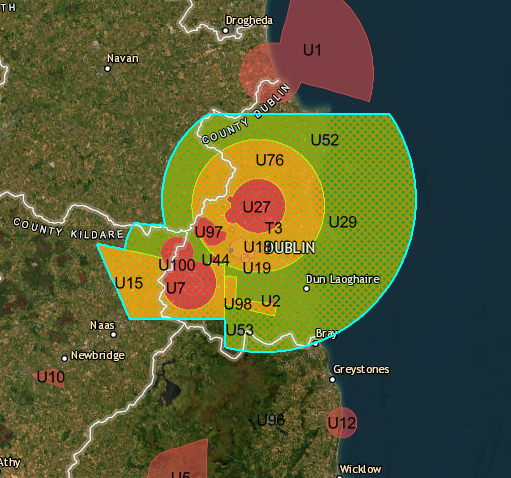
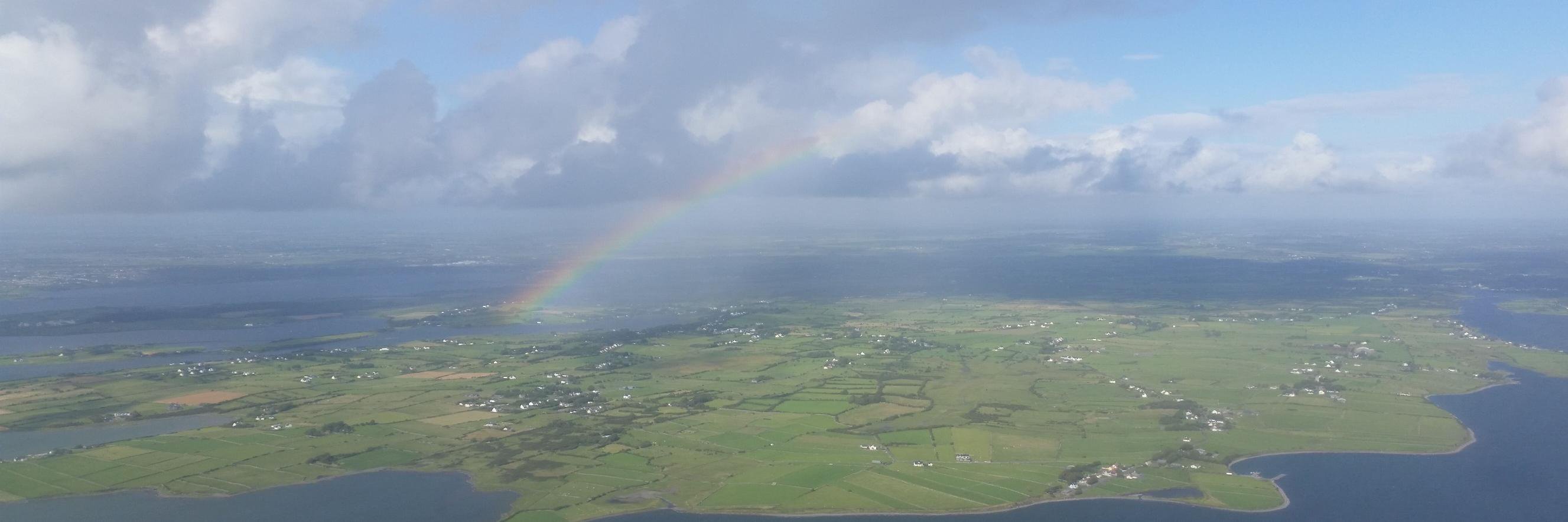
Our latest track is dedicated to the imaginary Dublin drone.
The track is available now on all major music services including Spotify.
#serefold#Dublin#Ireland#drone
https://t.co/UOCQRDyWcx
T3 No drone zone in force in Dublin. If you are in the specific category, contact [email protected] for access permission requests. Full info at https://t.co/Fto71DzkRp
#drones#Safety#Dublin
First signals are in for the first two @iceye_global radar satellites📡
Built under 🇬🇷Greece’s National Small Satellite Programme with support from @ESA, the satellites will deliver data to support disaster management and environmental monitoring: link to article: https://t.co/IZXPKesS59


![IAApress's tweet photo. Over **26,000 drone pilots trained in Ireland** to the highest global standards.
Join them! 👉 [https://t.co/l11OPTqKc2]
#DroneSafely #IAA https://t.co/sTdAu8xWw7](https://pbs.twimg.com/media/G7-0iBOWkAMbu3G.jpg)