Top Tweets for #BaseMaps

🎁Give yourself the gift of premium imagery from @vantortech, now available at SkyWatch-exclusive prices.
Limited-time offer ends Dec 31, 2025.
👉 https://t.co/ypd4ZL2Bpa
#satelliteimagery #satellitedata #basemaps #elevationdata #vantor


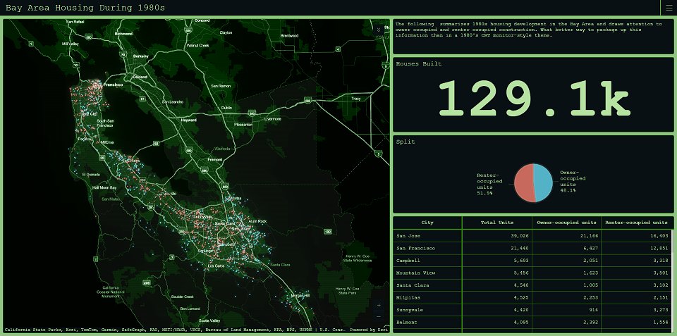
Tinting #basemaps to match your #dashboard theme https://t.co/s5XbVa0A5Y
#ArcGISDashboards #dataviz #mapping #GIS #esri #arcgis #maps @Esri @EsriFederalGovt @EsriSLGov @ArcGISApps @URISA
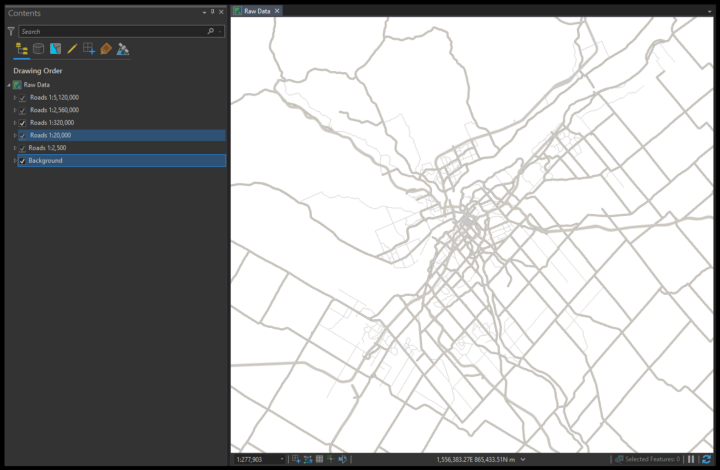
Overture #Maps #Data in #ArcGIS https://t.co/VeFSB2uHrn
#basemaps #OpenStreetMap #3D #featurelayers #GIS #esri #arcgis #mapping @Esri @EsriFederalGovt @EsriSLGov @ArcGISPro @ArcGISOnline @URISA


Day 3️⃣: Visualized #London crime data with #Pandas, including bicycle theft trends 🚲📉
Day 4️⃣: Made a #choropleth map of population density using #GeoPandas. 🔥
Day 5️⃣: Mapped the 2017 #SolarEclipse with #Contextily and different #basemaps. 🌘🌍

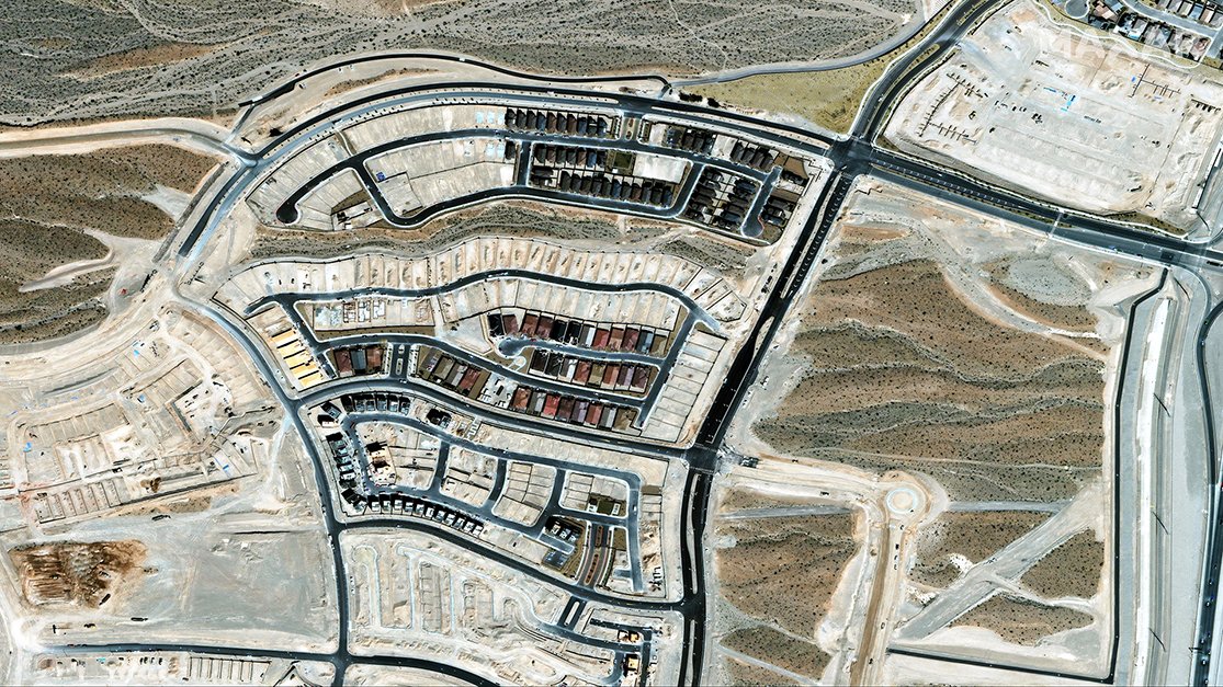
Vivid Advanced #basemaps are now available in #15cmHD and will regularly update with fresh imagery over areas of major urban change. This is the highest resolution commercial basemap created from #satelliteimagery. More details in today’s blog post: https://t.co/VBQdOVylPi

🗺️ Erfahrt in unserer Fallstudie, wie das innovative schweizer Unternehmen @MapTiler es dank @OVHcloud & @OVHcloudStartup schafft, Karten für Entwickler zu erstellen, die jeden Tag 400 Millionen Zugriffe haben! 📈 #OVHcloud #StartupProgram #MapTiler #Basemaps #PublicCloud


#30DayMapChallenge Day 28: #IsItAChartOrAMap
Line and Antonia have approached this challenging theme from distinct angles, offering intriguing perspectives on their subject or choice.
#ArcGIS #BaseMaps #OpenSteetMap #LivingAtlas #SmartWatches #Garmin


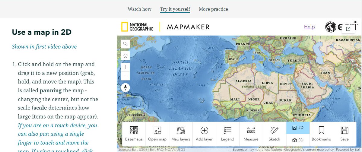
Navigating #maps and #basemaps doesn't have to be tricky. We've got just the activity for you!
In this #skillbuilders activity, you can learn how to use 2D & 3D maps in #NatGeoMapMaker 👀
Try it yourself! https://t.co/aLKiiP291q

📢more amazing things our users are doing!
@FabienWagner shared the accidental find of "an apocalyptic landslide in Peru's Sierra Del Divisor Park" after updating from biannual to monthly #NICFI #basemaps.
Truly😱😱😱 worthy!
https://t.co/TjsaZiDVPW

Just updated my deforestation algorithm using Planet NICFI from biannual to monthly. The results left me stunned! What I thought was a large error turned out to be an apocalyptic landslide in Peru's Sierra Del Divisor Park 😱🌍🤖🛰️ @CTrees_org @NICFISatData

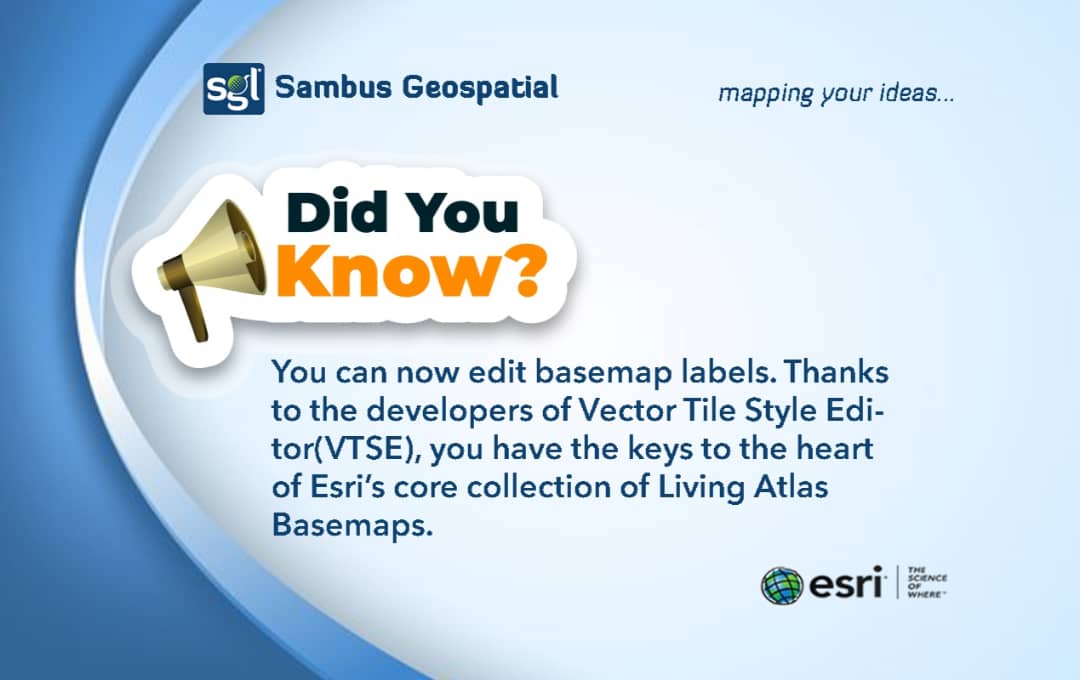
You want to make some changes in your basemap?? No problem.
You can now isolate isolate specific labels, remove them or change their style.
Learn more: https://t.co/10azRI8JAe
#mapping #esri #arcgispro #basemaps

@InvemarC, in Colombia, has used the Program's #basemaps data in mangrove restoration and #disaster assessment in mangroves post-hurricane Julia. And you, how are you using the #NICFISatelliteDataProgram data?
https://t.co/Y7MbPvAVcu
(3/4)

#Tutorial spotlight - 'Discover ArcGIS Online'
This 20 min tutorial teaches students to:
✅#find locations
✅change #basemaps
✅use #bookmarks
✅experiment with #clustering tools
✅manipulate #data
Try it today:
https://t.co/enqSWXkVai

Great inspiration to improve your imagery #basemaps in #ArcGIS with a shadow effect!! 😍 Thanks @John_M_Nelson! 👏🗺️ @LivingAtlas @Esri_Spain

Please do not emboss your imagery basemap. Here's how: https://t.co/3V1M7v3VxD

I spent the 2nd half of 2022 working on these map styles and they finally launched! #cartography #basemaps
New work: #AmazonLocationServices has launched four new map styles as part of their Open Data Maps service. Collaborating w/ AWS to make these maps has been a pairing of some of our favorite things: working w/ #OpenStreetMap & delivering custom map styles! https://t.co/XlXJoz5ePx


Vector Tiles generation - Do’s & don’ts https://t.co/Y0JJPTtLHg by @FabienAncelin
#basemaps #mapping #maps #bestpractices #ArcGISAdmin #GIO #GIS #esriCanada #esri #arcgis @Esri @esricanada @EsriFederalGovt @EsriSLGov @ArcGISPro

Improve the accessibility of your maps with these new enhanced contrast basemaps in ArcGIS Living Atlas of the World. Explore more here: https://t.co/LS4nJ7JyVf
#ArcGIS #basemaps #maps #livingAtlas #GIS


#ArcGIS Platform brings you 𝗕𝗮𝘀𝗲𝗺𝗮𝗽𝘀, a vast library of pre-styled maps for your apps that are customizable to meet your unique needs. These ready-to-use #basemaps serve as the geographic foundation for your application.
Learn more https://t.co/YdLAPrnOVw
#esriindia

Last Seen Hashtags on Sotwe
お尻ぺんぺん
Seen from United States
losesvirginity
Seen from Turkey
chav
Seen from United Kingdom
mlbb ai
Seen from Philippines
foursome
Seen from Saudi Arabia
esli
Seen from United States
Auntified
Seen from United Arab Emirates
agegap
Seen from United States
เมียอวบน่าเย็ด
Seen from Thailand
moms
Seen from Belgium
Most Popular Users

Elon Musk 
@elonmusk
240.3M followers

Barack Obama
@barackobama
119.3M followers

Donald J. Trump
@realdonaldtrump
111.6M followers

Cristiano Ronaldo
@cristiano
109.8M followers

Narendra Modi
@narendramodi
106.9M followers

Rihanna
@rihanna
97.5M followers

NASA
@nasa
92.1M followers

Justin Bieber
@justinbieber
90.7M followers

KATY PERRY
@katyperry
87.3M followers

Taylor Swift
@taylorswift13
81.1M followers

Lady Gaga
@ladygaga
72.6M followers

Kim Kardashian
@kimkardashian
69.6M followers

Virat Kohli
@imvkohli
69.3M followers

YouTube
@youtube
68.6M followers

Bill Gates
@billgates
63.7M followers

The Ellen Show
@theellenshow
62.5M followers

Neymar Jr
@neymarjr
62M followers

CNN
@cnn
61.9M followers

X
@x
60.9M followers

Selena Gomez
@selenagomez
60.4M followers