Operating manufacturing & import co., specializing in branded merchandise, promos & retail products. Tweeting on industry, China, blogging & life in the South.
MORE Dramatic video out of Ocracoke, NC. Storm surge is ONE of many threats from ANY tropical cyclone. Other hazards include flooding, wind, tornadoes and rip currents! Don't focus on the category! Our hearts go out to ALL impacted by #Dorian. #nws
Good news: locally, storm surge appears to have failed to reach projections. Dorian’s closest pass to shore happened just after low tide and that may have helped. The next high tide (~1 am) could still be dicey from for east-facing Cape Fear beaches to the Crystal Coast though.
No Cape Fear Dorian landfall... but the eye wall and core bands are still lashing. Winds will shift north and continue to ping tropical storm-force (inland) and hurricane-force (beaches). Tornado threat: just about over. Friday: rapid improvement in all respects. #CapeFearStrong
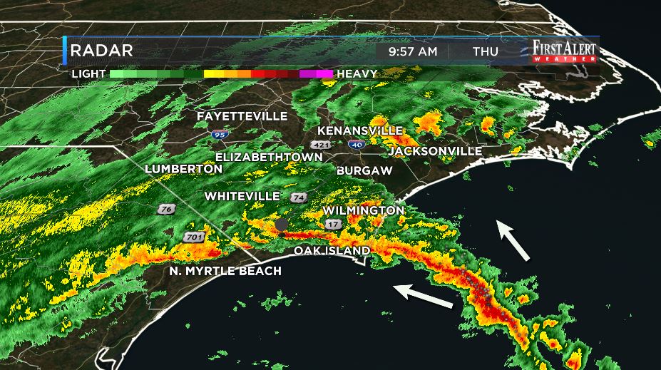
As the outer bands of #Dorian continue to come onshore and move inland, the threat of tornadoes remains elevated. If you are in a location affected by these bands, have an area of shelter available to you quickly.
Getting some pictures into the office of the damage in Emerald Isle, NC caused by a tornado around 9 AM this morning. We thinking of those that have suffered damage. PLEASE have multiple ways to receive warnings the next 24 hours!
Hot take on the band spiraling in as we near 10 a.m.: more lightning than the first one, fewer but not zero rotation points. Still, please be alert as additional Tornado Warnings may develop, especially in a heavy rain / poor visibility situation!
Report that US 17 in Brunswick Co. is under water in spots around 17 mile marker.
Like I said ... not a day to be out driving down there, and it's not getting better.
Tornado Warnings are falling like dominos. Turn @wectnews volume up if you need to shelter! Please set your WECT Weather App to follow your location to know exactly when your neighborhood goes under a Tornado Warning. We are tracking 3+ warnings at a time. Stay safe, friends!
A growing rain and tornado threat this morning... Winds grow and peak at hurricane-force this evening and tonight... Rapid improvement tomorrow! Going to be a bumpy ride in the next 30 hours from this tweet, though, so please stay vigilant! #CapeFearStrong
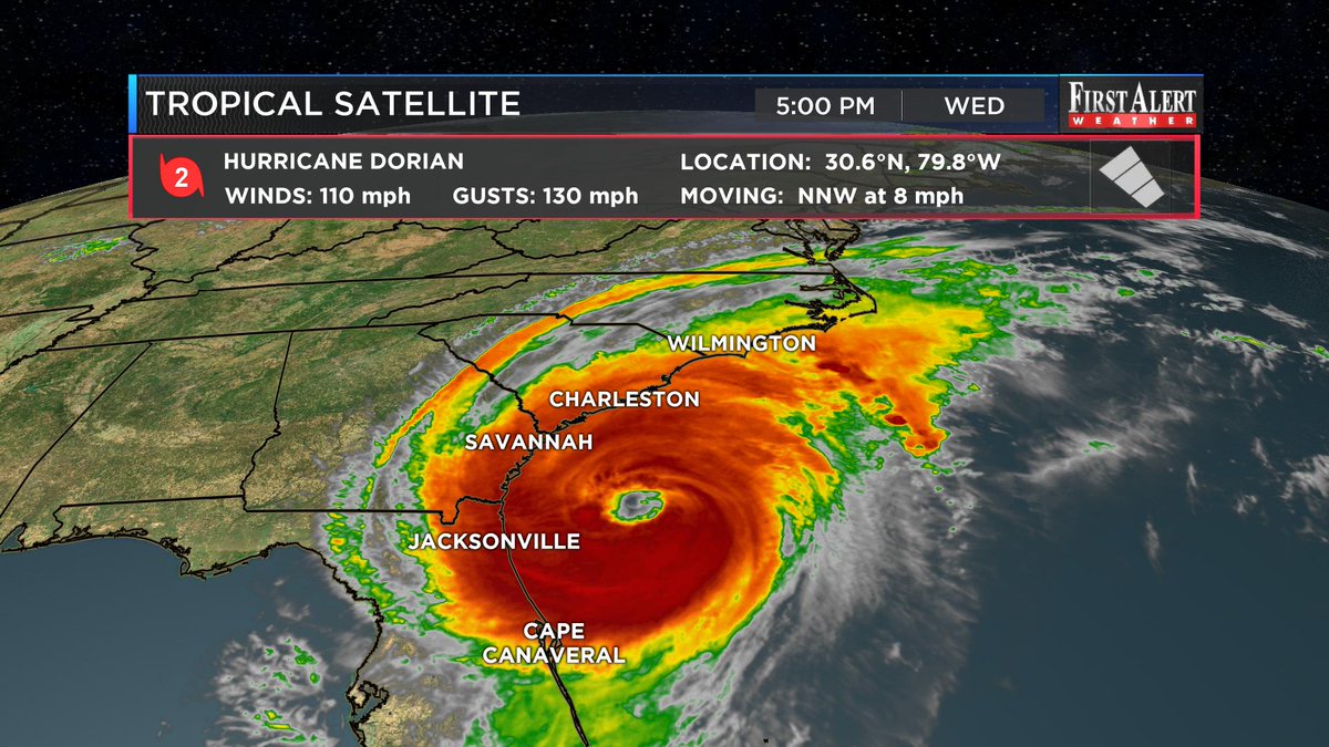
Hurricane #Dorian is slightly stronger with the 5 p.m. Wednesday update. Sustained winds are up to 110 mph. No real changes with the track or imapcts. #WECTwx#ILMwx#ncwx