Digital Twin of Mohakhali, Dhaka: Reflection of the vertical expansion of the city.
3D model not only visualize the building but shows the lack and opportunities for the sustainable city planning.
#GIS#DigitalTwin#ArcGIS
Mapped and analyzed 227 earthquake events (1923–2026) using USGS data in ArcGIS Pro.
It's time for data-driven disaster planning and proactive urban resilience!
#ArcGISPro#GIS#Earthquake#Bangladesh
The Normalized Difference Vegetation Index (NDVI) is a crucial indicator for monitoring vegetation health and assessing environmental conditions. I have created an animation showcasing the monthly NDVI of Bangladesh from 2021 to 2024 (up to May)
#NDVI#GIS#RemoteSensing#WithJuv
The night-time light map reveals that city area and it’s surroundings, district center, highway road network illuminated at night.
In contrast, coastal, hilly and haor area reflect the minimum light.
#gee#gis#remoteSensing#Nighttimelight
Dhaka City over 36 years in just 20 seconds! This Landsat time-lapse captures the dynamic transformation of Bangladesh's capital from 1988 to 2024.
Tools: Google Earth Engine l Clipchamp
#WithJuv#dhaka#RemoteSensing
🚀 A captivating Digital Elevation Model (DEM) brought to life with the FABDEM🌐.
🌄 The terrain comes alive in ways I never imagined. It's more than just data; it's a journey through landscapes, elevations, and insights.
🛠️: ArcMap 10.8
🗂️ : FABDEM
#GIS
For those who are interested in Bangladeshi-British MPs, in the parliamentary debate today on Israel's military operation in Gaza. Two MPs supported a ceasefire, and two did not. Can you guess which ones?
Tulip Siddiq MP (shadow minister) and @rushanaraali MP did NOT vote for a ceasefire. @RupaHuq and @ApsanaBegumMP voted for the ceasefire. Comments?
We are happy to let you know that our team has published an article on "Mapping and Global Hotspot Analysis on Monkeypox Disease Incidence" in New Microbes and New Infections Journal, Elsevier.
https://t.co/4xVWxNDdUj
@JuvairH@md_mainu@DrAJRodriguezM@ElsevierConnect
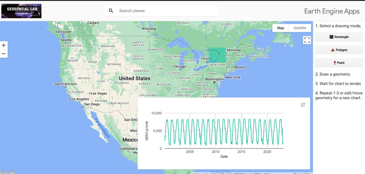
I have recently developed a new app using Google Earth Engine (GEE) with the help of GEE materials. This app allows users to easily extract NDVI using MODIS satellites.
Try it out:
https://t.co/MBNA3EM5OY
#googleearthengine#ndvi#gis#remotesensing
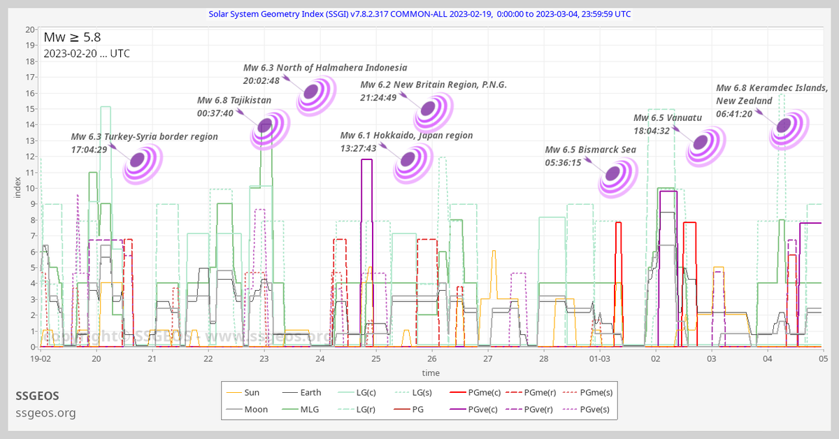
M ≥ 5.8 from 19 February to 4 March (so far). Stronger #earthquakes rarely occur on average. More often they occur in clusters. Do not make the mistake saying that M 6 quakes occur every 2.7 days! They do not in real time, as clustering relates to planetary/lunar positions.
We have marked (subduction) zones in the world that have the potential to generate great earthquakes (~M ≥ 8.5), that have been quiet for a relatively long time. One of these zones could experience a great earthquake in the near future.