The Washington DC 00Z weather balloon capturing exactly 1776 J/kg of DCAPE on July 4th is a pretty cool coincidence! #DCwx#vawx (shoutout to PHI/LWX for pointing it out)
One of the most powerful storm damage images I’ve ever seen…
This was sent to us from Highmore where they recorded a 131 mph wind gust from the Catholic Church. It actually split the roof of the church.
(📸 Joseph Mat)
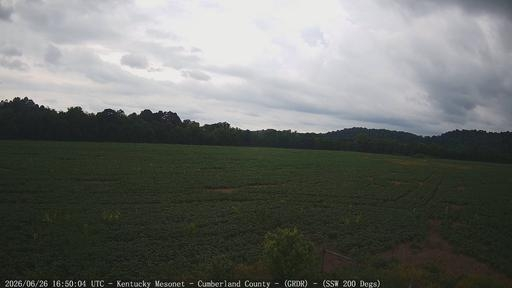
For the Flash Flood Emergency recently issued for Cumberland, Clinton, and Metcalfe counties, this is a current image of the Cumberland County mesonet site as well as a comparison picture on a typical day. This site has had over 8" of rain since 12AM. Please seek higher ground!
5 tornadoes have been confirmed across the area from severe weather Sunday night and early Monday morning. This information remains preliminary, but surveys are complete at this time.
Four tornadoes have been confirmed so far from severe weather last night and early this morning. More surveys are planned for tomorrow in Meade/Harrison, and possibly in Orange County.
: The 114mph wind gust from Mason County, Kentucky has been verified. Becomes the second highest pure wind gust in Kentucky in recorded HISTORY. 🫢- George
Elevated threat of tornadoes detected for Sunday, June 21st, 2026.
See attached map for details.
This forecast initialized on Thursday afternoon. Follow for future forecast updates.