Neoweather is the Leading Front in Weather. Our organization was built on the new dimension of social media and looks to become your #1 source for weather.
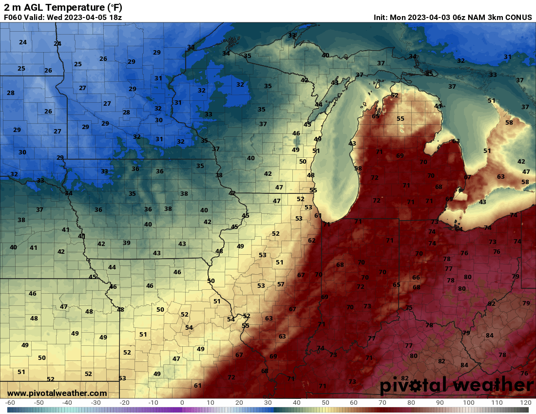
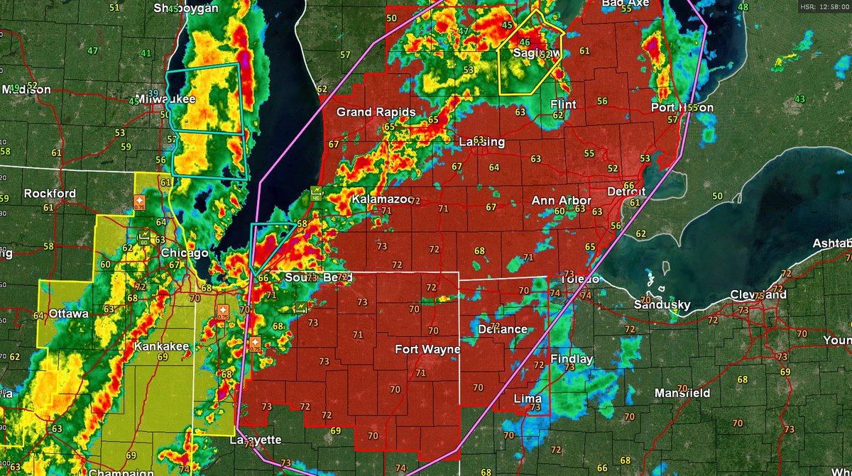
Tornado 🌪Watch and look at those 9am temps!
Pushing in summer warmth and humidity! 🥵
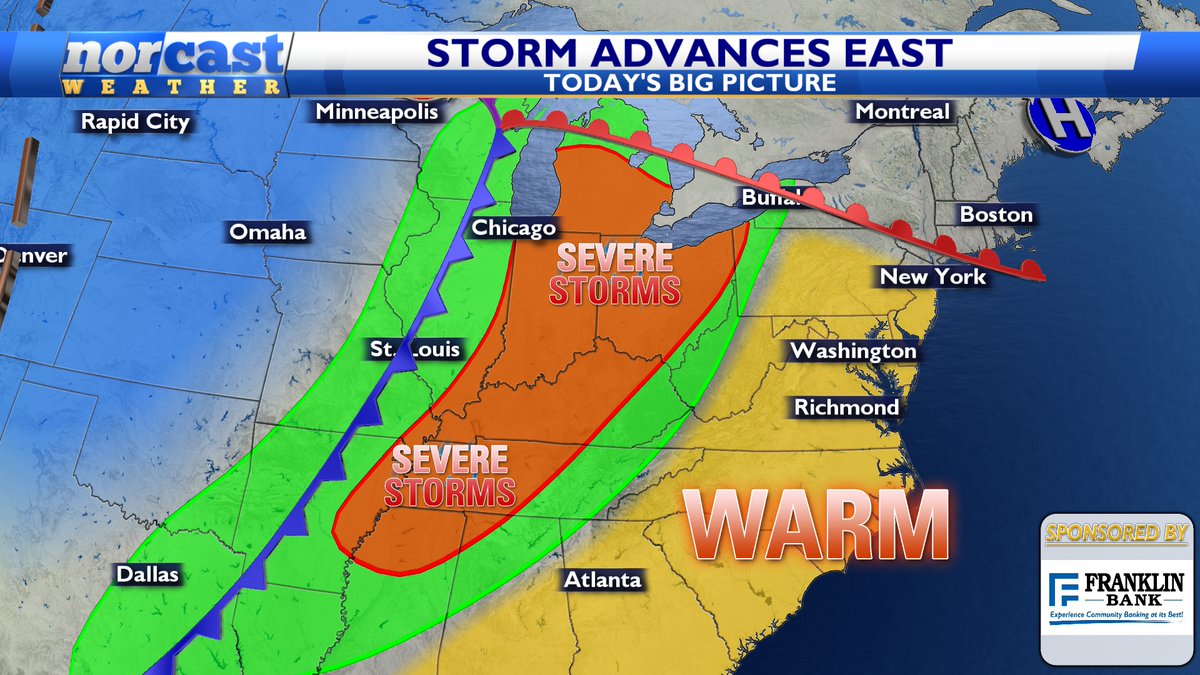
Storms over the next several hours can produce all modes of severe weather in the red.
This threat moves east for the evening.
An intense band of heavy❄️❄️❄️ is moving across the #Cleveland metro area right now. Expect visibility to drop between 1/4 and 1/2 of a mile at times as well as a quick 1 or 2 inches of snowfall possible. Travel may be impacted! #SlowDown#OHwx#PAwx#NWS#CLEwx
‼️🚨🗞️ EXCITING NEWS 🤩🙏🌅
We have some some great news to share with you! This is such a big step for our weather company.
We started almost 13 years ago as a source for school kids to get snow day forecasts and now we help school districts make decisions on snow days.
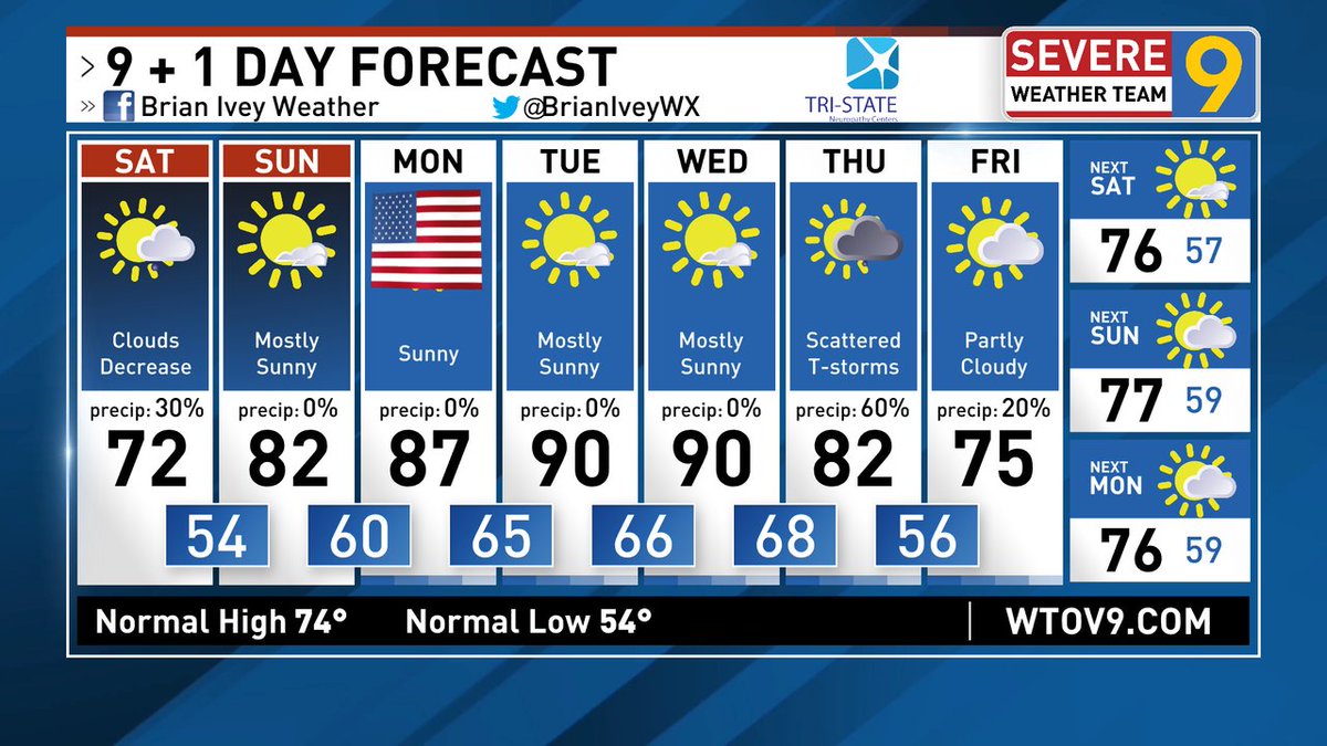
Let's go!! Showers end and lots of sun shows up. That heat and humidity really builds as we go through the early week. No rain worries until Thursday. Have an awesome holiday weekend!
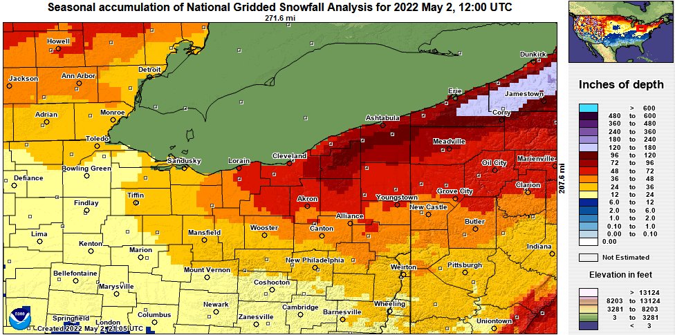
@NWSWPC And to "piggy-back" off the NWS WPC tweet about this past winter season snowfall analysis on our local area, here is zoomed in look and graphic showing most areas saw below average snowfall except Akron-Canton.
Link to map at https://t.co/e2NYKk6DsO
#OHwx#PAwx#CLEwx
Rounds of showers pass on by. A couple rumbles of thunder are possible, but no strong storms.
We watch for colder weather Saturday night with sunshine returning Sunday afternoon.
Next week we track some sun and some rain.
#OHwx#PAwx#WVwx
Science! Why the perfectly symmetrical depressions around trees? They are efficient at transporting heat up from the ground and radiating “longwave radiation,” or heat, of their own.
That melts the snow! @fox5dc@MyRadarWX@capitalweather
BIG STORM Update
We'll see some heavy snow with some areas near 10"
There is still bust potential with mixing. Are not sure on if less or more mixing.
#OHwx#snow
Plenty of cold will pour into the western US as we venture into the New Year. The mild temps will back down further south and east.
The major Arctic #cold will remain West and into the northern Plains.
This does not mean it won't get active at times = better #snow shots.