here are a few of the news outlets covered our recent publication in @nature climate change
https://t.co/2dTwsmnOWW
https://t.co/uDBp7y2mbT
https://t.co/8XxB9NadNm
https://t.co/j2j06oFTmv
🌍✨ Want to create stunning satellite timelapse animations for any location worldwide? Check out this tutorial using #EarthEngine and #geemap!
📹 Video Tutorial: https://t.co/ibNJVjHp3K
📓 Jupyter Notebook: https://t.co/UB84j64YyX
#geospatial#dataviz
Looking for data recipes and tutorials to help you learn how to work with synthetic aperture radar (#SAR) data? Check out the learning resources from our NASA Alaska Satellite Facility SAR data center on the new Earthdata website.
View tutorials: https://t.co/xdUyVKxate
A ShakeMap shows the ground shaking caused by an earthquake. This map from the @cageosurvey compiles all the ShakeMaps generated from 1981 - 2023 for earthquakes of magnitude 4+! https://t.co/Xkwl6obXzC
Do you want to learn how to monitor Vegetation mapping using Google Earth Engine and ArcMap?
More Info visit our Website: https://t.co/i4EFoxX5HU
#googleearthengine#remotesensing
🚀Adding 200+ WMS basemaps to #QGIS with a few simple clicks! 🌎
GitHub: https://t.co/B32BcBPaLs
Video: https://t.co/mzI0WnfyIy
#geospatial#python#opensource
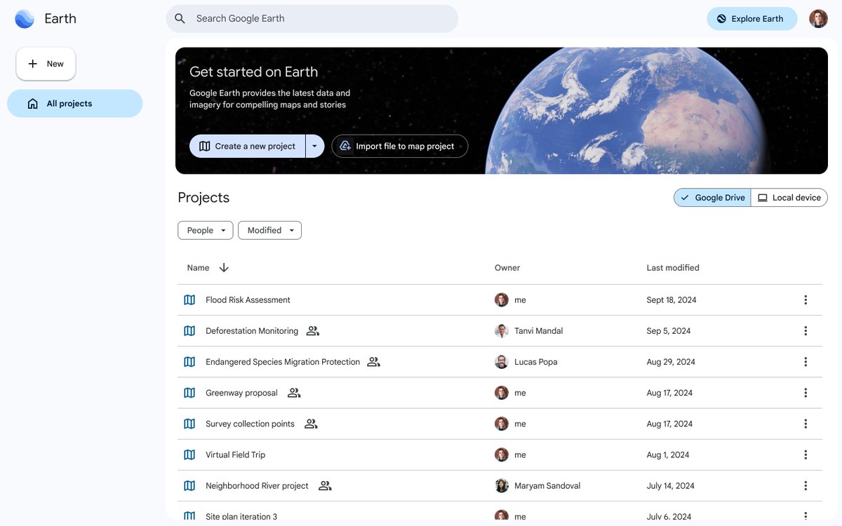
New Google Earth updates make managing and sharing your work easier than ever. A new home screen keeps your projects organized, and you can now copy/paste data like polygons and lines between projects. Learn more: https://t.co/XnAku273rN
******* NEW PAPER ALERT******
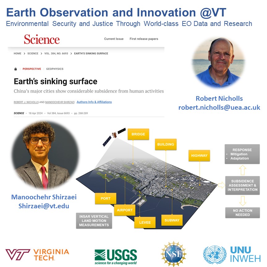
In this invited @ScienceMagazine perspective, Dr. Nicholls and I discuss future research directions to integrate land subsidence measurements into decision-making and adaptation plans.
pub: https://t.co/zmPASOUPXz
@EOI_lab@VT_Science@vtgeosciences
****** PhD Defense *********
I am thrilled to announce that Vickie Lee (@JCLee_vickie) of @EOI_lab at @VT_Science@vtgeosciences is defending her PhD thesis this Wednesday. She will tell us about cutting-edge #InSAR technology and its application in #waterbanking & #faulting processes. Make sure to attend. There is also a Zoom link on demand.
#Leafmap now supports downloading Google Open Buildings for any country with only one line of code 🖥️. It can automatically download all tiles and merge them as a single vector file🌎
Notebook: https://t.co/QCVaf6zfUk
GitHub: https://t.co/9goCGfaTpw
#opendata#geospatial #dataviz
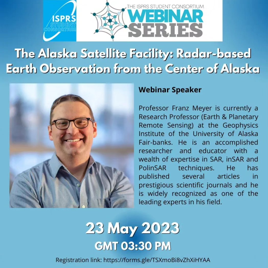
📢 ISPRS SC Webinar Alert‼️
🔗 Registration is now open!
https://t.co/LV5DQfUBcT…
The @ISPRS_SC Webinar Series presents "The Alaska Satellite Facility: Radar-based Earth Observation from the Center of Alaska" with our guest speaker Dr. Franz J. Meyer. 👨🏻🏫🛰️
See you there!🤝
Urban Atlas from @CopernicusLand has available 10 m resolution raster containing height information generated for urban areas of selected cities.
Use #Areialod and enjoy neverending fun.
The draft program of the 2. ICCC Workshop on "#Geodesy for ##Climate Research" (March 28/29th) 2023 is now available. You can still register free of charge until March 21st:
https://t.co/cKI7ELw5kb
Don't miss it! We are looking forward to meeting you for exchange & discussions.
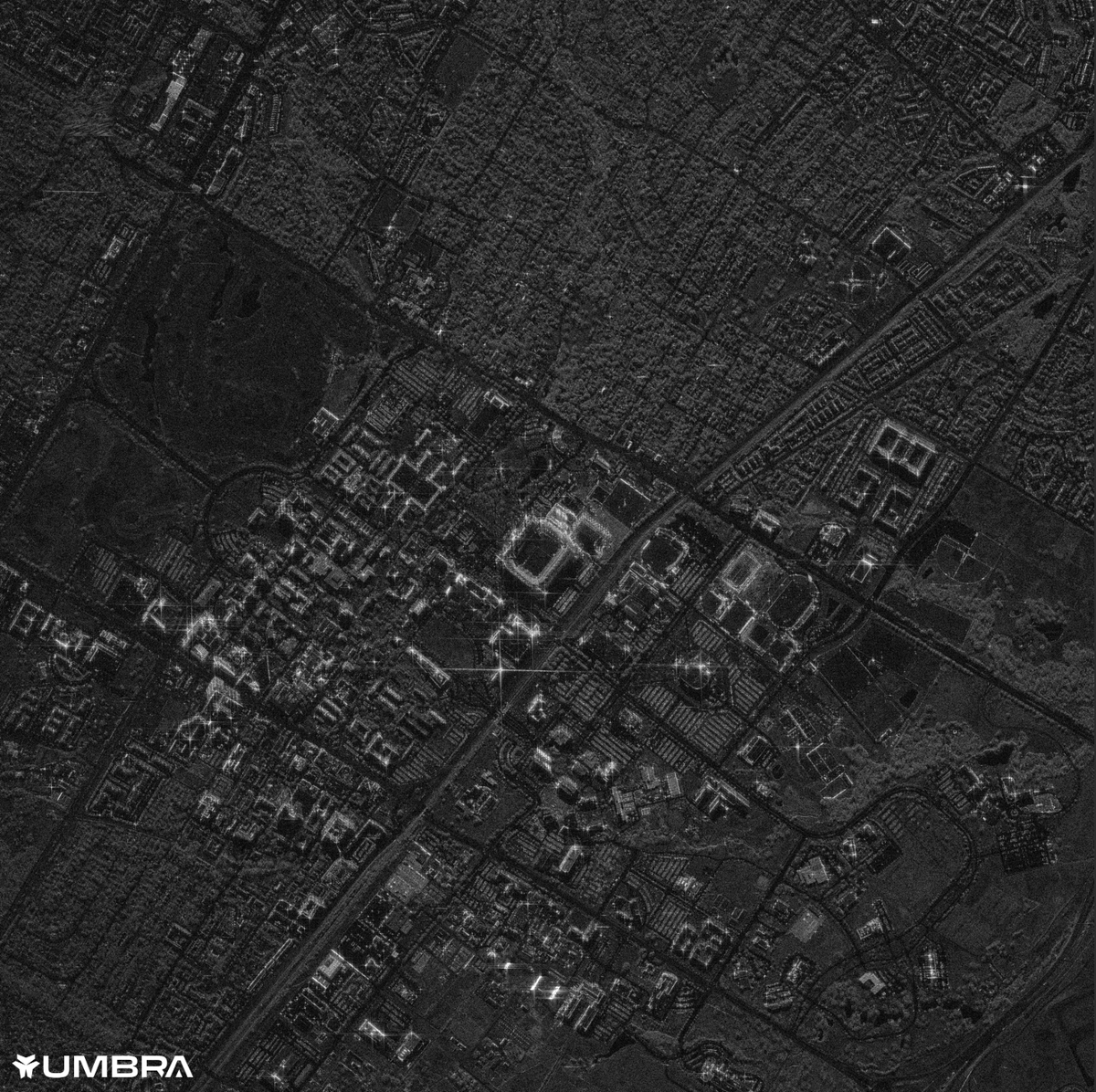
Umbra’s co-founder @dominocielo spoke to @evanloomis and the Aggie Venture Fund Mafia @TAMU! The talk focused on space, unit economics and VC. Using Canopy, Umbra's self-service tasking platform, the class collected a happy snap of Texas A&M (CC 4.0).
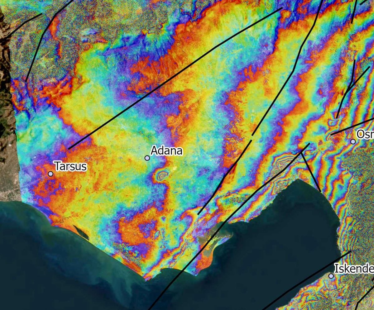
InSAR people, talk to me about this little blip near Adana that appeared between Jan 28 and Feb 9, ~100 km west of the southern termination of the M7.8.
Roughly coincident with a little hill - perhaps activation of a small thrust fault?
Thanks to @pmb229 for pointing it out.