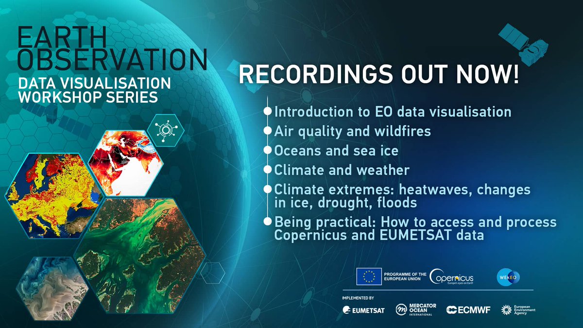
Our #EODataViz 🛰️ series has come to an end, but you can still watch the recordings to learn more about visualising #Copernicus and EUMETSAT #OpenData, on topics such as:
🔥 Wildfires
🌦️ Weather
🌀 Climate extremes
🌊 Oceans & sea ice
And much more!
🔗 https://t.co/f5bUkN3Lkw
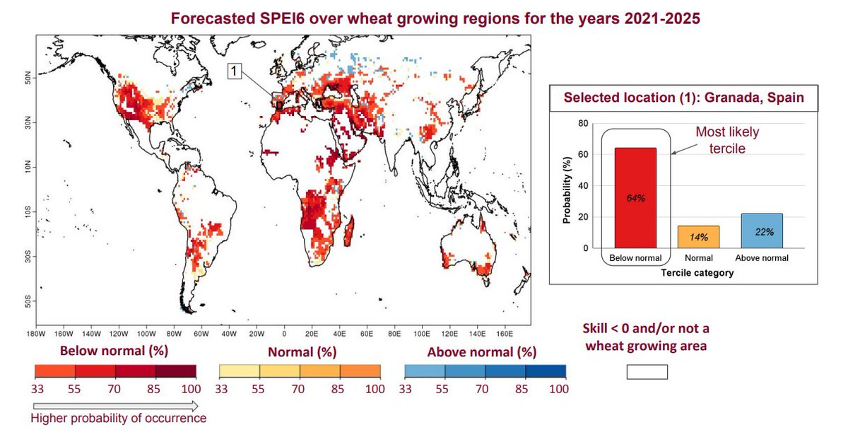
Weather forecasts help farmers better plan their day-to-day work 🚜 But what if they could have predictions in the long term?
@CopernicusECMWF developed a prototype service with predictions of drought conditions for wheat crops up until 2025
Have a look: https://t.co/TaRnGbjGTv
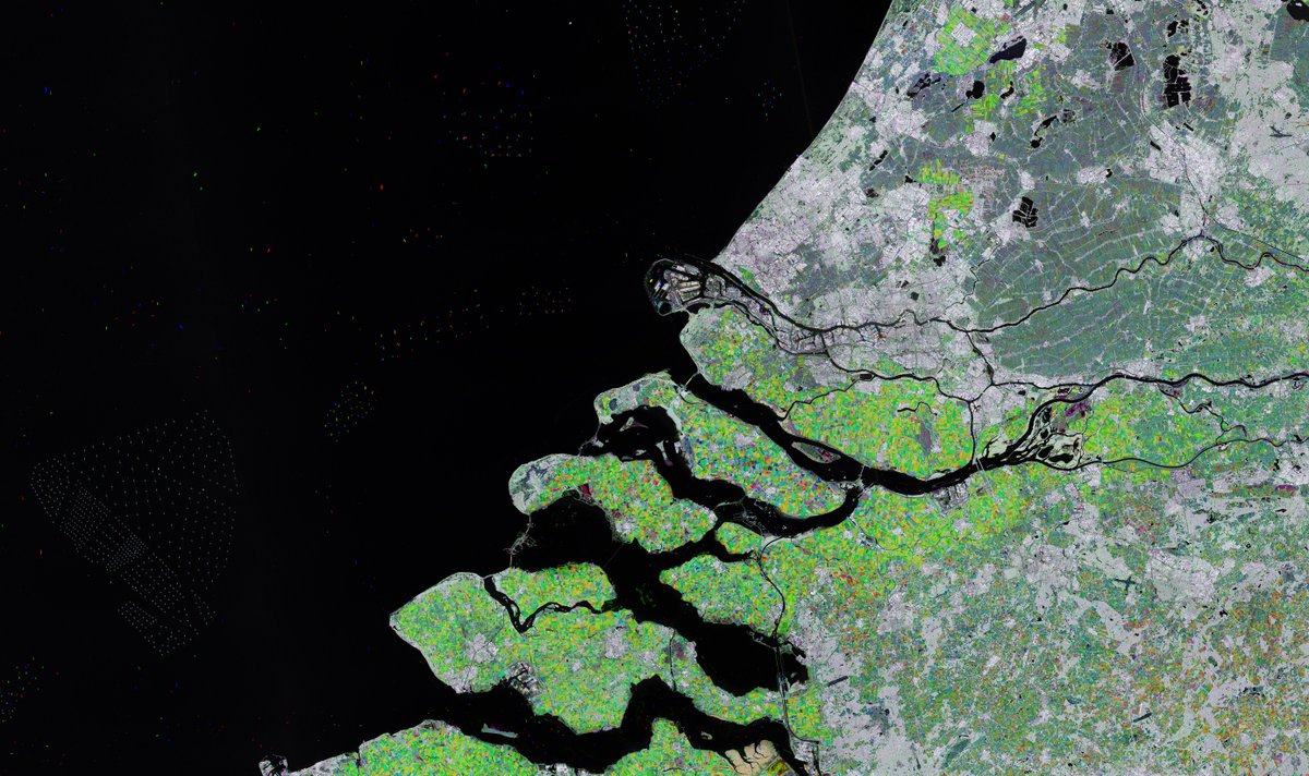
📷🇳🇱This high-resolution interactive image of the southwest Netherlands was captured over several months by @CopernicusEU#Sentinel1.
Follow the link to explore this image at its full resolution and learn about the region.
What can you see? 🌿🚢🏙️
👉 https://t.co/XFL9iZZDBG
We can only act on what we know.
#EO has been helping the global community track the changes impacting the planet's climate for decades, transforming space data into #ClimateActionNow 🌍
Here are some examples of what satellites have seen from space: https://t.co/s3hP2kNB37
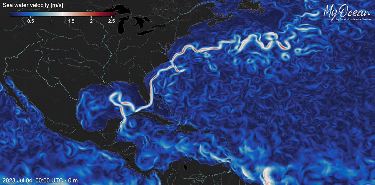
#DYK that the #GulfStream is a powerful current〰️ that transports warm water from the Gulf of Mexico to the Atlantic #Ocean❓
The #CopernicusMarine Service monitors it, as it is vital for understanding the Earth's heat balance 🌡️
⬇️Gulf Stream visualised on #MyOceanViewer
DYK that EU bases the planning of offshore wind farm installations on the use of satellite data provided by Heritage Missions?
A long-term study of #Envisat data focused on wind currents, allows the efficiency of the installations to increase
Read📰https://t.co/G0DZKZtJju
📷@ESA
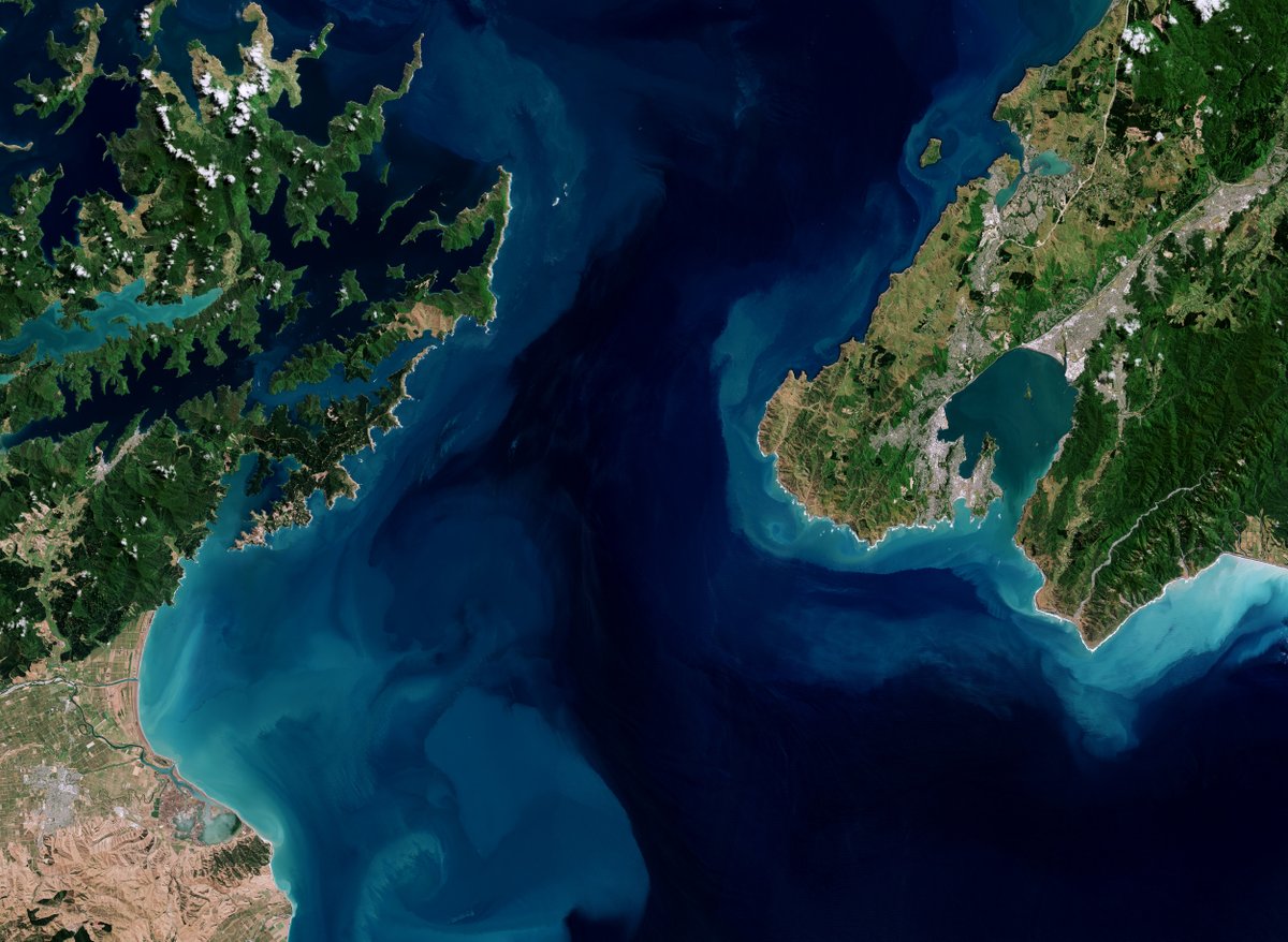
📷🇳🇿This high-resolution interactive image of Cook Strait, #NewZealand, was captured by @CopernicusEU#Sentinel2.
Follow the link to explore this image at its full 10 m resolution and learn more about the region.
What can you spot? 🛫⛴️🏙️
👉 https://t.co/38M3a6XFSc
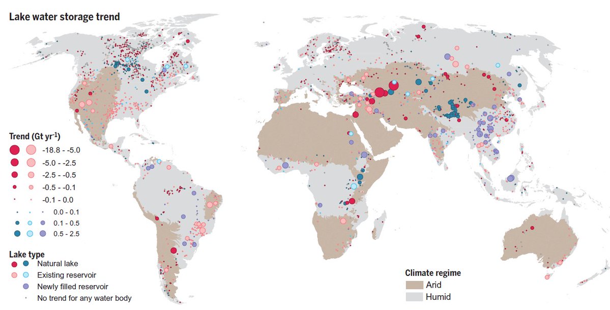
In a study led by US scientists, @esa#EO missions #CryoSat & #Envisat helpded to reveal worldwide lake water loss trend. Both optical and altimetry data was used for the study, published in Science journal.
Read📰https://t.co/75UY0mb3pA
More on data: https://t.co/Lbj1X2KsAd
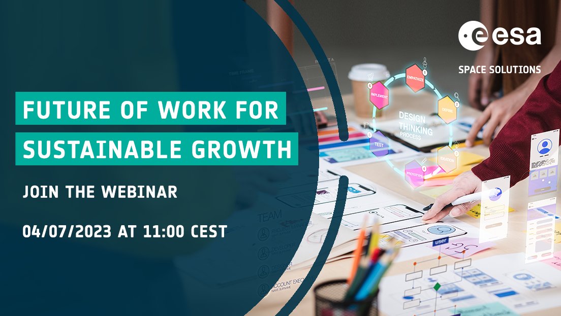
🔜 Join our webinar to introduce: ‘Future of Work for Sustainable Growth’, a new call for proposals that use space assets to support workplace #digitalisation.
🎙 With guests from @PlugandPlayTC Europe & @ambr_tech.
Tuesday 4 July, 10:00 BST/11:00 CEST ➡ https://t.co/xsnsKNGtIU
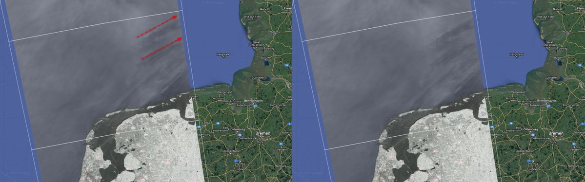
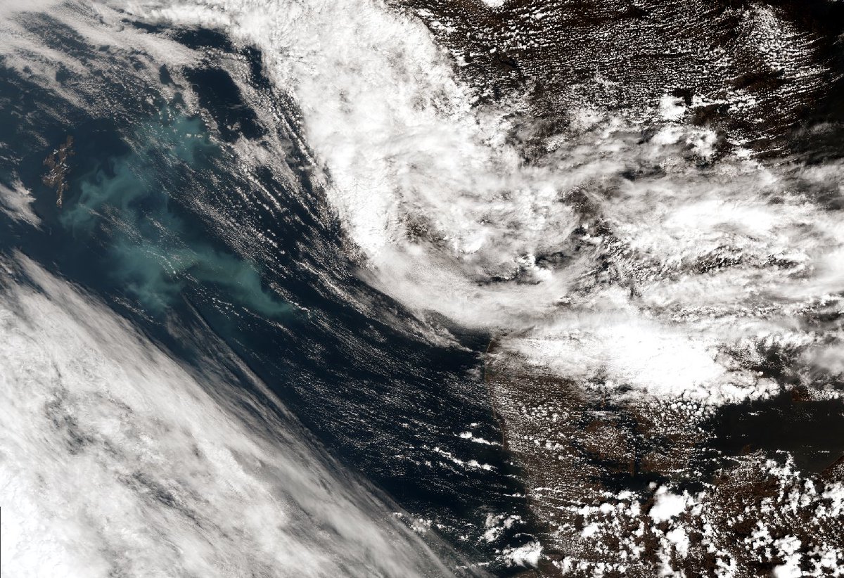
The clouds left the perfect gap to be able to see this bright phytoplankton bloom in the North Sea yesterday morning 🌊🦠
Captured by the #Copernicus#Sentinel3 satellite 🛰️
As reported by @CA_DWR, Lake Oroville in California has reached full capacity, thanks to winter storms and snowmelt.
This animation was made with @CopernicusEU#Sentinel2 images and compares the lake's water levels in September 2021 vs June 2023.
📸 https://t.co/Ev4VWZspMd
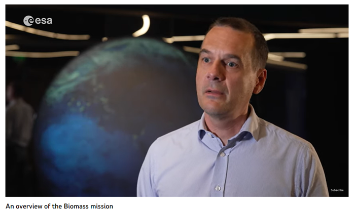
Klaus Scipal, Mission Manager of @ESA's #SMOS & #Biomass#EarthExplorers 🛰️talks about the upcoming Biomass mission, describing:
• the objectives
• how it will fill gaps in knowledge of forest ecosystems
• which users will use its data📡
📽️2️⃣: https://t.co/IpujOZ3CWc
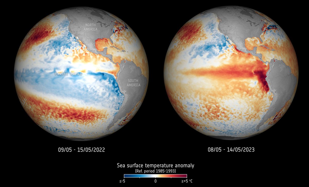
🛰️🌊 Satellite measurements have shown that the temperature of the surface waters of our oceans recently hit an all-time high.
Learn what this means in terms of #ElNino and #ClimateChange.👉 https://t.co/MjbXZJMC4p
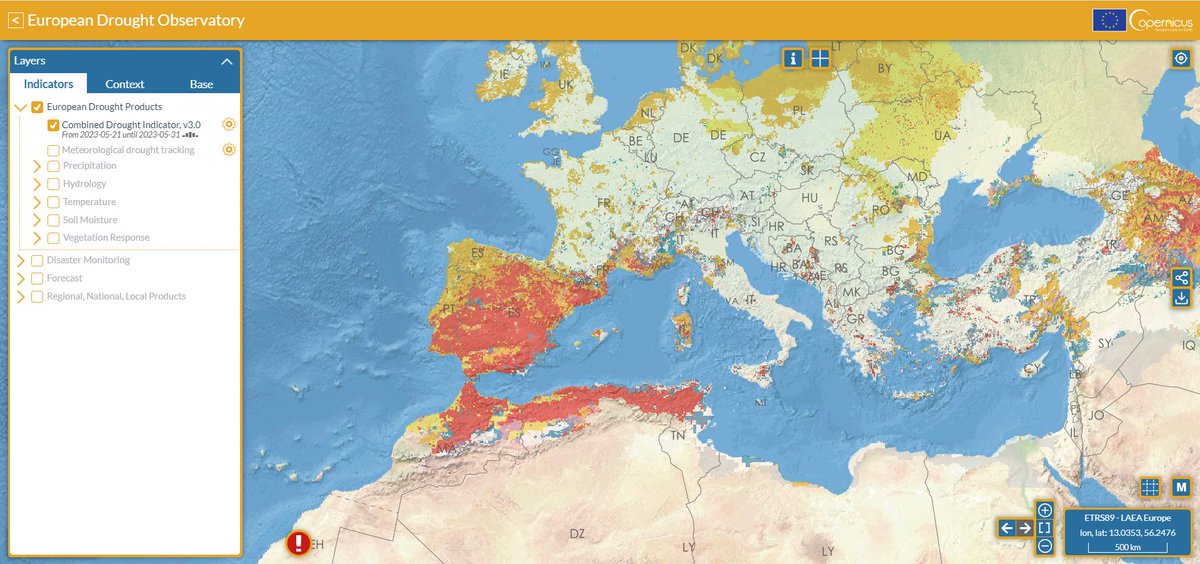
#ICYMI@CopernicusEMS has recently launched a new web portal for its #drought observatories - #EDO and #GDO❗️
A new interface has been developed to make access to maps and data as easy and seamless as possible
Check the new portal at👇
https://t.co/wBQ6ffGp2S
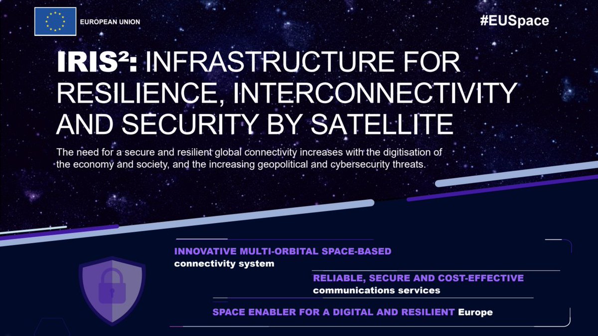
#IRIS2, Europe's new Infrastructure for Resilience, Interconnectivity & Security by Satellites will foster:
🎯Competitiveness
📈Societal progress
For a digital, resilient, and safer Europe🇪🇺
More at👇
https://t.co/YenC2AFa6f
By 2030 digital technologies including 5G, IoT & AI will be at the core of new business models.
Join us on 4 July as we introduce: ‘Future of Work for Sustainable Growth’, a new call for proposals that use space assets to support workplace #digitalisation.
https://t.co/xsnsKNGtIU
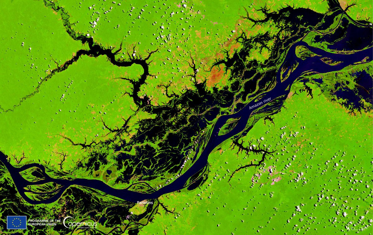
🌳Mark #WorldRainforestDay by watching an edition of the Earth from Space programme where the @CopernicusEU#Sentinel2 mission takes us over part of the Amazon rainforest - the world's largest tropical rainforest.
Follow the link to watch the video. 👉 https://t.co/R9XOfjZCdu
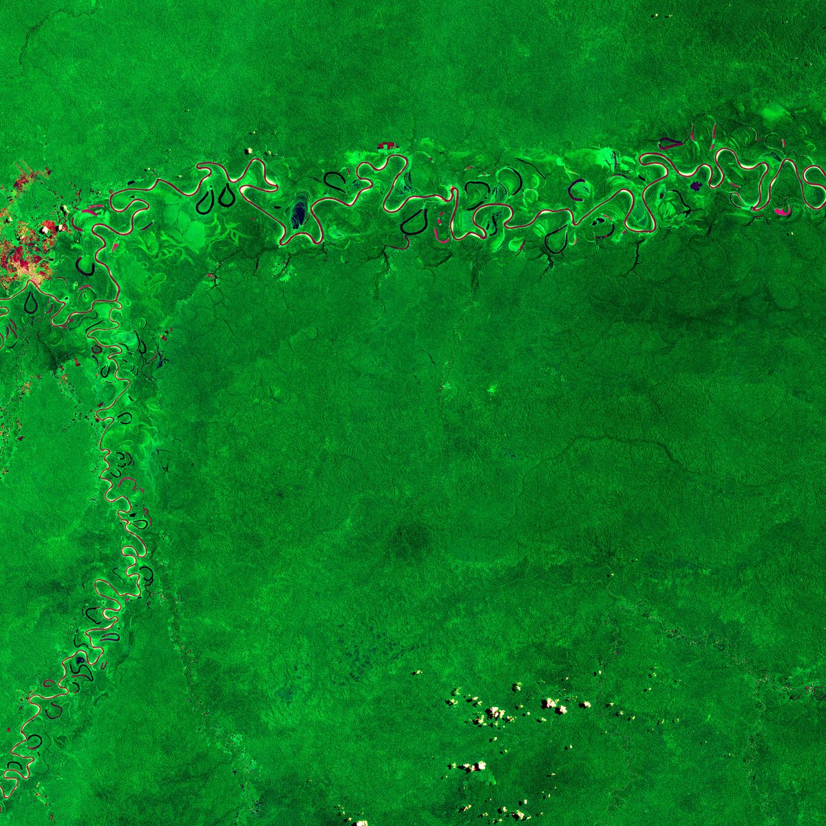
🟢#WorldRainforestDay🟢
#Rainforests play a major role in carbon sequestration & climate change mitigation
They also contribute to cloud formation, precipitation, and hydrological cycles while preventing erosion
⬇️Amazon Rainforest fragment seen by #Copernicus#Sentinel2🇪🇺🛰️
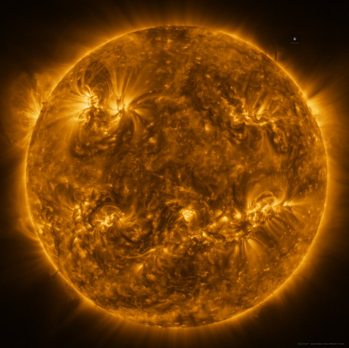
🌞😎 Today marks the Northern Hemisphere #SummerSolstice!
Celebrate the Sun by learning about this high resolution mosaic image, taken on 7 March by @ESASolarOrbiter. Can you spot Earth, included for scale? 👉 https://t.co/MJ8oStbpFU
#TheSunUpClose ☀️ #WeAreAllSolarOrbiters
Scientists used observations from TPM PROBA-1’s CHRIS🔭to classify the leaf🌿angle & maturity of crops. CHRIS provides data on leaf area index (LAI) & chlorophyll, relevant for monitoring stress in forests and mapping agriculture use.
Learn more https://t.co/NAeEfWQVtb
📷ESA