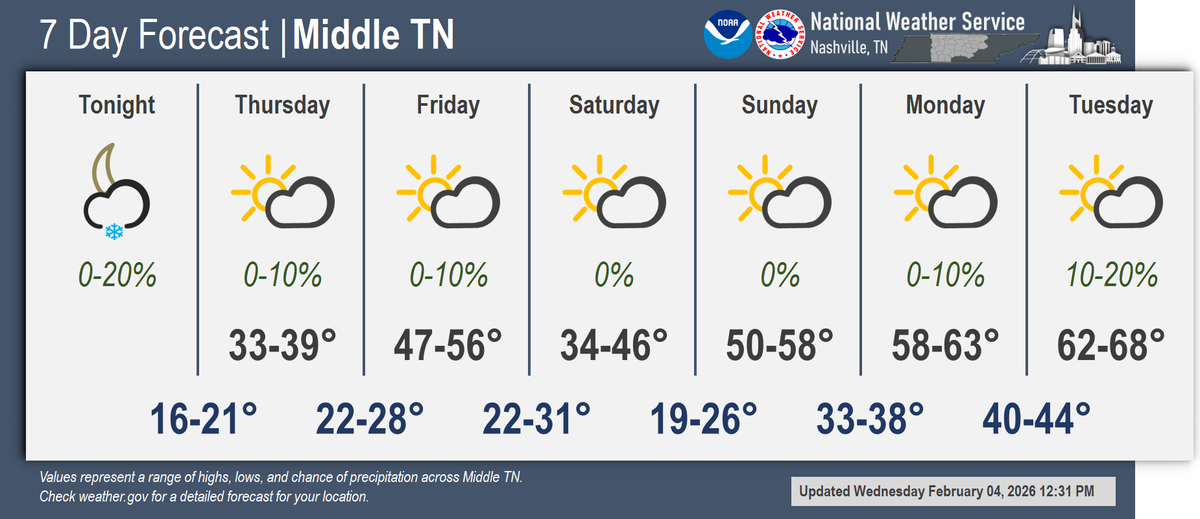
Since my "first call" snow forecast on the last storm went so poorly, I figure I need to make up for it. Prove I'm not a total fool, right?
Here's my first call for this weekend.* Prove me wrong nature, I double dog dare you.
*Friday flurries non-withstanding.
#FordWarnWx
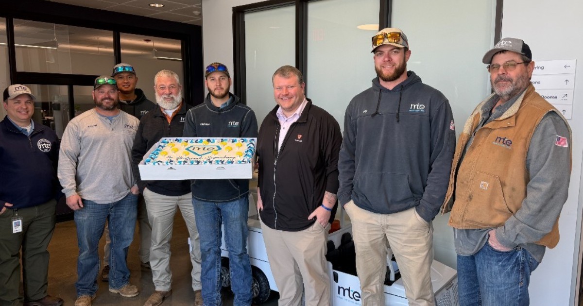
We had quite the surprise at our Murfreesboro headquarters today! A big thank you to Tim from Julia's Homestyle Bakery for delivering this incredible cake for our team to enjoy. 🎉🍰
We are grateful to serve communities full of thoughtful, caring people, and the entire MTE team continues to be blown away by the support you've shown us over the last couple of weeks. Thank YOU for bringing good energy to us.
Three decades. Five continents. Countless storms.
AMS caught up with storm chaser, filmmaker & musician Hank Schyma on his new book Storm, the risks of documenting extreme weather, and what surprised him most.
Read more on AMS Headlines 🗞️: https://t.co/uFoWuL0V2R
We're small, but mighty. Only 3 strong, and that means long hours, late nights, and early mornings—often away from family—so you can count on accurate, dependable weather information when it matters most. Proud to stand by these 2 on National Weatherperson's Day
This could change tornado warnings. 🌪️📡
Phased Array Radar scans storms in seconds — not minutes. That means earlier detection when every second counts. Hopefully we will see phased array radar replace the aging WSR-88D.
#weather#storm#tornado#radar
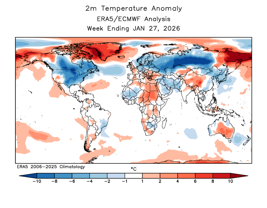
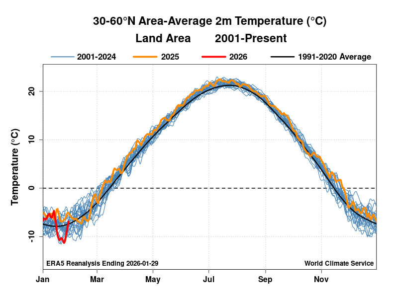
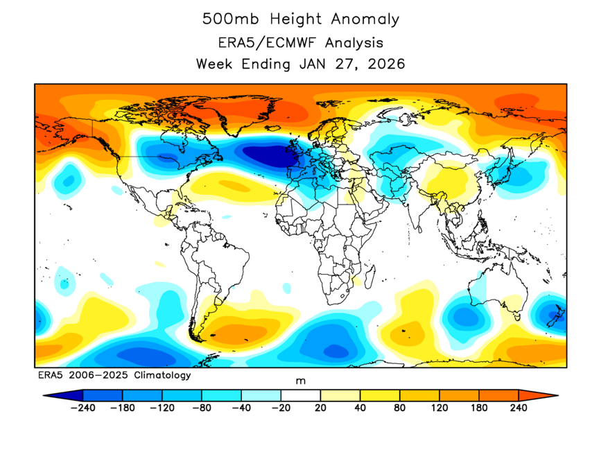
The recent negative AO episode (Arctic blocking) produced quite a dip in the 30-60°N land-area average temperature.
Per ERA5, the recent minimum daily value was -11.3°C, lowest since 2012. (The 1950-present record is -14.2°C in late Jan 1969)
The normal high temperature in OKC on February 4 is 52. So far today, the high is 52.
The normal high temperature in Lawton on February 4 is 56. So far today, the high is 56.
The normal high temperature in Wichita Falls on February 4 is 57. So far today, the high is... 56. ☹️
An abundance of snow is neat in the eastern US (+23 feet above 15-year mean), but the real story is the lack of snow out west (-20 feet). Not good for water resources later this year.
Here's an animation of the snow accumulation difference from the mean (Oct 1 to Feb 4) #snOMG
The Arkansas Glacier is gone. The 11 consecutive days with at least 1'' of snow on the ground ranks 3rd in recorded Little Rock weather history. It was the longest stretch in our lifetime. #ARWX#ARStormTeam
[Severe Weather Preparedness Week] Do you know what to do if you need to shelter from a tornado when on the road?
Get off the road and into shelter if possible. Never seek shelter under an overpass or tree, as this puts you at greater risk of being hurt. #gawx#WeatherReady
BREAKING UPDATE: Gov. Bill Lee has requested an expedited disaster declaration from the #WhiteHouse for #Tennessee after the winter storm. The request includes Individual and Public Assistance as crews continue to work to restore power. https://t.co/c9jjTCnHFE
Good news on the horizon, warmer weather. While we remain on the cooler side through Saturday, a period of notable warming is expected Sunday into early next week. Overall rain chances are low through the next 7 days. Either way, we'll take the warmer weather! #tnwx
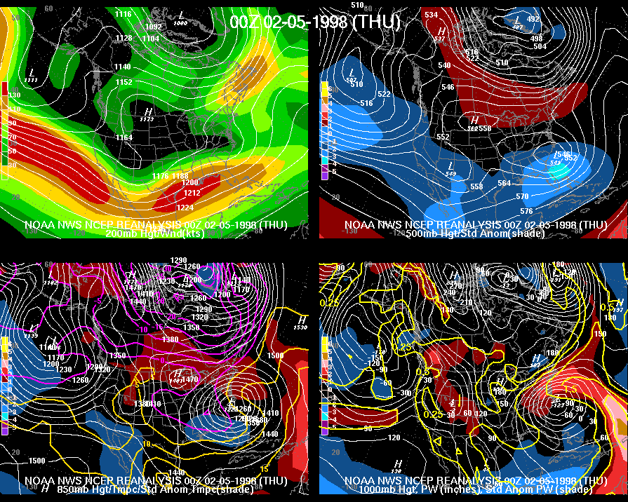
Hey @NWSMorristown do you guys have a history page on the "Dynamic Cooling" Snowstorm of Feb 3-4, 1998? I only found an accumulation chart and map from NWS Nashville.
This feels like a very important event to discuss, especially in the Upper Cumberland!
@weatherpyro The short answer to that question is a no, most of our write-ups are recent & have occurred shortly after a major storm. @NWSLouisville has a brief summary here: https://t.co/4lVj3hUwKP
Went down a rabbit hole to dig into this storm, found the upper weather charts for it.
@weatherpyro@NWSLouisville Otherwise you can poke around archived text products we issued back then in an archive Iowa State maintains. This is a discussion from a now retired met of ours: https://t.co/t4GXncZof3
Since much of the remaining snow will melt today, here's a look at the good & the bad of how the forecast played out for this past weekend's snow storm. #scwx#gawx
https://t.co/QUgCb9EsXH
#OTD in 1998, a multi-day heavy, wet snowfall buried a good chunk of the Commonwealth. Louisville set a single-storm record with 22.4". Covington saw 18.5", Jackson 17.6", Lexington 17.4". Totals were lower but still significant for Owensboro (7.7") & Bowling Green (6.6"). #kywx
Pretty wild stat here!
We've now had 1"+ snow depth at Memphis Int'l for 11 straight days. This is longest period of time to have 1"+ snow on the ground since records began in 1928!
The Crisis Cleanup hotline number is 844-965-1386. It is set to remain active until February 13, 2026. Volunteers from local religious organizations and community groups are offering help. https://t.co/kk4xP3tIj6


![NWSAtlanta's tweet photo. [Severe Weather Preparedness Week] Do you know what to do if you need to shelter from a tornado when on the road?
Get off the road and into shelter if possible. Never seek shelter under an overpass or tree, as this puts you at greater risk of being hurt. #gawx #WeatherReady https://t.co/gqfTkM9FQI](https://pbs.twimg.com/media/G__qhRKW0AEBUW6.png)