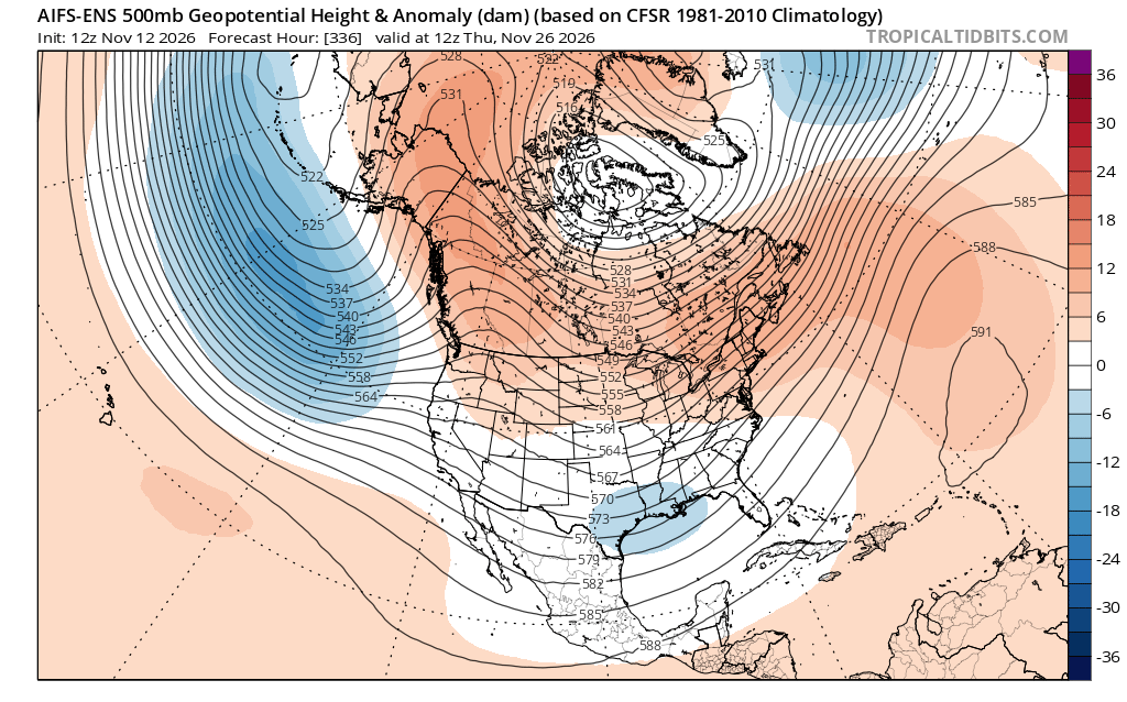
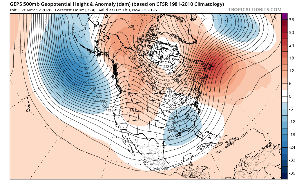
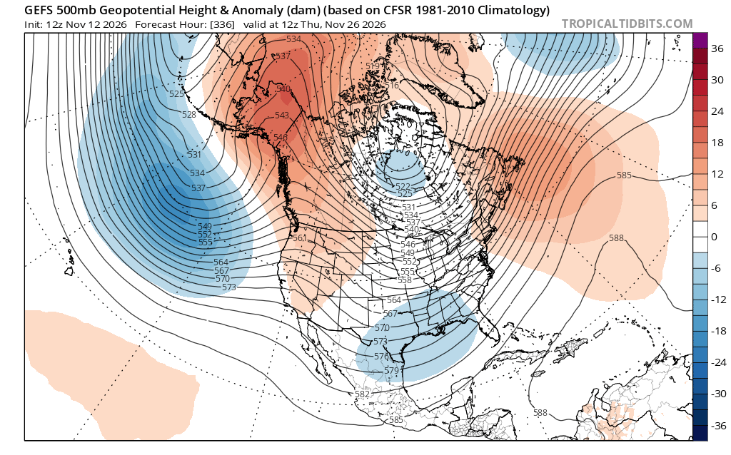
Fuck it, cant be calm anywhere it doesn't work. WIDEPREAD HEAVY FUCKNI TWATTING SNOW SHOWERS (also organised bands of snow) WANKING IN FROM THE EAST. ACCUMULATIONS EASY OVER A FOOT FROM THIS RUN EASY
With the help of AI, I’ve managed to reconstruct the QBO situation... and, let me tell you, it looks like we might be heading toward a scenario similar to 2016 only earlier than it unfolded that year. We’re talking about a potential QBO disruption
#ElNiño#PolarVortex#Winter
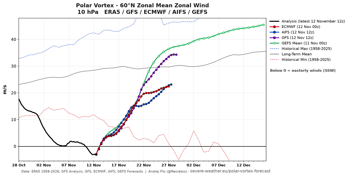
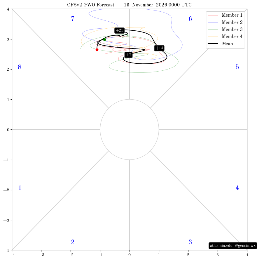
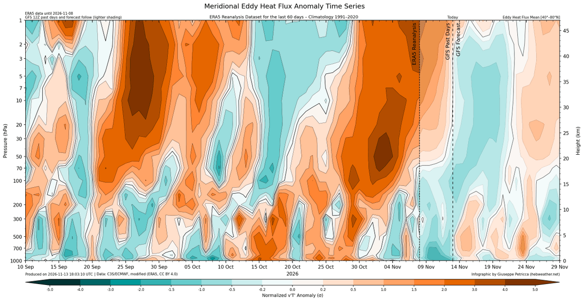
We are in SSW territory, marking this the earliest SSW on record. The impacts of the SSW are likely to flow down to surface over the next few weeks increasing the risk of blocking episodes going into December, aided by other tropospheric influences.
Many people have wondered why they couldn't access Gemini 4 Carbon on Google AI Pro. Here's a reference card.
(yes, disappointing, you have to upgrade or use the API)
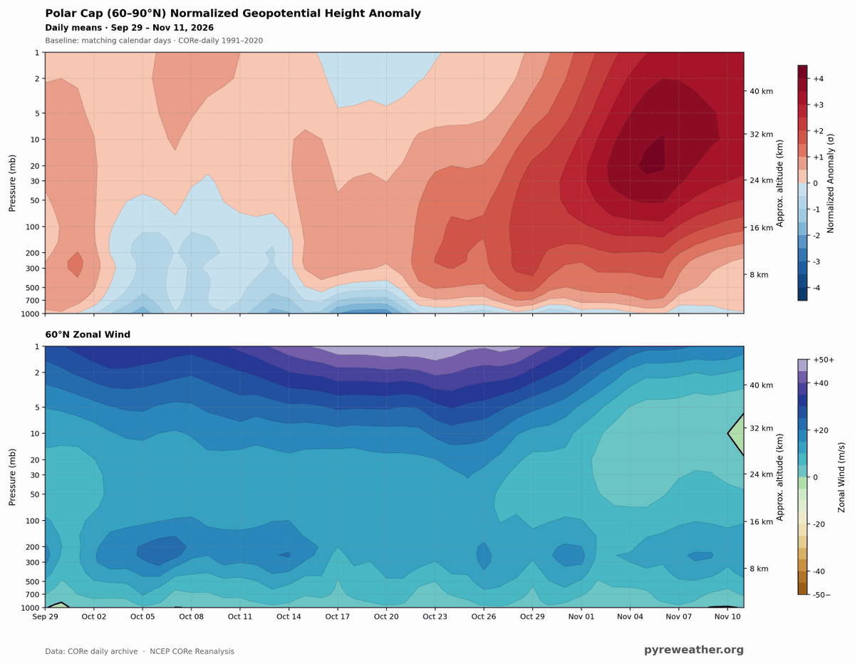
BOOM! Here it is!! That little green wedge on the right side of the lower image? that's the easterly turn of the 10mb winds at 60N Latitude.
The Sudden Stratospheric Warming event has officially arrived!!
@Statisticizer
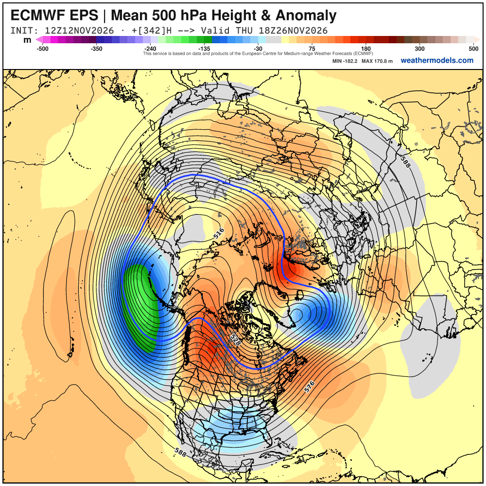
Did someone order Turkey on ice? The models are in agreement on a an interesting pattern for Thanksgiving that is favorable for an East Coast snowstorm. I admit more what if than a real risk for now but I'd be excited to this pattern in a month! Consistent with influence of #SSW
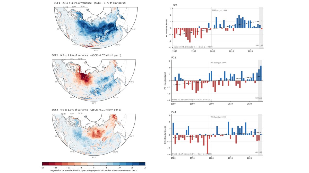
@HamoudaMosti & I computed the patterns of October Eurasian #snow cover extent. The dominant one is a continent wide snow cover that is increasing. The second is a dipole with more snow in East Asia but less snow in West Asia, that is getting stronger with 2026 the highest value.
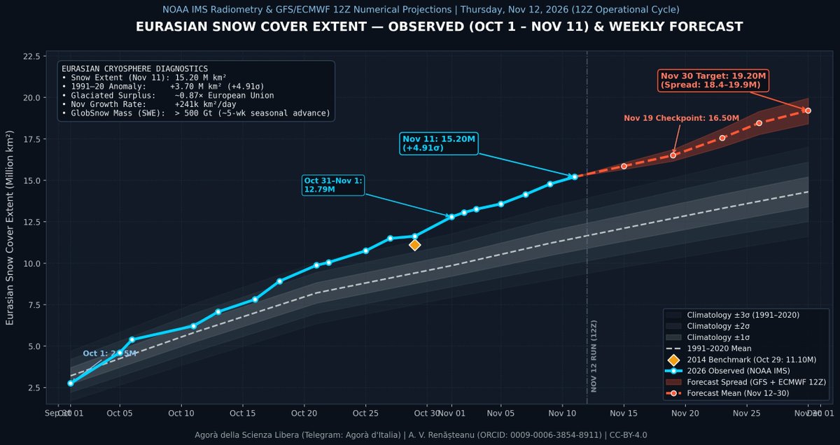
Since October 1st, I have been collecting data on Eurasian snow cover using NOAA IMS satellite data. I will update these charts every Thursday.
#Winter#Snow#ElNiño#PolarVortex#weatherforecast
@MUweather@epawawx I understand perfectly; however, based on what I’ve read in published studies on the subject, it appears to have been a hybrid one that, in terms of its circulation patterns, was almost a Modoki type
There is a growing signal within model outputs that today’s major SSW will “drip” down into the troposphere later this month and into early December.
This, coupled with favourable troposphere teleconnections will increase the likelihood of high latitude blocking and outbreaks of cold weather during early December.
@MUweather@epawawx In our case, we have an exceptionally strong El Niño event ("Mega Niño") of the EP type, with a QBO+ phase that is descending into an easterly regime, alongside a strongly negative PDO. Furthermore, solar activity is on the decline compared to year 23–24, which were at a max