Today we launched the @IFRC Information Management Strategic Direction 2021-24
Our plan to leverage data to help the global @IFRC network serve those who need us most.
https://t.co/ruh0wSIKbD
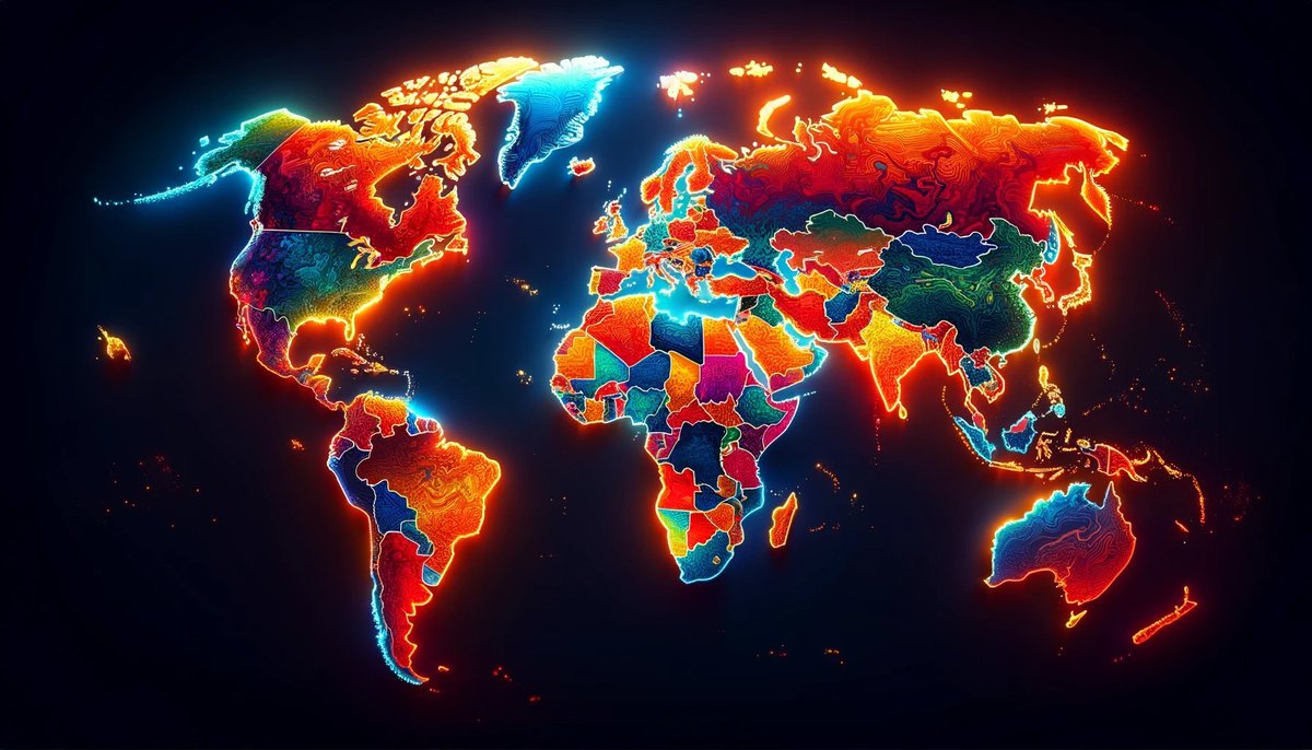
Official sub-national GDP is a nightmare to find.
Most countries don't even publish it.
However, some geospatial datasets provide these insights for every country in the world.
Here's an UPDATED list of geospatial GDP datasets, I wish I knew about 5 years ago:
Come and join us for a special English/Arabic story time!
@Nadinekaadan will guide us through fascinating stories and spread the joy of bilingual storytelling.
📌Wed 22 Nov, 4-5 PM, Shepherd's Bush Library
(Contact details edited ⬇️)
@LBHF@ArabBritishCent@LDNLibraries
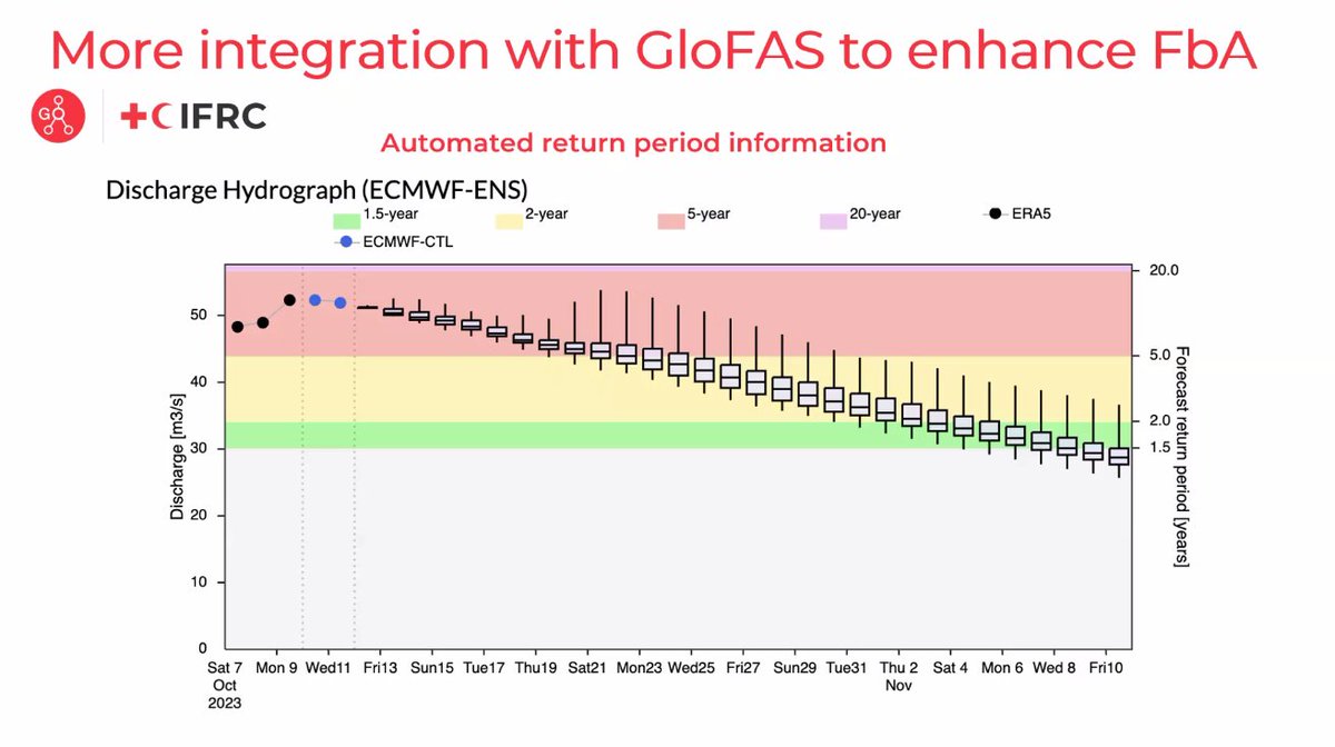
🔴Live from the #CEMS2023 Annual Conference on #DRRDay
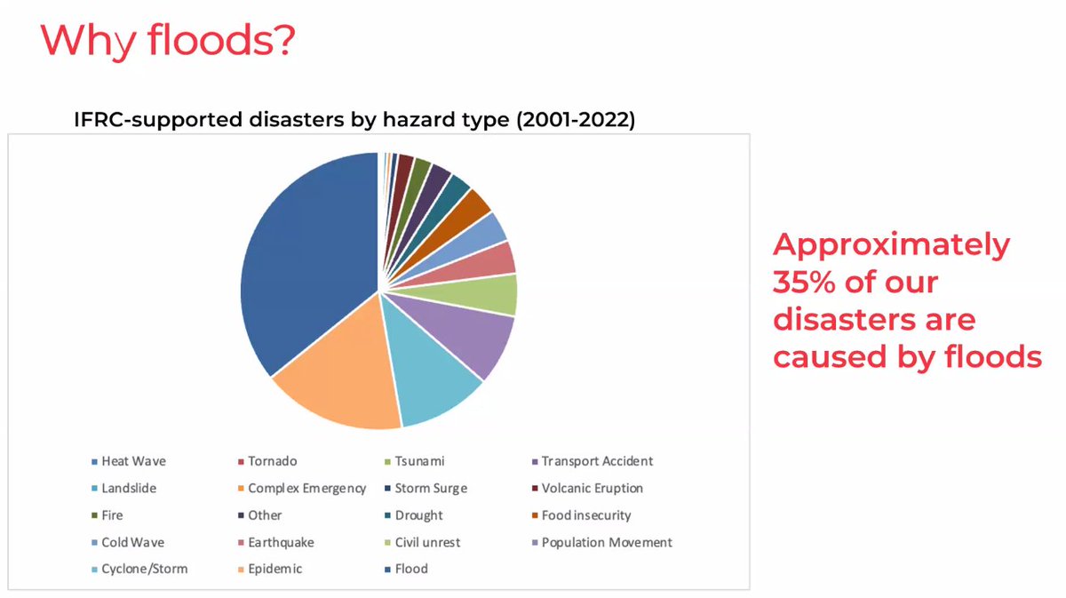
▶️#Floods are the most frequent type of disaster worldwide
Justin Ginnetti from @IFRC discussed the critical role of our flood early warning systems and how #GloFAS🌊 is being used in their work
📺https://t.co/clqQoS3c84
Would you like to learn more about #humanitarian IM and use of #GIS? Join our group on LinkedIn for current and prospective #MapAction#volunteers to meet some of our current cohort and to find out about the six positions we are currently recruiting for. https://t.co/dvLZNVXYlo
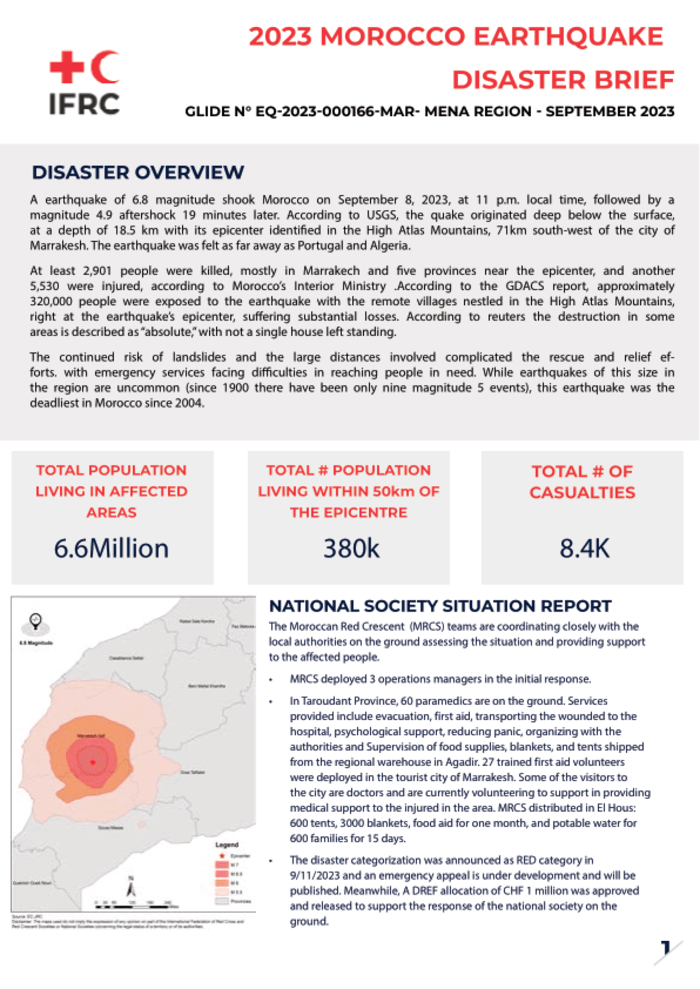
#Morocco earthquake disaster brief, per @IFRC:
▪️ 6.6 million: Population living in affected areas
▪️ 380 K: Population within 50 km of the epicentre
▪️ 8.4 K: Total casualties
More information: https://t.co/6RkUL4UUEP
Maxar has released 8,724 satellite images for the #Morocco Earthquake, increased from 882 images released yesterday 📈🛰️
GitHub: https://t.co/kBgNFO3pJn
GeoJSON footprint: https://t.co/GXlGPUng9g
#moroccoearthquake#geospatial#dataviz
No matter the crisis.
No matter how hard the challenges.
No matter where, no matter who. #NoMatterWhat
Our humanitarian workers are always there, saving lives. Thank you for making this world a better place and being a real source of inspiration. #WorldHumanitarianDay
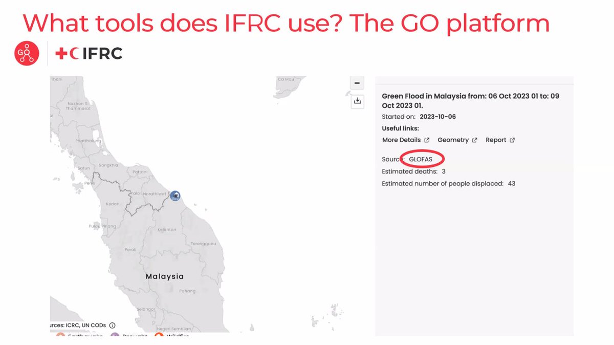
IFRC GO is the platform that connects information on emergency needs with the right response.
This complex & ambitious platform aims to be the single source of truth for the @ifrc network in emergencies.
Read about the latest planning sprint & goals:
https://t.co/2kA9bDAVeN
June 21st is #ShowYourStripes Day.
It is an annual event where individuals, meteorologists, & organizations promote discussion about global warming by using @ed_hawkins iconic warming stripes.
Here is my animation showing local stripes around the world.
https://t.co/SnXAE0MZaq
This animation shows every recorded earthquake in sequence as they occurred from January 1, 1901, through December 31, 2000, at a rate of 1 year per second
[source, read more, NOAA: https://t.co/EYOmHG0l7i]
I've been involved in discussions of AI governance for years - here is a short piece on why the last decade was largely wasted and what needs to be done now https://t.co/HyIXWYSz0Y
AFRICAN GAZE was an exhibition showcasing the weird and wonderful art form that is the Ghanaian movie poster. These are some of the best...
A THREAD
1/20 - Mrs Doubtfire
A striking visualization of human-caused climate change - watch what happens in the Arctic... 🫠
Temperature anomalies by latitude band (zonal mean) from 1880 to 2022. Visualization produced by @NASAViz at https://t.co/Tu8aN47qlq. Data from @NASAGISS at https://t.co/8pB26JbSzJ.
@IFRC_DREF@ifrc If you want more background, dig into this short blog on how the challenge contributes to the ultimate aim of digitalising the @IFRC_DREF here: https://t.co/auMvRI3pgb
📢Calling on all Data Viz Champions
📊To improve analysis of @IFRC_DREF data
🏆Take the @IFRC Nightingale #DataViz Challenge
🇰🇪 and win an all-expenses paid trip to the Global Innovation Summit in Nairobi, Kenya 26-28 June
👉Find out more: https://t.co/iO12Ie2KGy