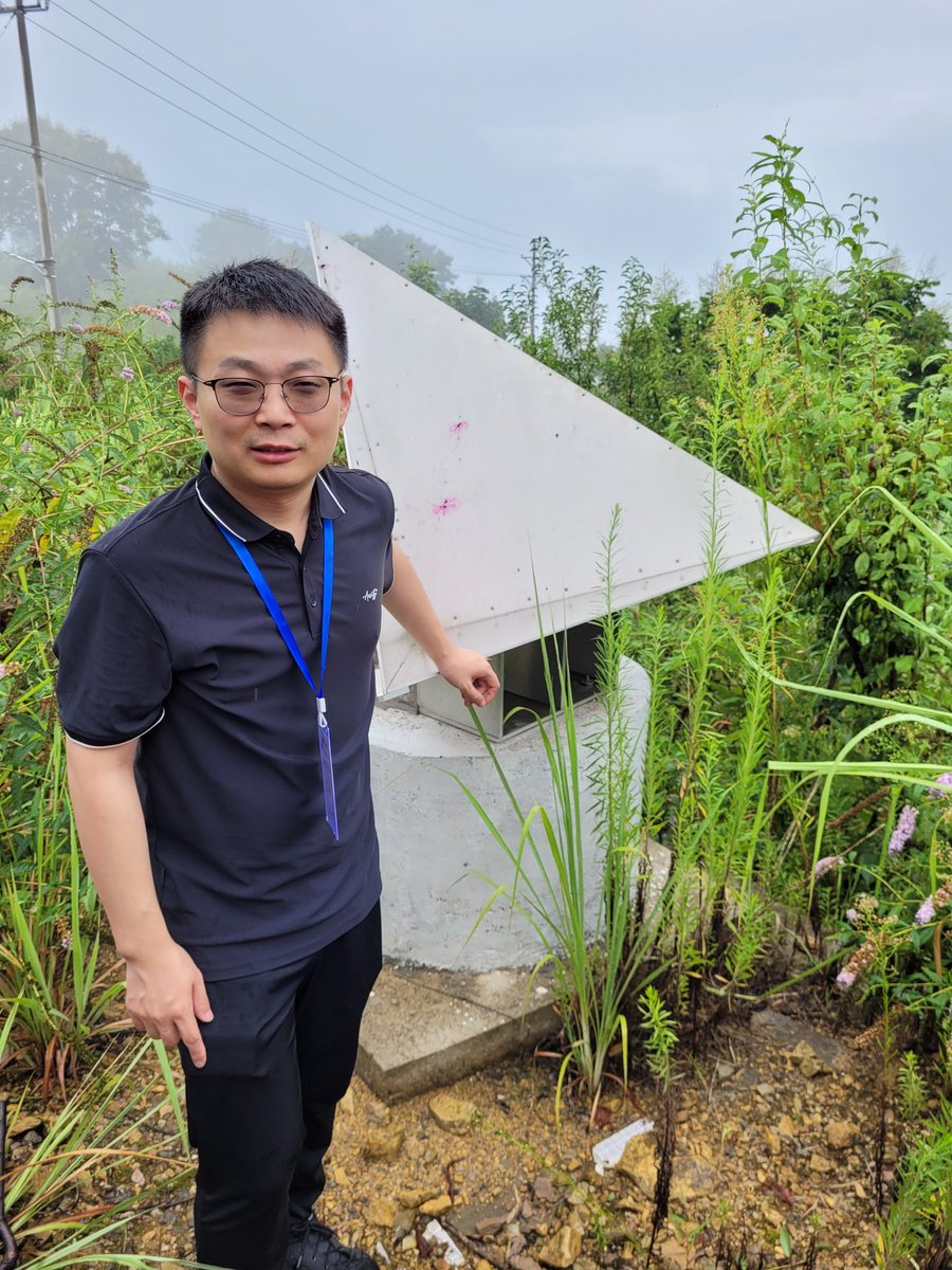
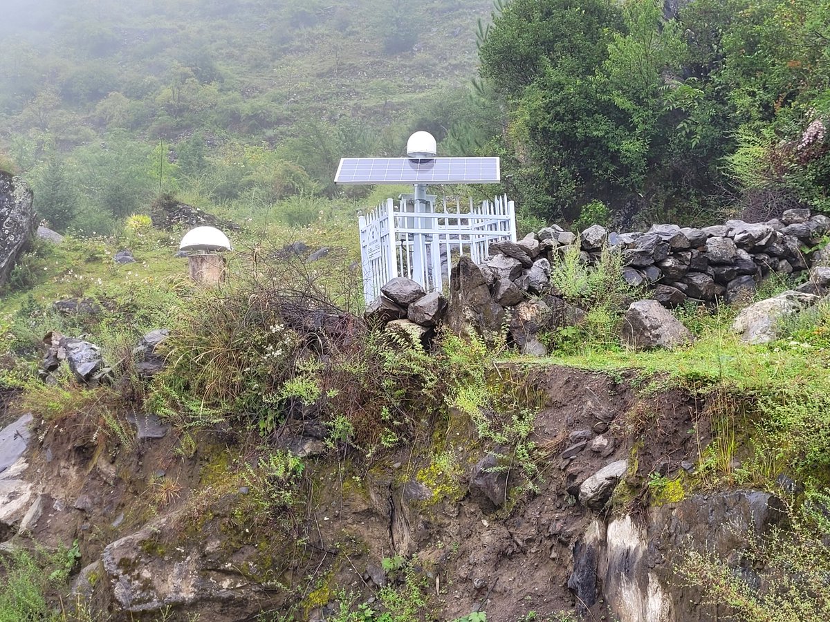
Visiting our CR-based monitoring system at #Aniangzhai landslide, a large, deep-seated ancient #landslide that was partially reactivated in June 2020 in #China after a chain of other hazards nearby. For more details see
https://t.co/EqnaA551jB
https://t.co/xzWAF2agNV
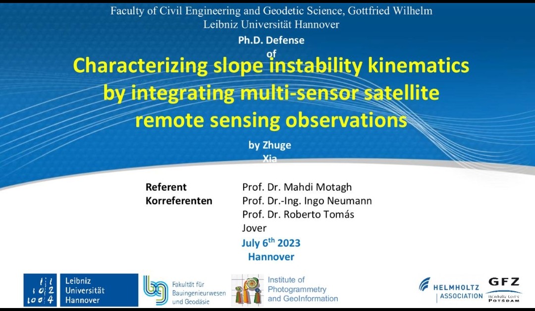
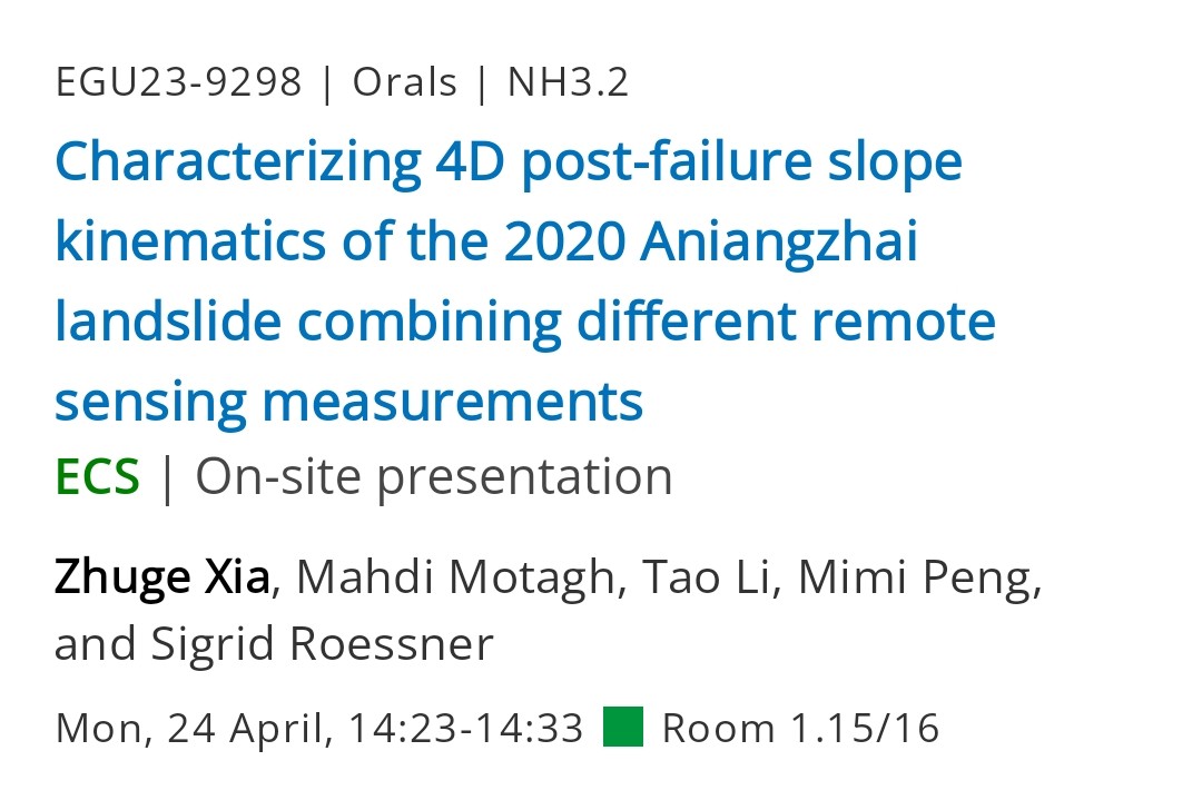
First day of @EuroGeosciences General Assembly #EGU23 conference!
Our group will be presenting two talks today about #Aniangzhai#landslide & tectonics of the #Tianshan orogenic belt
Zhuge Xia, April 24, NH3.2, 14:23-14:33
Xiaohang Wang, April 24, TS3.7, 16:15-16:25
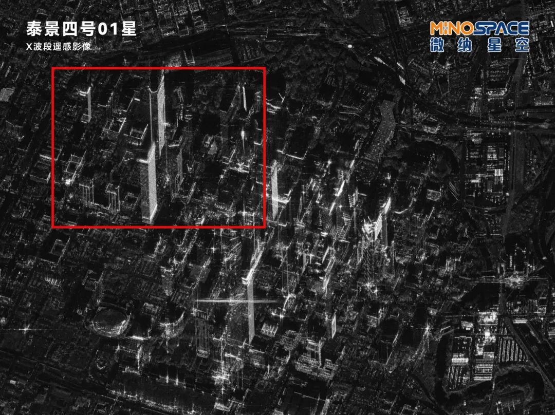
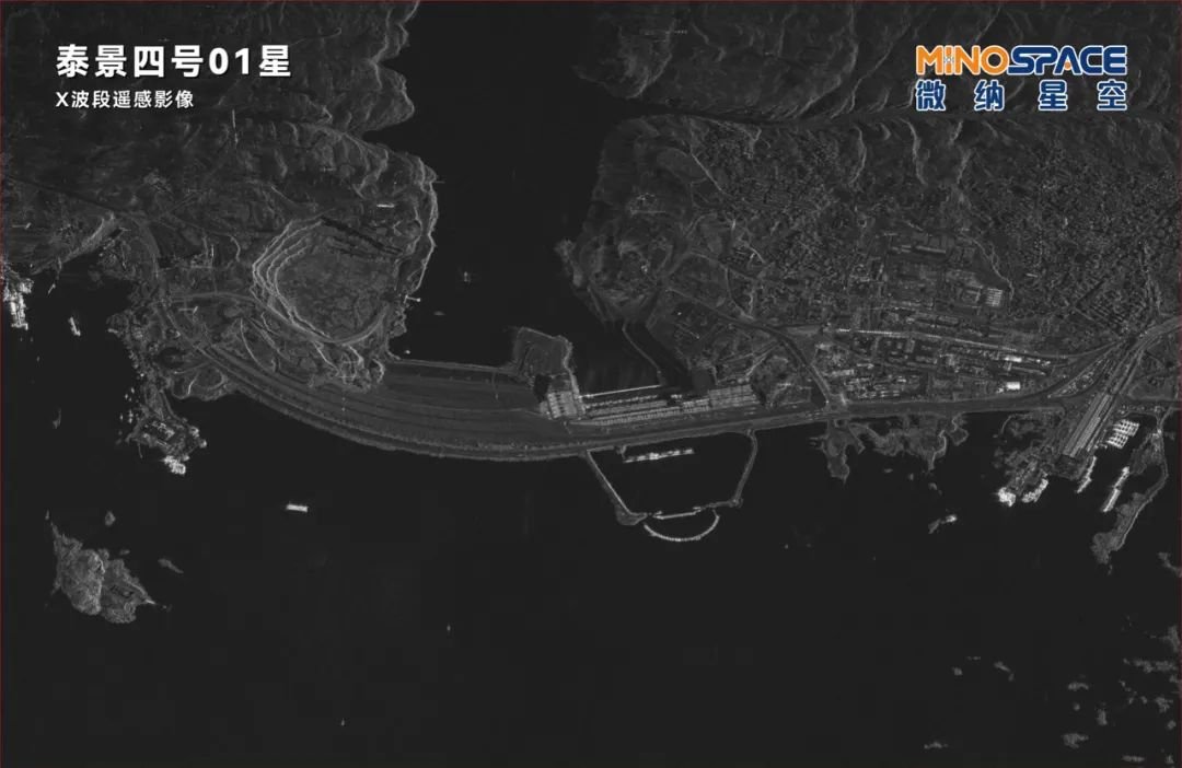
SAR images look so cool! Here are some taken by China's first commercial X-band SAR satellite: MINOSPACE's Taijing-4-01:
The Space City Houston and home of Rockets;
Verrazzano-Narrows Bridge connecting Staten Island and Brooklyn;
Aswan High Dam of Egypt
Can we rely on #checkdams for #flood control in face of changing climate? See the lessons we learned from the 28 July 2022 #flood in northwestern #Tehran
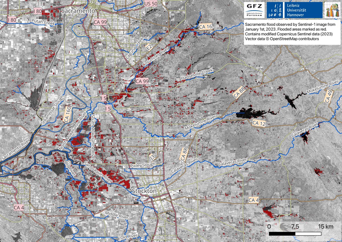
The map below is derived using #SAR-based #Sentinel -1 image on 1st Jan 2023. Flooded areas are depicted in red; Blue color represents water bodies.
#Highway99 (depicted as CA99) can be seen flooded in the map. (3/4)
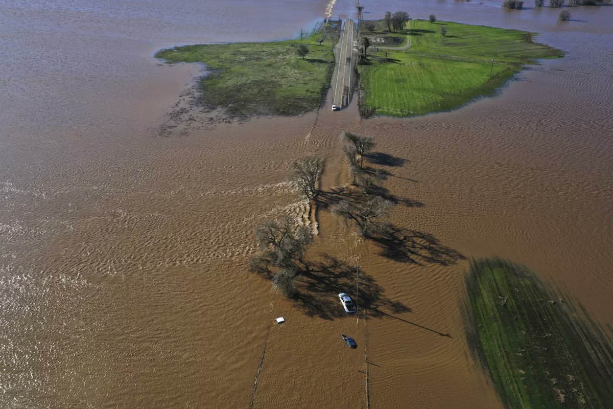
"When disaster strikes, our team is always ready to jump into action. Thanks to the hard work of @Mahmudhh, @MahdiMotagh, and @ShagunGarg1511, we've been able to closely monitor the recent #California#flooding using satellite imagery to create detailed flood maps. (1/4)


![KirkDBorne's tweet photo. [Free PDF Download] Introduction to #Probability for Data Science: https://t.co/L51j3udY5j by @stanley_h_chan
—————
#StatisticalLiteracy #Mathematics #AI #BigData #MachineLearning #DataScience #DataScientists #DataLiteracy #Statistics https://t.co/nd1nW7JGn0](https://pbs.twimg.com/media/FHgdDMJWYAI8hNj.jpg)


