The GeoLibre processing toolbox now speaks all 19 languages.
Whitebox language packs are now published for every language GeoLibre ships: Arabic, Chinese, Dutch, French, Georgian, German, Hindi, Indonesian, Italian, Japanese, Korean, Persian, Portuguese, Russian, Spanish, Thai, Turkish, and Vietnamese.
All 1,066 Whitebox tools: names, descriptions, parameter labels, and parameter help text, plus the 48 processing categories and 45 menu subcategories. That is 14,938 translated strings per language, roughly 270,000 of them across the set.
Embedding hundreds of tool descriptions for 19 locales would add tens of megabytes to every web, desktop, and mobile build for text most users never need. So the packs live outside the app and you install only the one you use. Everything else about localization stays bundled and works offline.
Open Settings > Language > Manage language packs, then click Download pack. You can also import a pack from a local JSON file with no network access at all, and self-hosted deployments can point at an internal mirror.
Try it out:
- Launch GeoLibre web: https://t.co/8gMtkVtfnm
- GeoLibre: https://t.co/VXq8c1o2Nd
- Documentation: https://t.co/7VA2AQoCUc
- Language packs: https://t.co/ektVry92Qk
#GIS #Geospatial #OpenSource #MapLibre #GeoLibre
Network Security: Get Started with QUIC and HTTP/3
For decades, traditional HTTP traffic over TCP, also known as HTTP/1 and HTTP/2, has been the backbone of the web. But nowadays, we have HTTP/3:
https://t.co/KBf17Z6D8Q
@three_cube@DI0256@IamSmouk@co11ateral
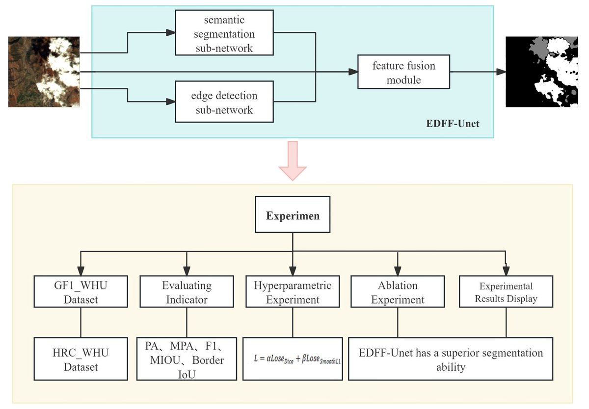
☁️☁️ EDFF-Unet: An Improved Unet-Based Method for #Cloud and Cloud #Shadow#Segmentation in Remote Sensing #Images
✍️ Xingyi Wang et al.
🔗 https://t.co/RP4Wug5jvW
GeoLibre v2.5.0 is here!
GeoLibre is a free and open-source, lightweight, cloud-native GIS platform for visualizing, exploring, and analyzing geospatial data. It runs everywhere you do, in the web browser, on the desktop, on mobile, and inside Jupyter notebooks, all while keeping your data local and private.
This release is about meeting you where your work already lives: open your QGIS and ArcGIS Pro projects directly, talk to your team on the map itself, explore hyperspectral imagery as a 3D cube, work in discrete global grids, and host sharing and live collaboration on your own server.
It is also the most community-driven release so far: 121 pull requests and 52 issues closed in 8 days, from 14 contributors, 12 of whom sent their first contribution to GeoLibre in this cycle. Thank you all.
What's new in v2.5.0
- Comments on the map: pin a comment to any location or feature, reply in a thread, resolve it when it is handled.
- Live collaboration, on your own server: several people can open the same session and see each other's edits, cursors, and comments in real time.
- QGIS and ArcGIS Pro project import: open a .qgs, .qgz, .aprx, or .mapx and get the layers.
- Discrete global grids: three new DGGS plugins (A5, DGGRID, and DGGAL) render and identify cells over the current view, plus DGGS Generator, Binning, and Compact processing tools.
- Hyperspectral data you can actually read: local NetCDF and HDF grids are colormapped in the browser, a cube gets an RGB band combination picked by wavelength.
- Spectral profiles from a click: identify a pixel to chart its spectrum against wavelength.
- Smart styling on add: every new layer arrives with its own color and geometry-appropriate sizing, and a Style suggestions strip offers one-click renderers.
- Autosave, crash recovery, and project history, plus an Elements panel for managing every annotation from a list, a Layer Library for saving a fully configured layer and re-adding it to any later project, and project duplication and templates.
- GeoLibre Desktop is on the Mac App Store, and Thai brings the shipped locales to 16 languages besides English, all at 100% coverage.
Try it out
- Launch GeoLibre Web: https://t.co/8gMtkVtfnm
- GitHub: https://t.co/VXq8c1o2Nd
- Documentation: https://t.co/7VA2AQoCUc
- Release notes: https://t.co/CpiMpoacKj
#GIS #Geospatial #OpenSource #RemoteSensing #DataVisualization #MapLibre #GeoLibre
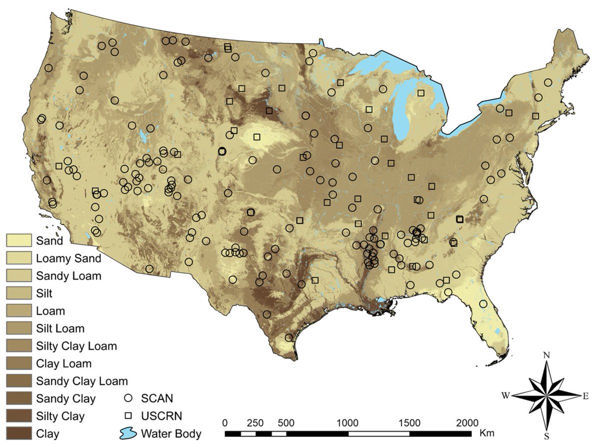
👋👋 Surface and Subsurface #Soil#Moisture Estimation Using #Fusion of SMAP, NLDAS-2, and SOLUS100 Data with #DeepLearning
✍️ Saman Rabiei et al.
🔗 https://t.co/16lgkwjHQI
An interesting 'new to me' tool: @Esri's "World Imagery Wayback" allows you to swipe between its most recent imagery and older imagery back to a release date of 2014.
At low zooms, the imagery reflects even earlier periods than that.
Try it:
https://t.co/ddMPGuTJOP
We're announcing a major update to Weather Lab, our interactive website for sharing Google’s AI weather models from @GoogleDeepMind and @GoogleResearch: https://t.co/7vCH7Qw2Fo
GeoLibre now supports route animation with a few simple clicks!
Try it out:
- Launch GeoLibre Web: https://t.co/KglWTTrR6P
- GitHub: https://t.co/aVS3kYopRw
- Documentation: https://t.co/vmiSb5GU4n
#geospatial#opensource#GeoLibre
🇮🇩 An underground actor is advertising what is claimed to be a “93GB+” database allegedly associated with Indonesia’s Ministry of Transportation (Kementerian Perhubungan Republik Indonesia).
The underground listing claims:
• Data spanning 38 provinces and 514 cities/regencies
• Hundreds of thousands of vehicle and owner records
• Jakarta-region transportation-related records
• Large-scale database access allegedly containing transportation system data
The post also includes:
• Sample screenshots
• Alleged database field structures
• Extortion-style messaging (“Pay or Sell”)
• Negotiation references tied to deletion of the alleged dataset
At this stage:
• The claims remain unverified
• The authenticity of the alleged data has not been independently confirmed
• The source and extent of any compromise remain unclear
• The screenshots alone are insufficient to validate the full claim
If legitimate, the alleged exposure could pose risks involving:
• Vehicle ownership information
• Transportation infrastructure intelligence
• Citizen personal information
• Administrative credentials
• Transportation operational systems
• Large-scale identity correlation
Transportation ministries and public-sector infrastructure operators continue to face elevated targeting due to:
• Critical infrastructure relevance
• Large centralized citizen datasets
• Smart transportation initiatives
• Regional operational dependencies
• Interconnected government systems
Threat actors increasingly target:
• Transportation authorities
• Public infrastructure agencies
• Smart city ecosystems
• Vehicle registration systems
• Public-sector administrative portals
Organizations should monitor for:
• Unauthorized credential activity
• Exposure of transportation-related systems
• Phishing targeting government personnel
• Suspicious access to administrative databases
• Data appearing across underground marketplaces
Daily Dark Web is continuing to monitor underground communities for additional technical evidence, validation samples, or official responses regarding this claim.
#DDW #Intelligence #CyberSecurity #DarkWeb #ThreatIntelligence #Indonesia #Transportation #CriticalInfrastructure #DataLeak
Maxwell–Boltzmann statistics is a classical statistical method in physics that describes how particles are distributed over various energy states within a system at thermal equilibrium. It is primarily applied to ideal gases where quantum effects are negligible, such as at high temperatures or low densities. This framework leads to the Maxwell–Boltzmann distribution, which explains the spread of particle speeds in a gas, linking microscopic motion to macroscopic properties like temperature and pressure, and forming the foundation of the kinetic theory of gases.
KK 246 (ESO 461-036) is a glittering irregular dwarf galaxy that resides within the Tully Void, a vast region of empty space adjacent to our Local Group. Beautiful in its isolation, KK 246 is the only galaxy known to exist within this vast volume of nothingness. 📷 ESO #KK246
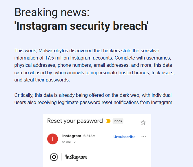
🚨Cyber Alert - Instagram breach exposes data of 17.5 million accounts
A major security breach affecting Instagram was discovered this week by Malwarebytes, revealing that 17.5 million user accounts were compromised.
The stolen data includes usernames, email addresses, phone numbers, physical addresses, and more.
The stolen data is already available on the dark web, and some users have begun receiving real Instagram password reset notifications, indicating active attempts to exploit the breach.
Source: https://t.co/BfcpXYyr7b