Our aerial imagery archive is now available in bulk from the Registry of Open Data on AWS. Data is collated by region and survey and is cloud-optimised: https://t.co/TLpbgIWeR2. Run through our tutorials then grab the data #opendata.
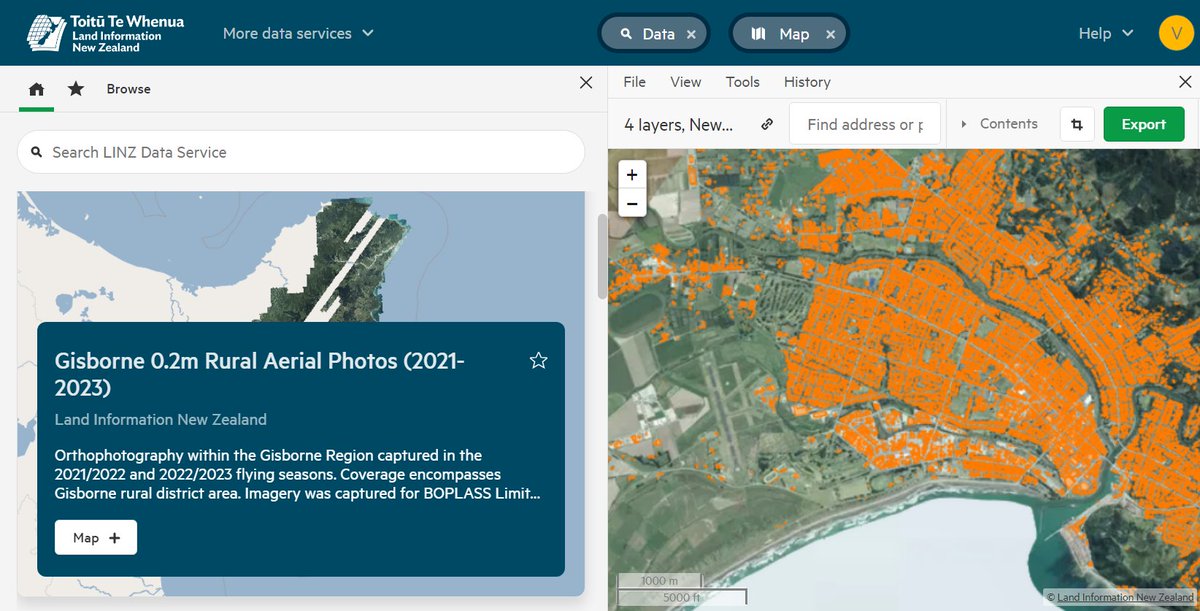
The new LDS user interface is now live! https://t.co/J1TW8aZ8JF Check out the awesome new features and ways of working with spatial data:
🎉Pin your favourite datasets
🎉Crop data on export
🎉Create multiple mapviews
#opendata
@EmmaVitz I would like to think that you baked a cake. Churning data butter is what happens before the free and open LiDAR and building outlines are even published. I don’t think we (LINZ) should be baking cakes instead of ensuring there is enough butter to go around.
Over the past few weeks, we’ve published 7 urban (for most it’s their first ever urban capture) and 2 rural imagery datasets across Canterbury and Otago. Thanks @ECan. Available from LDS @ https://t.co/yPSJbnp1Ql and @ https://t.co/qodmL5eSer #OpenData
A rare tweet from me but #SuperSaturday is a huge deal. Get vaccinated tomorrow or, if you already have been, encourage whanau or friends to. Shot Aotearoa.
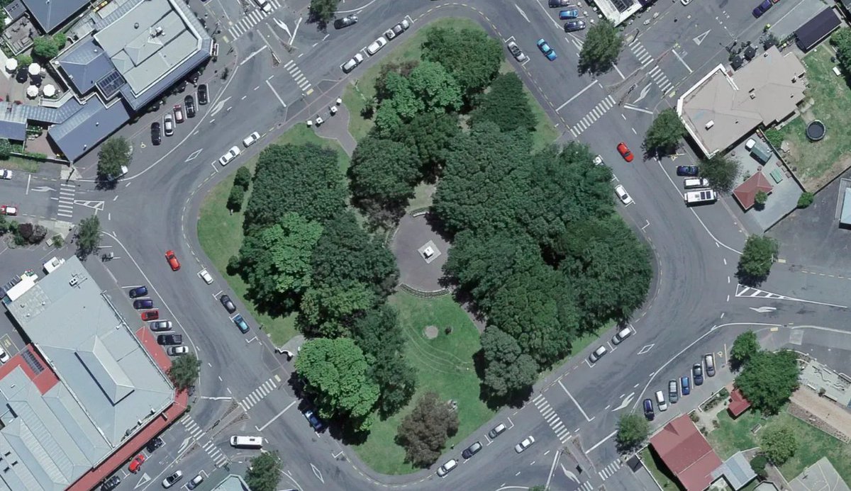
The first ever #opendata urban imagery for Masterton, Carterton and South Wairarapa is on LDS https://t.co/mQHoOyEiD5. Captured in 2021. Thanks Masterton, Carterton and South Wairarapa district councils. Also @ https://t.co/qodmL4WJ0j (Image: Martinborough Memorial Square)
Feast your eyes on 9263 km2 of new rural 2021 imagery for the Wellington region at 0.3m pixel resolution. This provides updated imagery for the region last published in 2017. Thanks @greaterwgtn you’re looking awesome https://t.co/lxuamScx8U #opendata
We're looking for a Senior Developer in the Topo team to work on our #opendata publishing processes. Think creating tools/infrastructure with Python/TypeScript for national-scale aerial imagery and elevation datasets hosted in AWS. #gisjobs
https://t.co/Wva8jJdLPf
Great excitement here today with the launch of LINZ's new Basemap service. This is #opendata at its finest. Check out the Aerial Imagery Basemap and get mapping!!
https://t.co/FX7ODq3frh
Woah @LINZLDS are looking for *19* developers to start immediately, in what’s IMO probably one of the more interesting govt in-sourcing projects around. https://t.co/IooURXuTPF