The Sentinel-1 time series for Fentale shows 1) a dyke intrusion in 2015, 2) slow uplift in 2017-2025, 3) a new dyke in 2024 further north. The 2015 dyke did not cause an eruption - more info from IGSSA, @NERC_COMET & BGS here: https://t.co/6IMYdbF2H0 https://t.co/DfG6BWMP2T
Sentinel-1 data show a magma intrusion occurred north of Fentale volcano, Ethiopia, on around 27 September, causing many felt M4+ earthquakes. Today's acqcuisition shows deformation is now decreasing. Please follow Ethiopian experts at IGSSA for more information.
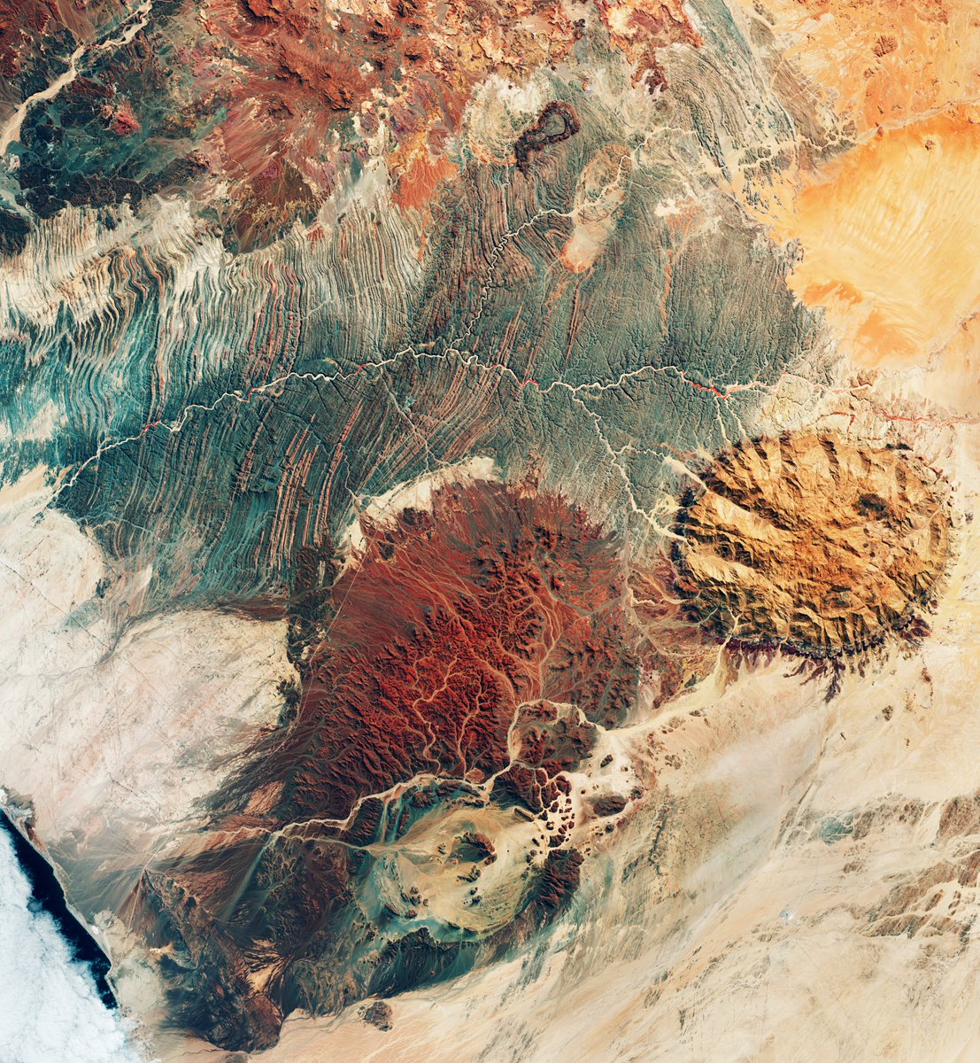
Mars or Earth?
This image may resemble the surface of Mars, but it actually is stunning terrain of northwest Namibia.
Several significant geological features dominate this @CopernicusEU#Sentinel2 image:
⛰️The Brandberg Massif, one of the highest granite mountain in Namibia.
🌊In the Ugab River valley.
🪨 The Messum Crater which was formed by a collapsed volcano.
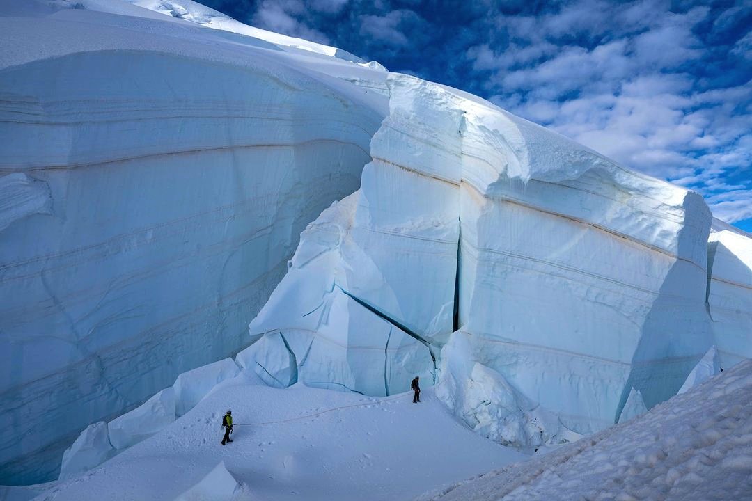
Impressive stratigraphy visible in the seracs of the Mt Blanc du Tacul (4248 m asl) north face! ❄️⏳️
The record of February 2021 major saharan dust event is just mind-blowing!
Pic. M. Colonel
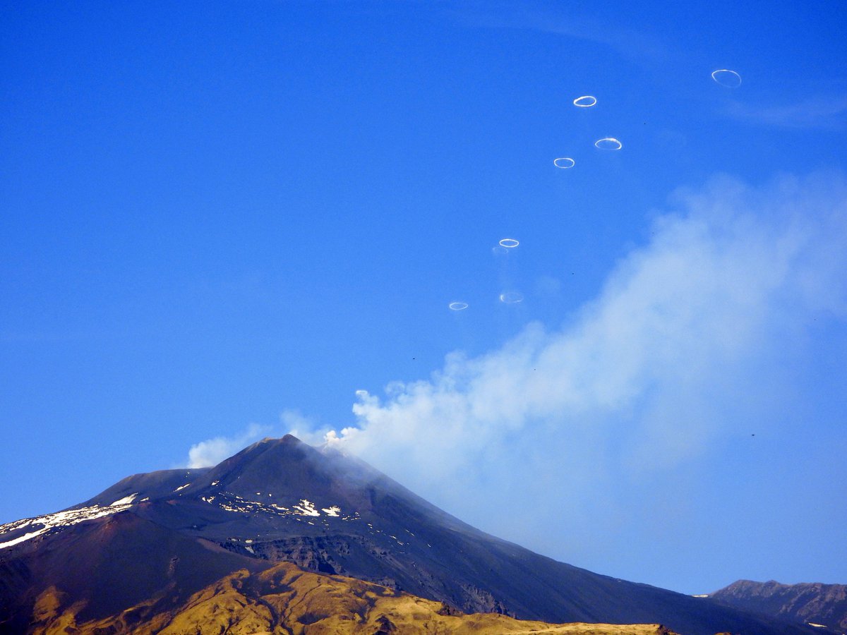
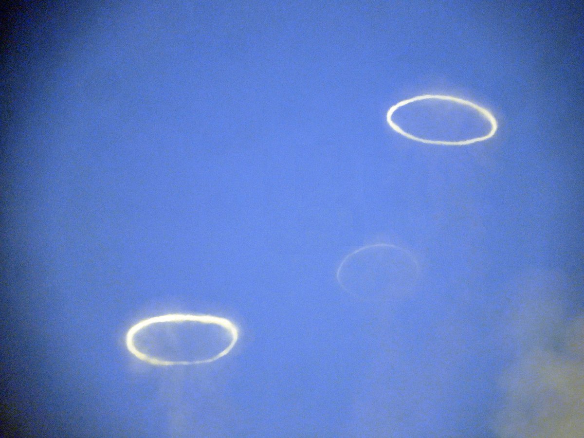
#Etna's Southeast Crater continues emitting countless graceful vapor rings ("volcanic vortex rings"), a phenomenon never seen like this before. Someone said "maybe because we receive so much bad news lately, Etna has decided to do something simply beautiful". 5 April 2024
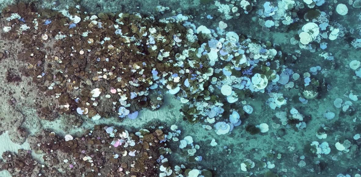
The same reef from a drone shot in 2023 and just a few days ago (2024) - the bleaching on the northern GBR is next level. The world is on fire (even under the water). Photos from Mar Inn
Wow, an incredible day!!
Watching Volcan de Fuego erupt like clockwork from a safe viewing point on Acatenago ~3km
We saw active explosive volcanism - absolutely awe inspiring.
#GuatVolc2024
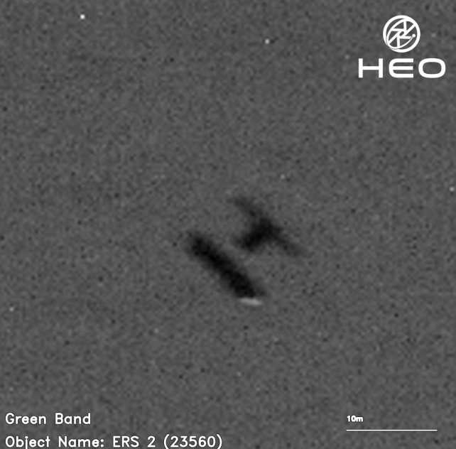
@ESA_EO's ERS-2 will re-enter the atmosphere next week. We hope this will incident-free; the probabilities suggest it should be. We should take a moment to recognise the enormous achievements of the ERS system. @CopernicusEU 🇪🇺 is what it is today because of ERS. Pic by @heospace
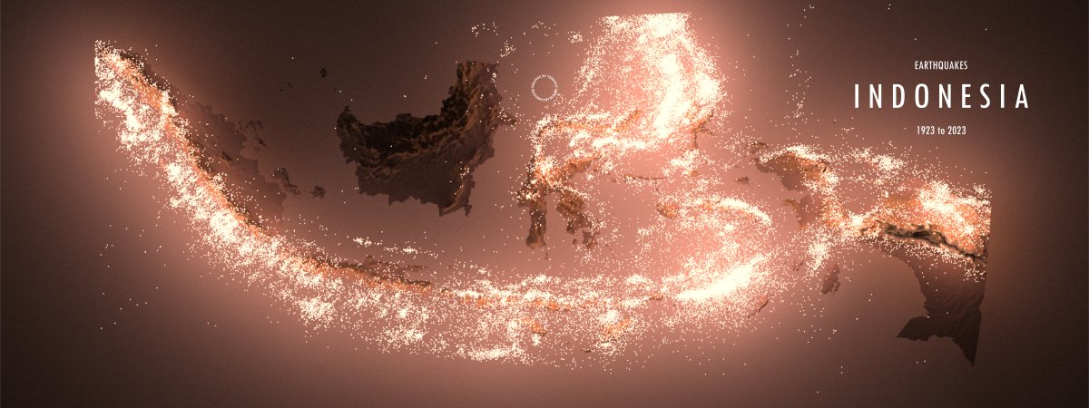
Why only M5.0 earthquakes when we can visualise _all_ earthquakes? I asked myself. Over 70k points, no problem. A map of Indonesia showing the epicentres of all earthquakes from 1923 to 2023.
#rayshader adventures, an #rstats tale
🌋 NEW: Sakurajima has been busy over the last 12hrs. I’ve put together this video of the last 3 explosions from 3 different angles (just one angle from the last one due to it getting dark)….
🥰 It would be lovely if you could share this as it takes me a lot of time monitoring volcanoes and putting the videos together for you 🥰
Speed X20
clipped from livestream: ZAIHOCH on YT
#Sakurajima #Japan #Kagoshima #volcano #eruption #桜島 #Geology
A damage proxy map for the M6.8 #earthquake that struck #Morocco on 8 Sep 2023. From #Sentinel1 satellite #SAR data acquired 56 hours after the earthquake. We hope this map will support relief efforts. More maps and information at https://t.co/QPWQZYgqmc






![jason_loxton's tweet photo. Folks, I give you an excellent rock! [Syn-depositional deformation in Ediacaran pyroclastics/flows, Scatarie Island, Nova Scotia.] https://t.co/PUX5RPxs9m](https://pbs.twimg.com/media/GTSJZbyW4AAzNwj.jpg)