WTF? We brutally dismember BERT and replace all his organs?
👉🏻 Check our latest work:
https://t.co/SP5gl4idsW
⛵️ BERT-of-Theseus ⛵️
*NEW MODEL COMPRESSION METHOD*
*ONE* loss + *ONE* hyperparameter + *NO* external data = GREAT PERFORMANCE
with a @huggingface -compatible weights
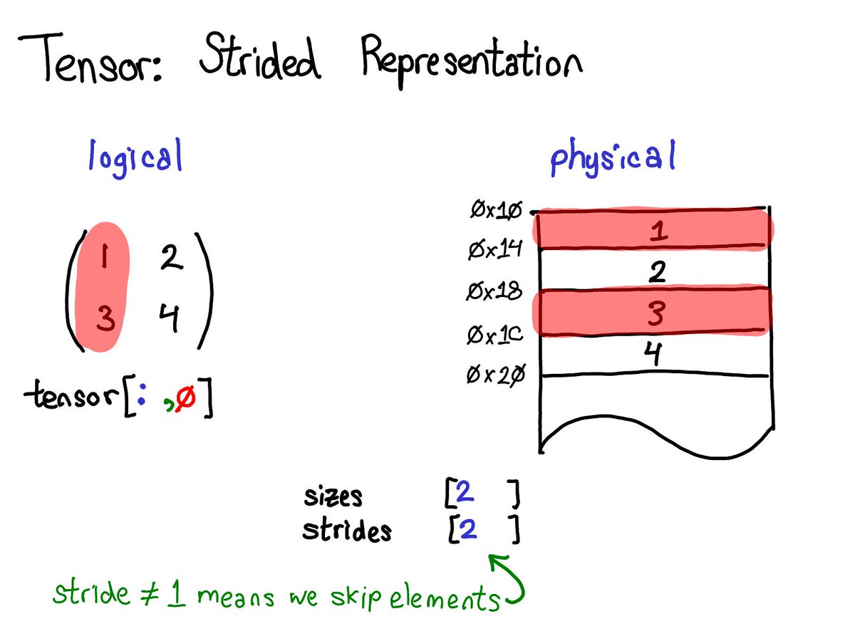
PyTorch 1.3 includes support for model deployment to mobile devices, quantization, & front-end improvements, like the ability to name tensors. New tools & libraries are also launching for improved model interpretability & multimodal development. Read more: https://t.co/HaaIt9cU3U
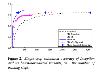
The paper that introduced Batch Norm https://t.co/vkT0LioKHc combines clear intuition with compelling experiments (14x speedup on ImageNet!!)
So why has 'internal covariate shift' remained controversial to this day?
Thread 👇
I'm so excited about our current projects on energy-efficient NLP!
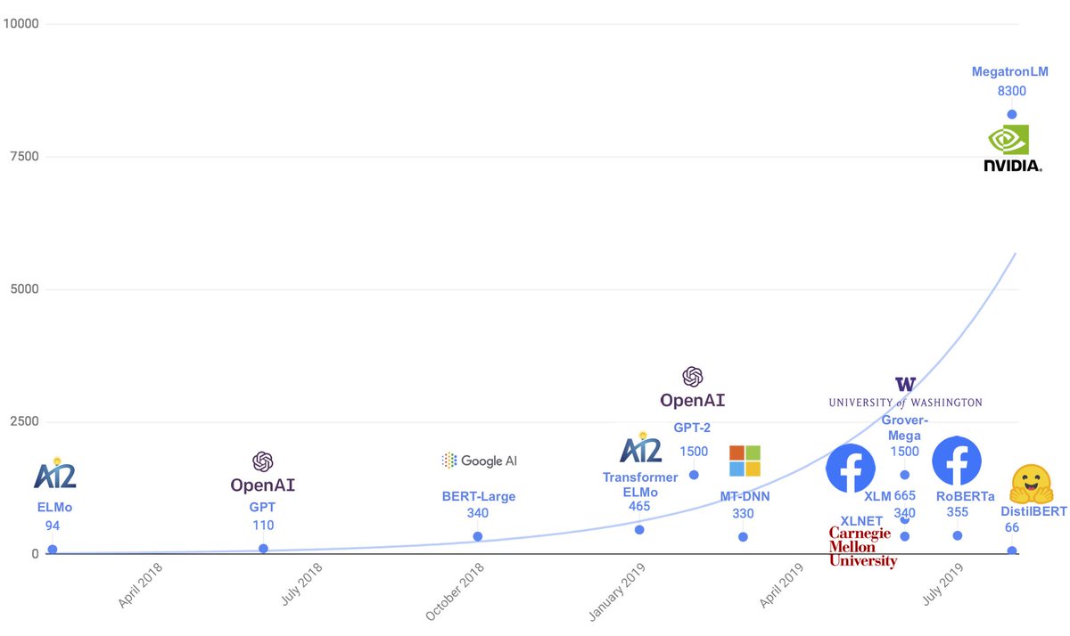
Distilled models are very complementary to larger models. Training cost make headlines but as large-scale models reach production, inference time will likely account for most of a model's total environmental cost
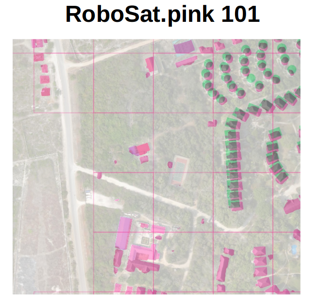
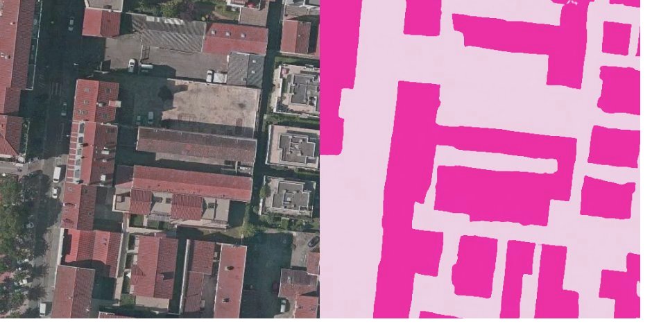
#ComputerVision ecosystem for GeoSpatial Imagery,
at scale: @RoboSatPink
https://t.co/NBeeQcCvJy
#NLP: From Text2Map, a state of art.
https://t.co/jZ4SqDEvGR
Both talks @foss4g, on how to use #DeepLearning to extract valuable patterns from #GeoSpatial (open)data.
Optimal Transport generalizes sorting to spaces of dimension D > 1.
GeomLoss implements a smooth Quicksort-like solver, packaged as a PyTorch layer. Keeps a linear memory usage + x10 to x1,000 speedup compared with the Auction and Sinkhorn algorithms. https://t.co/HhqtuDX3TX
For the first time in the series, #SpaceNet round 5 will use a "mystery city" for final scoring! Winning algos will have to work not only on the training cities, but on a new, different geography. More details: https://t.co/BzblnOcEOh
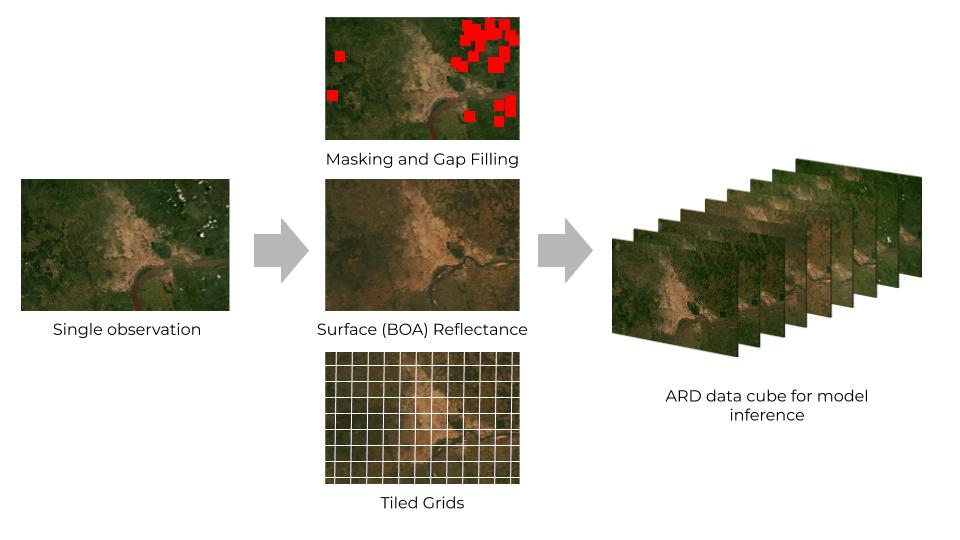
Next week is #ARD19, a remote sensing data interoperability workshop to be held in Menlo Park. In anticipation of the event, our senior director of analytics engineering tackles essential ingredients for ecosystem-wide geospatial analytics capability. https://t.co/xfoGSnXDg1
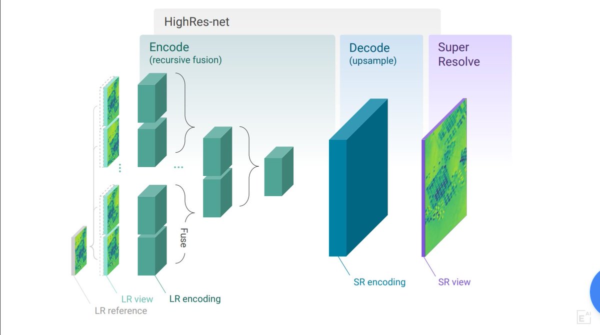
Great news! We've open-sourced
HighRes-net for Multi-Frame Super-Resolution by Recursive Fusion.
https://t.co/9z5xvbh5UW
Our #PyTorch implementation that topped @esaACT's competition.
We're hoping this will help researchers working with satellite imagery
#AIforGood @element_ai
@mouthofmorrison@developmentseed Next step could be that OpenSource Software companies already involved in GeoSpatial AI, avoid to spend energy, by keeping developing solutions by their own, and begin to converge on a common toolbox.
Could be.
cc @azavea@developmentseed@sinergise
Coming events, where @data_pink will be present:
- April 18 #AINIGHT (booth)
- May 22-23 Joint Urban Remote Sensing Event (booth)
- June 11-12 @AI_PARIS_ (booth)
- June 13 @ow2 (talk)
Hope to see you there !