🚀 Using NASA's SAR data just got easier! Our Sentinel-1 SAR radiometric terrain corrected products are now fully compatible with GIS software & optical imagery. Plug-and-play with ease! 🌍 Learn more: https://t.co/uRqg2xpwUa
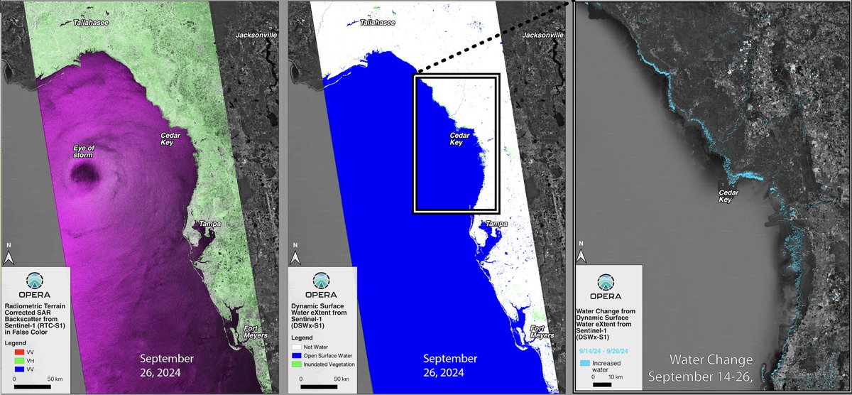
A new Data-in-Action story at NASA's #PODAAC examines coastal inundation from Hurricane Helene's storm surge in the Tampa Bay region of Florida using NASA JPL OPERA analysis-ready dynamic surface water extent and Sentinel-1 #SAR derived products.
https://t.co/L0M5KB6wFa
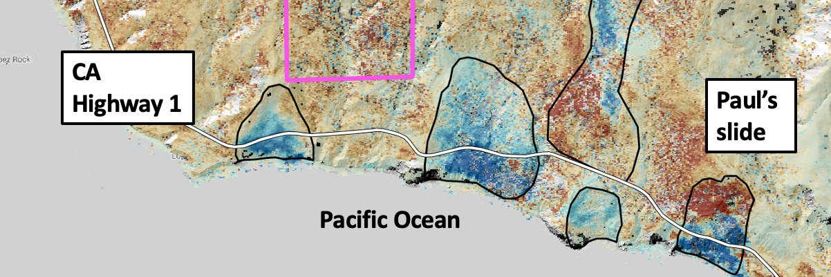
Residents of Rancho Palos Verdes, California are looking to the scientific community for help as slow-moving landslides destroy their community -- my newest story for AGU's Eos: https://t.co/YmxvkG6oej @AGU_Eos
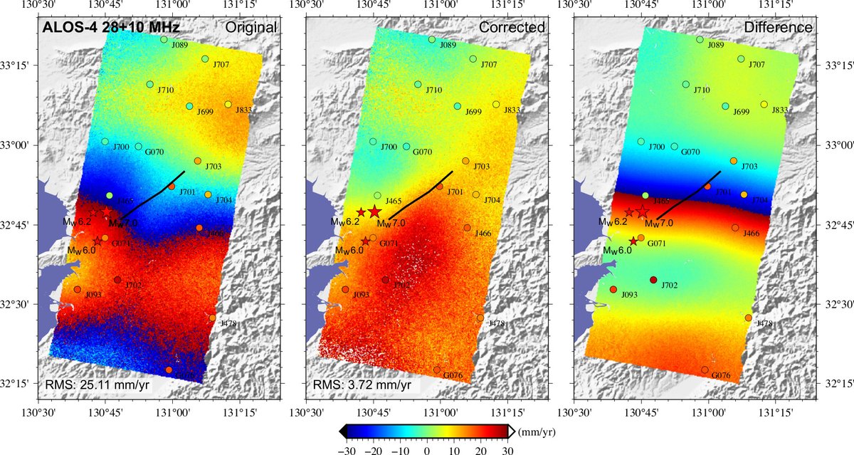
Sharing our paper titled An analysis of the potentials of L-band SAR satellites for measuring azimuth motion. Download the paper for free until November 15, 2024 at https://t.co/3in4ksaZVb
💥Want to use @Ak_Satellite’s #Sentinel1 burst archive with your favorite SAR processor? Check out burst2safe – a Python package that converts burst data to ESA’s SAFE format. Available on PyPI and Conda!
#GoldenAgeOfSAR#S1Bursts
https://t.co/0h5nbsXPqD
OPERA will host a free hybrid (online + in person) workshop on Friday, July 19, 2024, from 8:30 am – 1:05 pm Pacific Time at the Liberty Station Conference Center, San Diego, CA. To register please see our website https://t.co/sYWr6FCfF1. We hope to see you there!
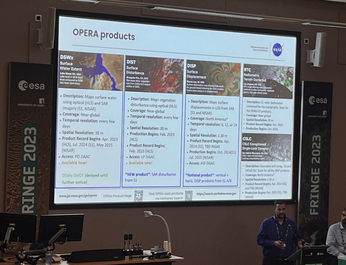
New NASA OPERA Land Surface Disturbance Annual from Harmonized #Landsat Sentinel-2 (HLS) Version 1 product available at NASA's #LPDAAC summarizes the DIST-ALERT product into an annual #vegetation disturbance data product. @NASAJPL
Learn more: https://t.co/tFR1yGQJzj
🚀 Join us at the 4th OPERA Workshop (July 19) to explore products enabling science, application, & decision-making! 📅FREE & OPEN Registration. Explore the possibilities with surface💧water, 🔥disturbance, and 🌋displacement products. Register now! https://t.co/UyNTx7AEUa
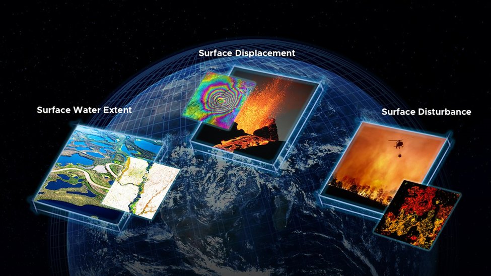
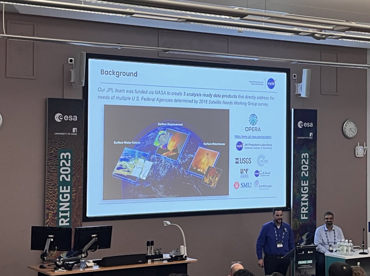
NASA's OPERA project released two new analysis-ready products. The OPERA project uses data from satellite radar and optical instruments to produce surface water extent and surface disturbance data products.
Learn about the new RTC SAR Backscatter Product: https://t.co/E777gTClCY
🚨SAR Twitter🚨
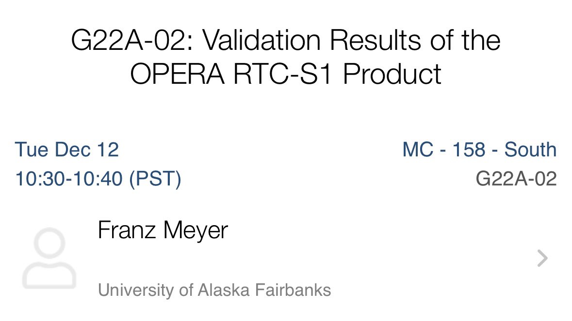
Tomorrow is #SAR Day at the @theAGU#AGU23 meeting. Come by room 158 in Moscone South for an all-morning series of presentations 🛰️🥳!
My contribution is at 10:30am in the same South 158 room. Swing by to lean about @NASAJPL OPERA!
#GoldenAgeOfSAR
NASA's Observational Products for End-Users from Remote Sensing Analysis (OPERA) project released two new analysis-ready #SAR products designed to minimize the technical barriers of working with satellite radar data.
➡️Learn more in our latest feature: https://t.co/E777gTClCY
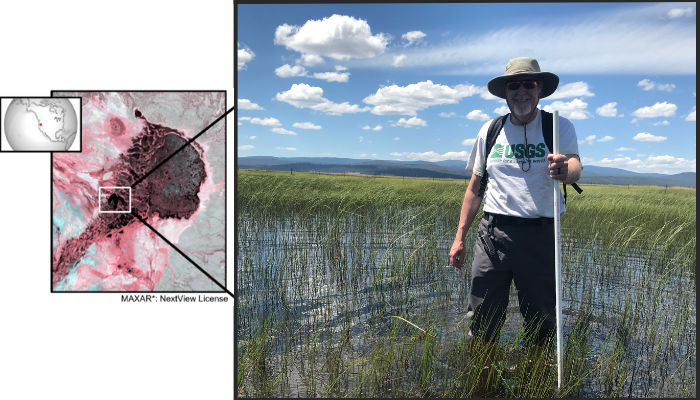
How do you tackle partial surface water in satellite images? In a new @EGU_HS blog post by @USGS's John W. Jones, learn how satellite data from @NASA's #OPERA and #HLS, @USGSLandsat, and other projects and missions take on this challenge! #Sentinel
https://t.co/yrAJkW8ehq
Excited to share my new study with @GuoYu_Madison, @JulieWa46843981 and @danethanNU that came out in journal Water Resources Research https://t.co/jgaonv2Asd, it’s now OPEN ACCESS!