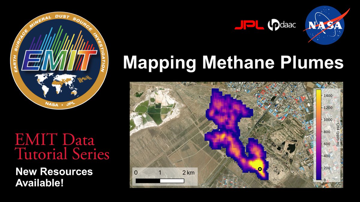
New #Python#Jupyter notebook tutorials show you how to work with @NASAJPL#EMIT#methane plume data. #LPDAAC
*⃣EMIT Resources GitHub Repository https://t.co/WOfbPXmeu0
*⃣ EMIT Methane Plume Workshop Recording https://t.co/iC0LJV13Rb
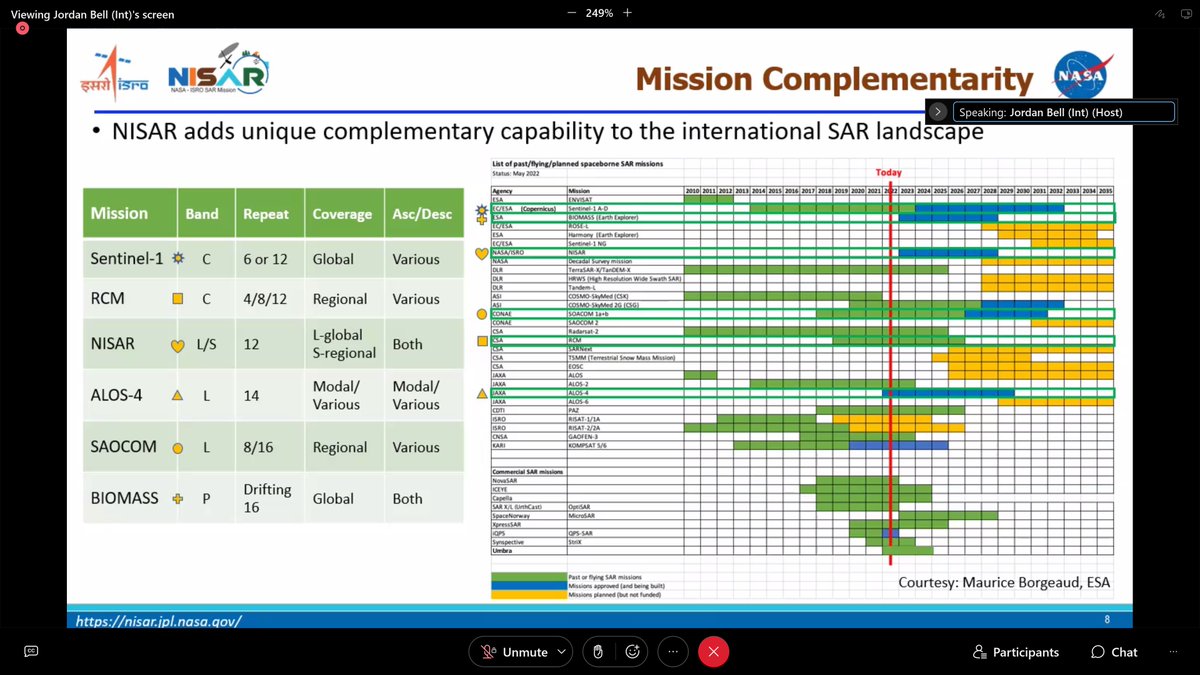
Get ready to meet @CopernicusEU ROSE-L 🛰️
"It's a bit like a car, which at the same time should be small, provide a lot of space and go fast, but with little fuel consumption."
Rose-L, the Copernicus L-band Synthetic Aperture Radar, will help monitor geohazards, flying the same orbit of #Sentinel1.
🎥 Full video premiere this Thursday at 16 CET on @esa YouTube: https://t.co/ZTYf3gXLNd
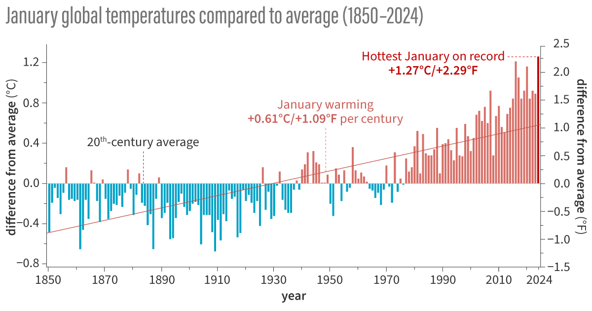
The global #climate summary for January 2024 is in...
Global surface temperatures were 2.29 degrees F above the 20th-century average, making it the warmest January on record and global precipitation was nearly record-high.
For more: https://t.co/8Fzne2Orse
Come see EMIT at #AGU2023 ! From continent-scale mineral maps to facility-scale greenhouse gas point sources, the first year of EMIT observations is a tantalizing glimpse at the potential of imaging spectroscopy for understanding our planet.
🚨 New Paper Alert 🚨
Our work on investigating a deep seated slow-moving landslide in the western Karakoram got published. Possible roles of meteorologic and anthropogenic factors discussed.
@LuiglLombardo@hakan_tanyas@mkemalemil
Check it out here:
https://t.co/sAECuJjAB9
Great news! Historical processing of the Harmonized #Landsat#Sentinel-2 (#HLS) HLSS30 v2.0 data is complete. HLSS30 data are now available from November 28, 2015 to the present.
Discover data at NASA's #LPDAAC: https://t.co/iLdiulMMBm
@esa@esa_EO@sentinel_hub
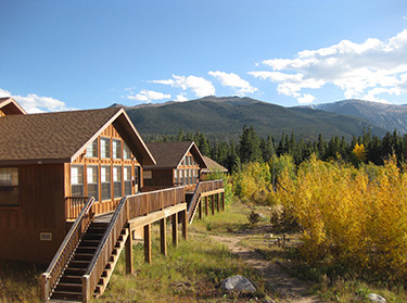
Don’t miss out on CLaSH’s no-cost, @NSF sponsored Graduate Summer Field Course at Colorado State University’s Mountain Campus. In this week-long, action-packed experience, you'll have the opportunity to study land surface hazards.
Apply by April 24 at https://t.co/62fPQbSCwp
The 06-02-2023 Turkiye quakes were recorded on seismic stations managed by @SgsOrgSa and @ces_kaust. The following videos illustrate how seismic waves due to the 7.8 and 7.6 magnitude quakes cross through the country. @KAUST_PSE@Prof_QuakeMod@Sjonni_KAUST @LauraParisi_Sci #ErSE
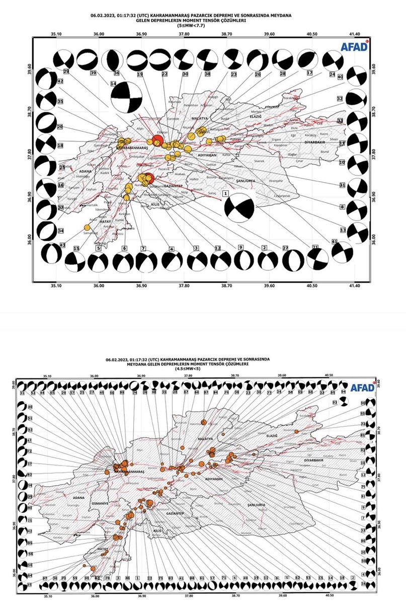
📌 6 Şubat 2023 #Pazarcık ve #Elbistan (#Kahramanmaraş) depremlerinden sonra bölgede meydana gelen M> =4.5 büyüklüğündeki depremlerin moment tensor yöntemiyle yapılan odak mekanizması çözümleri.
📌 Moment tensor solutions of the earthquakes with magnitude M> =4.5
@LastQuake
TREA's #3D#STN-1 imagery analysis of the #Kahramanmaras#earthquakes. Images below show the E-W, N-S, and V movements obtained from #satelliteimagery acquired between 28 Jan-10 Feb 2023. The movement corresponding to the faults indicates significant #grounddeformation (>3m).
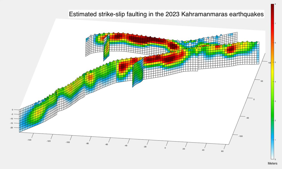
Our current version of the fault-slip model of the 6 Feb. 2023 Kahramanmaras earthquakes, estimated by @XingLisom based on data processed by @Jihong_KAUST, as part of the CDI and @CES_KAUST group efforts. @KAUST_PSE 1/5